our
news
AWARDS, ACCOLADES, PUBLICATIONS AND NEWS.

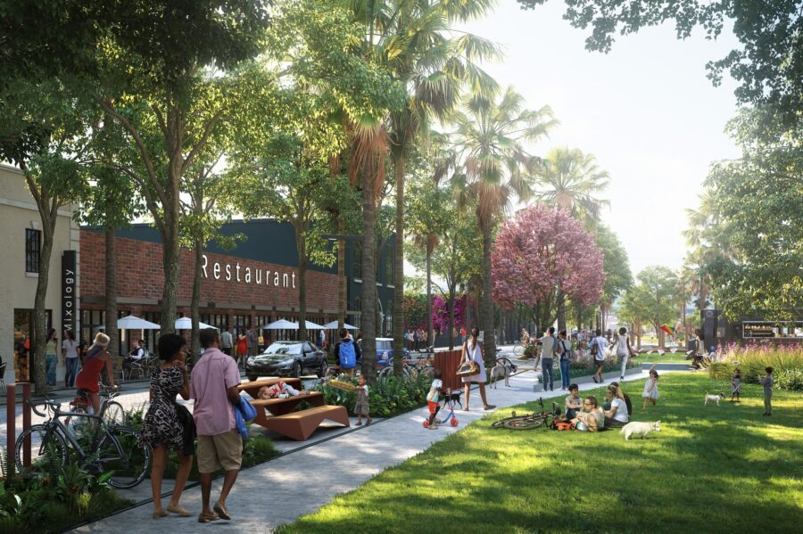
Urban planning group Plusurbia Design revealed what the future of the Greenville Gateway could become on Tues., Oct. 18.After a series of community meetings and a survey earlier this year (which received 479 responses), the urban design group designed a future look for specific areas of the corridor, including:Bon Secours Wellness Arena
East North Street (at the end of I-385 + continuing past The Well)
Pettigru Historic DistrictSome of the most notable changes proposed include transforming East North Street with trees, bike lanes + additional apartments and shifting Bon Secours Wellness Arena’s entrance into a pedestrian-friendly entertainment hub with restaurants and outdoor space.The project, initiated by the owners of local automotive marketing agency DOM360, focuses on a specific corridor of Greenville between these streets:North Church Street
East Washington Street
Atlas Street
Sunflower Street
Richland WayFamiliar places in this area include Bon Secours Wellness Arena, Greenville’s Law Enforcement Center, and the Pettigru Historic District.Plusurbia Design will help develop and implement this vision with private + public funding, and with input from community leaders, organizations, and you.
WPTV: Article
October 27, 2021WEST PALM BEACH, Fla. — Nora is the name of a comprehensive master plan for a neighborhood in West Palm Beach located south of Palm Beach Lakes Blvd and North of Quadrille Blvd.“Nora is accretive to the smart growth of Downtown West Palm Beach,” says Ned Grace. “As a team deeply rooted in the Palm Beach area, we are witnessing a readiness and desire for a new kind of neighborhood in West Palm Beach’s urban core. The tailwind from the migration of industry leaders from around the country is adding fuel to this new demand, and Nora is the missing piece of West Palm Beach’s Downtown.”“We believe this previously overlooked area of Downtown will become a treasured gem in West Palm Beach. Our responsibility is to work thoughtfully and systematically to ensure the mix of commercial and residential offerings achieves Nora’s potential,” says Joe Furst.
Plusurbia's Andrew Georgiadis shares our experience with reforming cities through zoning reform in the prestigious urban design publication and podcast platform Somos Cidade. Read more about how we use planning instruments to achieve human-scale cities (in Portuguese) below:Já comum na realidade dos Estados Unidos, o Planned Unit Development (PUD) é visto como uma possibilidade para promover e acelerar mudanças pontuais na malha urbana de municípios do Brasil, criando espaços mais qualificados e diversificados. O instrumento é utilizado naquele país por incorporadores e desenvolvedores imobiliários para propor a modificação do zoneamento existente de lotes ou de grandes terrenos em determinados lugares.
A partir desse modelo, é possível solicitar aos governos locais alterações na legislação de uma área para o uso misto do solo, implementação de empreendimentos – como bairros planejados –, melhorias na infraestrutura de uma região e ainda para aperfeiçoar ou introduzir ambientes públicos. “O PUD é empregado para aprovar um tipo de projeto que não cabe bem no zoneamento das prefeituras”, afirmou o arquiteto Andrew Georgiadis, em entrevista ao Somos Cidade. Andrew é diretor de Projetos do escritório PlusUrbia Design, com sede em Miami (EUA), e também professor da faculdade de Arquitetura da Universidade de Miami e presidente da Georgiadis Urban Design.
To keep reading, click here.
BY JOEY FLECHAS
MARCH 26, 2021 02:47 PM, UPDATED MARCH 26, 2021 03:57 PM
A 1936 shotgun house on Charles Avenue in west Coconut Grove was one of the 50 wood-frame homes in the historically black neighborhood that had been proposed by the city of Miami for designation as a protected landmark. ANDRES VIGLUCCI MIAMI HERALDMiami commissioners on Thursday approved creation of a new taxing agency in West Coconut Grove, a historically Black neighborhood where proponents aim to spend future tax revenue on affordable housing and economic revitalization.
The commission unanimously approved creation of the West Grove Community Redevelopment Agency (CRA), a new semi-autonomous arm of the city government meant to fund anti-poverty initiatives using a portion of taxes from the area. Proponents argue that when managed correctly, CRAs can provide seed money that spurs private investment.
To continue reading, please click here.
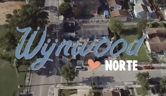
BY ANDRES VIGLUCCIMARCH 25, 2021 07:31 PM, UPDATED MARCH 26, 2021 09:32 AM.mcclatchy-embed{position:relative;padding:40px 0 56.25%;height:0;overflow:hidden;max-width:100%}.mcclatchy-embed iframe{position:absolute;top:0;left:0;width:100%;height:100%} Residents and property owners in Wynwood's working-class residential enclave have re-branded, organized and developed a plan to cope with gentrification. BY WYNWOOD NORTEA grassroots plan aiming to save the struggling working-class neighborhood of Wynwood Norte from looming gentrification by spurring limited redevelopment won final and unanimous approval on Thursday from enthusiastic Miami commissioners, who have called it a model for other city neighborhoods besieged by real estate speculation.The 5-0 vote came five months after commissioners initially approved the Wynwood Norte Neighborhood Revitalization District, a special zoning plan seeking to corral development pressure to benefit the historic community, once a predominantly Puerto Rican residential enclave that’s been steadily losing residents and businesses for decades.To continue reading, please click here.
WLRN 91.3 FM | By Daniel RiveroPublished February 24, 2021 at 1:40 PM ESTAs developers started to acquire chunks of land in the neighborhood, it seemed that a familiar pattern was about to play out. A Miami commission vote on Thursday is set to determine the future of the neighborhood.A decade of fast-forwarded development in Wynwood has converted what used to be the partially-residential neighborhood into a bustling mix of bars, restaurants and the occasional art studio.That’s the Wynwood south of NW 29th Street.Continue reading here.
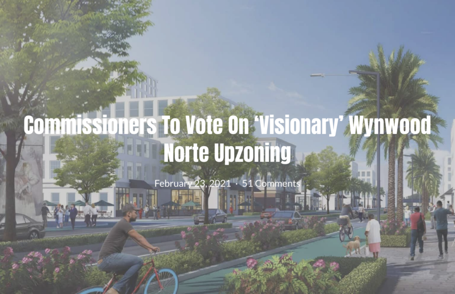
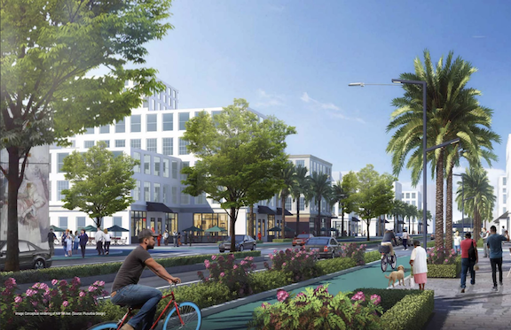
Miami commissioners are scheduled to vote this week on upzoning an area called Wynwood Norte.It is the second and final commission vote, after it unanimously passed a first reading in October. The second reading vote is scheduled for February 25.The Wynwood Norte Neighborhood Revitalization District is being created at the request of residents of the area who want to better control gentrification, according to an October article in the Herald.The plan for Wynwood Norte includes:Increasing zoning density with up to 9,000 more residential units than currently allowed (the current population of the area is around 4,000)Requiring a 10 percent set aside for affordable housing in exchange for the increased densityDevelopers would also fund shade trees, sidewalks, lighting, in addition to affordable housingForbidding demolition unless a new construction permit has been issuedRules to discourage lot assemblages, and encourage smaller scale developmentThe area encompasses 140 acres, or around 29 city blocks.Plusurbia Design created the plan. Please click here to read the full article.

The City of Miami passed the historic zoning overlay to mitigate displacement and encourage small incremental affordable development in the Wynwood Norte neighborhood in Miami. This is an important first step to keep our city resilient.To learn more about the project, please visit:Wynwood Norte[caption id="attachment_4205" align="alignleft" width="829"] A community collaboration envisions Wynwood Norte that accommodates development that is compatible with the old Miami neighborhood. PLUSURBIA DESIGN[/caption]Related articles:THE MIAMI HERALDTo fight gentrification, a working-class Miami enclave wins plan to spur developmentSOUTH FLORIDA BUSINESS JOURNALRezoning moves forward for area north of Miami's WynwoodPLANETIZENRevitalization Without Displacement: A New Model From Miami
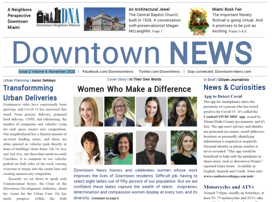
Plusurbia's Megan McLaughlin contributed to the latest issue of Downtown News where she addressed the importance of historic preservation and more specifically, her work in preserving the grand Central Baptist Church on NE First Avenue.Issue 2 Volume 4. November 2020Historic Preservation I Raul GuerreroMiami has great historic buildings. One is the Central Baptist Church which parallels the very history of Miami. Built in 1926 in neoclassical grandeur by the Memphis firm of Dougherty and Gardner, it has undergone a complete rehabilitation, explained preservationist Megan McLaughlin of PlusUrbia, who serves as adviser and liaison for permitting with the city. Given that she is an expert in historic preservation, we start by addressing characteristics of downtown historic architecture?Megan McLaughlin: Buildings from the 1920s are distinctive because they are very large. There was such a boom going on in the 1920s. Miami buildings were taller, more robust, than those in Palm Beach, Orlando and other municipalities in Florida. Because of the nature of architecture in that period, and up to the 1960s, buildings were more humane, designed for people to inhabit them, to experience them..."Older buildings were more about the human experience."Downtown News: You mean today’s buildings aren’t as humane?MM: Yes. Today they build with a different audience in mind. They have other requirements, which might not be so much human interaction. They have to house a lot of cars and that changes the nature and feeling of the building. Sometimes they build for impressiveness, to be viewed from across the Bay or from I95. It’s almost like advertisement, not so much to experience the building as a person from the street or inside. Older buildings were more about the human experience.To continue reading and to access the digital version of the November issue of Downtown News, please click below:Downtown News November digital edition

BY CATHY LEFFSEPTEMBER 27, 2020 08:04 PM , UPDATED 11 HOURS 58 MINUTES AGO[caption id="attachment_4205" align="alignnone" width="940"] A community collaboration envisions Wynwood Norte that accommodates development that is compatible with the old Miami neighborhood. PLUSURBIA DESIGN[/caption]In September 2019, the Wynwood Community Enhancement Association (WCEA) created a Community Vision Plan for Wynwood Norte after more than a year of meetings as a community-driven, participatory initiative. Bringing together diverse familiar and new stakeholders, we were united to improve the quality of life for the neighborhood. Recognizing increasing development pressures from surrounding areas, we knew doing nothing was not an option. We sought to address existing area conditions, while envisioning our collective desire to preserve and revitalize one of Miami’s oldest and most beloved urban neighborhoods.Click here to read the rest of the article: Miami can help Wynwood Norte adapt to future growth while preserving its past | Opinion Cathy Leff is Bakehouse Art Complex acting director and member of the Board of Directors of the Wynwood Community Enhancement Association (WCEA). She wrote this on behalf of Yoni Bornstein, WCEA president, and board members Asi Cymbal, Arnold Melgar, Robin Vasquez, Wil Vasquez and Julie Williamson.
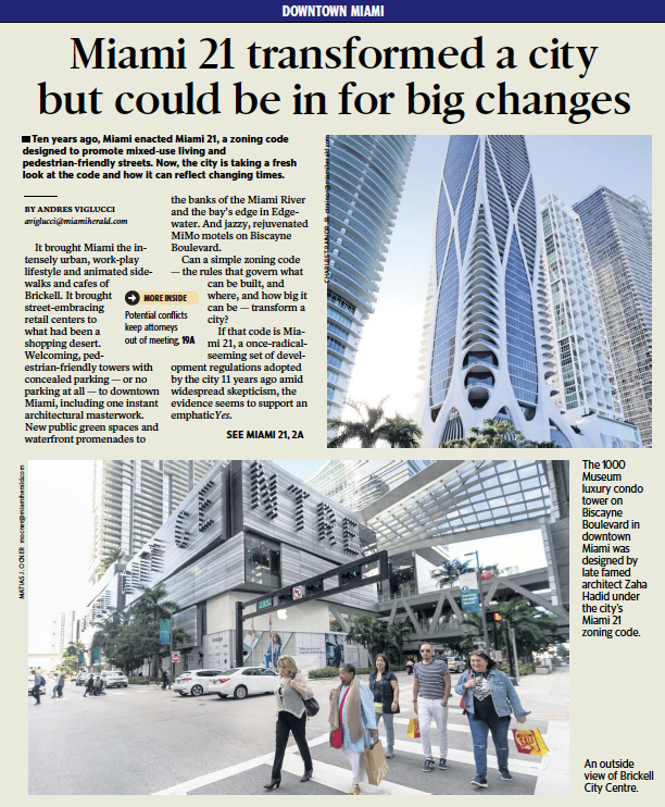
BY ANDRES VIGLUCCIJUNE 14, 2020 06:00 AM [caption id="attachment_4104" align="alignnone" width="960"] An outside view of Brickell City Centre in Miami, Florida on Tuesday, January 7, 2020. MATIAS J. OCNER MOCNER@MIAMIHERALD.COM[/caption]It brought Miami the intensely urban, work-play lifestyle and animated sidewalks and cafes of Brickell. It brought street-embracing retail centers to what had been a shopping desert. Welcoming, pedestrian-friendly towers with concealed parking — or no parking at all — to downtown Miami, including one instant architectural masterwork. New public green spaces and waterfront promenades to the banks of the Miami River and the bay’s edge in Edgewater. And jazzy, rejuvenated MiMo motels on Biscayne Boulevard.Can a simple zoning code — the rules that govern what can be built, and where, and how big it can be — transform a city?If that code is Miami 21, a once-radical-seeming set of development regulations adopted by the city 11 years ago amid widespread skepticism, the evidence seems to support an emphatic Yes.Now, just over a decade on, the city is undertaking a fresh look at Miami 21. This week, after a five-month delay caused by the COVID-19 pandemic, the city formally launched a special task force of experts and residents charged with substantially revising the code and tackling new goals that weren’t on the front burner when it was enacted in 2009.Chief among those: Finding ways to promote development of critically needed affordable housing, figuring out new rules for developing projects to meet sea-level rise, reviewing the adequacy of existing zoning for specific city neighborhoods, and addressing issues of equity and gentrification that Miami 21 may have inadvertently helped fuel.Almost certainly, the task force’s 12 members — a mix of architects and planners, developers, land-use lawyers and residents — will wrestle with how, or whether, to limit the massive and sometimes controversial Miami 21 Special Area Plan projects that have become flashpoints of community opposition.Although the city’s planning board last year called for doing away with the so-called SAPs entirely, city officials want to refine them. Experts say that could be done by increasing community participation while curbing density or building heights to ensure the projects are compatible with surrounding neighborhoods.[caption id="attachment_4106" align="alignnone" width="960"] A Starbucks on the ground floor of a residential building in Miami’s Brickell neighborhood opens directly to the sidewalk in pedestrian-friendly fashion under a template set by the city’s 10-year-old Miami 21 zoning code. CHARLES TRAINOR JR CTRAINOR@MIAMIHERALD.COM[/caption]SAPs have won both praise and scorn.The SAP section of Miami 21 was intended to sensitively guide large-scale development on at least nine acres through negotiations between developers and city planners. It led to the creation of the Brickell City Centre, the shopping, hotel, office and residential complex on several blocks of long-vacant land on the south side of the Miami River. It also allowed the transformation of the once-forlorn Miami Design District into an uber-luxury, pedestrian-friendly urban shopping and cultural district. But distressed, low-income Little Haiti could end up sandwiched in between two mammoth, not-yet-built SAP developments that have already been blamed for rampant land speculation, rising residential rents and small-business evictions in the neighborhood.Although the Miami 21 code has been amended several times, the city has not conducted the sort of thorough assessment that its designers at the Miami planning firm Duany Plater-Zyberk envisioned would occur every few years to adapt to a changing world.“The city has evolved tremendously since the inception of Miami 21,” Miami City Manager Art Noriega told the task force during the inaugural meeting, which was conducted virtually. “This is something we probably should have started some time back.”Under a resolution adopted by the Miami commission, the task force will meet at least monthly and issue a report with recommended revisions or additions by December to city commissioners.The questions the task force should explore, say its members and Miami 21 principal author Elizabeth Plater-Zyberk, take on added dimensions in the ongoing COVID-19 pandemic.One consideration: should the prospect of subsequent waves of infection or new epidemics justify requirements for greater setbacks and open space at the street level around buildings? That requirement would allow for maximum air circulation and space for social distancing, including separated cafe tables and wider sidewalks, they said.Another factor: Will decreased use of formal offices, or a greater need for working from home, produce a greater need for live-work housing that combines residential space with businesses or office space?Even questions over the continued desirability of increased urban density to foster city life should be on the table after coronavirus spread rapidly in close urban quarters like New York City, they say.“Wider sidewalks and fewer or narrower traffic lanes, wellness and equity questions, and rethinking of public space — the amount of it, the dimensions of it — would certainly be appropriate in light of world health,” said Plater-Zyberk. She stressed she has not kept up with the code’s use closely and is not involved in the revision effort.When it comes to affordable housing, there’s only so much a zoning code can do to spur affordable housing short of requiring it — something elected officials have resisted and may now be barred by a new state statute, experts say. Plater-Zyberk said Miami 21 could nonetheless provide greater incentives than it does now to developers. It could offer more capacity to build in exchange for strict commitments to including affordable or workforce housing in projects — though she warned those must be carefully calibrated.But she said Miami 21’s basic precepts have more than proven themselves.To promote walkability, activity and good urban design, the code bars visible parking or loading areas, requiring those be concealed behind screens or “liners” consisting of apartments, offices and shops. It requires “habitable space” at street level and lots of clear glass at sidewalk level, plus working doors and entryways, to make walking easy and alluring.The best SAPs, meanwhile, allowed developers and planners flexibility to arrange new buildings in innovative, cohesive ways that a strict adherence to Miami 21 would not permit. But Plater-Zyberk said city planners may have interpreted some SAP rules too liberally.One goal of SAPs is to allow planners and developers to depart from Miami 21 rules to amass density and height in sections of the property to create variety and open spaces across the site. Instead, at times, developers were allowed to increase density across the board in exchange for providing open spaces and other public benefits, she said.That could be fixed with a tweak of the rules, she said.[caption id="attachment_4103" align="alignnone" width="960"] Visitors stroll along Paseo Ponti on the reopening day of the Miami Design District on Wednesday, May 20. MIAMI DESIGN DISTRICT[/caption]“We got some special places out of that,” said Plater-Zyberk, whose firm drew up the master plan for the revamped Design District. “And then, I think, the fact that so many of the big buildings have been built with doors and windows at the street level instead of parking garages was important.”LONG DEBATEMiami 21, proposed in 2005 by then-Miami Mayor Manny Diaz, was shaped through years of intense public meetings, contested hearings and some determined opposition. It finally was approved by the Miami commission in 2009, just as development ground to a virtual halt amid a deep world recession.The new code represented a sharp departure from its predecessor, which strictly separated uses like housing, office and commercial — a suburban concept that critics say led to dead streets, a dying downtown and commercial districts without the foot traffic necessary to sustain them. It also produced jarring contrasts like massive parking garages, ramps and blank walls on important streets, and towers looming over single family homes. The complex and often ambiguous rules also lent themselves to manipulation by developers and their attorneys, critics charged.When construction finally restarted post-Recession with a vengeance, it was on the new, urban template of Miami 21. It’s been in place during one of the most extensive and long-lasting waves of development in city history.A variant of what’s known as a form-based code, Miami 21 regulates the shape of buildings and how they meet the street to create lively urban places through clear diagrams. The code won awards and attention across the country. Some other cities adopted similar strategies, most notably Denver, today widely regarded as another example of a revitalized pedestrian-friendly urban center.A key advance wrought by Miami 21 was its fostering of mixed uses within a single building or project in dense urban areas. Unlike the strict separation under the old model that requires driving from one place to the other, mixing uses puts living, working, shopping and recreation all within a close, walkable environment.That Miami 21 model helped transform Brickell from a district of sterile sidewalks to a magnet for young professionals, cafes and restaurants and workplaces that would have been difficult, if not illegal, to achieve under the previous code. Once rundown areas such as Edgewater and Biscayne Boulevard were overhauled through redevelopment on the Miami 21 template into sought-after neighborhoods.“People started noticing right away the fact that streets were becoming nicer,” Plater-Zyberk recalled. “I think there are a lot of obvious good impacts, from the low-rise bank on the corner that before would have put a parking lot out in front, to a more pedestrian-friendly streetscape.”Planning consultant and urban designer Juan Mullerat, a member of the current Miami 21 task force, said much of the code’s success lay in advancing sophisticated goals in simple terms.“It’s created better walkable human architecture. It has been able to humanize the public realm,” Mullerat, who worked for a year at Plater-Zyberk’s firm while the code was being developed, said. “The biggest strength of Miami 21 is its ability to put in simple terms some very complicated planning concepts. At the end of the day, it’s an approachable code.”Miami 21 also embraced some innovative ideas. It promotes preservation of historic buildings and places by allowing their owners to sell unused building rights to developers in high-density districts like Edgewater or Brickell, while plowing the proceeds into renovations. That transfer of development rights program gave new life to the iconic Vagabond and other historic motels in the MiMo district along Biscayne Boulevard in the city’s Upper East Side.[caption id="attachment_4107" align="alignnone" width="960"] The renovated Vagabond Motel is now open for guests. CARL JUSTE MIAMI HERALD STAFF[/caption]It also allows developers of residential buildings near transit stations to reduce parking on site, or eschew it completely, to reduce auto dependency and bolster use of public transportation.It also instituted a program of “public benefits’’ in which developers pay into city funds for affordable housing, parks and transportation improvements in exchange for “bonus” capacity to build. Plater-Zyberk said the city should assess and track benefits collected so far to see how effective the program has been as part of the Miami 21 review — and tweak the rules if necessary.One prominent condo developer, Related Group executive vice president Carlos Rosso, said Miami 21 could do more to “incentivize” builders to expand green and open spaces in and around their projects. Related was among the earliest to seize on Miami 21’s public benefits requirements, persuading the city to swap a piece of a dead-end street in Edgewater for a small public waterfront park and baywalk the developer built as part of its Icon Bay condo project.[caption id="attachment_4102" align="alignnone" width="960"] The Related Group’s Icon Bay condo tower in Miami’s Edgewater neighborhood includes a public park on Biscayne Bay built under the city’s Miami 21 zoning code. ROBIN HILL COURTESY THE RELATED GROUP[/caption]“We also opened up some additional streets, and now suddenly this park is connected to three streets,” Rosso said. “You go there in the afternoon, and it’s a small neighborhood focal point. People can meet, take their dogs, take their kids to play on the grass.”While Miami 21 strengthened requirements for developers of new projects on the bay and river to include public promenades, Rosso said it should go further to encourage creative approaches like that at Icon Bay. Related and other stakeholders have been pushing the city to fully connect the baywalk from the Design District south to Maurice Ferre Park in downtown Miami, a concept they call the Biscayne Line.The missing pieces of the long-contemplated baywalk could be completed if the code includes measures to encourage building associations and property owners to provide a connection now — perhaps using floating or suspended promenades in cases where lots are built out to the bay’s edge — even if they don’t intend to redevelop immediately. Those incentives could take the shape of credits against future fees, Rosso suggested.LESS PARKING?Echoing others, Rosso also said the task force should explore further easing minimum parking requirements, which critics say increase construction and housing costs and contribute to traffic congestion. Eliminating those requirements, though, isn’t feasible without transit improvements that a zoning code can’t mandate, he said.“We need to improve public transportation to get rid of the parking,” said Rosso, who added Related is communicating with city planners to offer input on Miami 21.The parking requirements also play into one gaping area where numerous experts and developers say Miami 21 has been ineffective: Encouraging needed, affordable and modestly scaled infill housing in neighborhoods like Little Havana. Though it’s dotted with scores of vacant lots, Miami 21 regulations make it difficult if not impossible for property owners to build the kind of small apartment buildings that could make a real dent in the city’s housing crisis, the critics say.That’s because a typical, narrow city lot can’t easily accommodate required on-site parking and car access while hewing to low-density zoning in some residential areas. As a result, critics note, very little has been built in those neighborhoods under Miami 21.“Essentially they are undevelopable,” Mullerat said.The lack of that kind of modestly scaled neighborhood development, called the “missing middle” — that is, a homey scale between high-rise projects and single family homes that’s the backbone of many traditional cities — is a national problem, experts say. That’s in part because banks and the development industry are geared to more-profitable big development, they said.But tweaking the rules to make it easier to develop those lots would spread prosperity by allowing small entrepreneurs to build, Mullerat said. What any revisions to Miami 21 must avoid, he said, is giving developers more capacity to develop without ensuring real community improvements. That’s something he said has happened in neighborhoods like Coconut Grove, where the city has allowed construction of oversized homes that erase local character and, in the case of the historically black West Grove section, push longtime residents out.“We have tools at our disposal as planners. Any change in the zoning needs to be equitable and it needs to be community driven,” Mullerat said. “A rezoning affects the surrounding property values, the living conditions and the identity of a whole neighborhood.”Some of those tensions between big development and its community impact reared up in the first task force hearing, intended as an organizational meeting.The three land-use attorneys appointed to the panel did not participate in the meeting at the suggestion of the city attorney’s office amid questions over whether their inclusion on the task force might constitute a prohibited conflict of interest under state law. All three are registered to act as lobbyists for dozens of developers seeking waivers and city zoning and development approvals under Miami 21.The city is awaiting rulings from the Miami-Dade County and Florida ethics commissions, assistant city attorney Amber Ketterer said. A complaint from a city resident triggered a Miami-Dade review, according to a June 4 email to the city from ethics commission executive director Jose Arrojo.[caption id="attachment_4105" align="alignnone" width="960"] The 1000 Museum luxury condo tower on Biscayne Boulevard in downtown Miami was designed by late famed architect Zaha Hadid under the city’s Miami 21 zoning code. CHARLES TRAINOR JR CTRAINOR@MIAMIHERALD.COM[/caption]One of the three attorneys, Iris Escarra of Greenberg Traurig, praised the code in an interview before Wednesday’s meeting for helping produce what she considers some of the finest architecture in the city’s history. She singled out the undulating 1000 Museum luxury condo tower by late famed British architect Zaha Hadid on Biscayne Boulevard in downtown Miami, which she helped shepherd to approval.“If you look at the buildings that have developed over the last 10 years under Miami 21, some have stunning architecture,” she said.“Miami 21 as a zoning code has allowed for that sort of creative architecture to come in and allow for city skyline to be enhanced. What the code has done is made everyone focus on how the building relates to its environment,” Escarra said. “The code has activated many streets that before could have been a wall with an entry, and that’s it.“It is designed and intended to engage everything around you.”To view the article on the Miami Herald page, please click here.
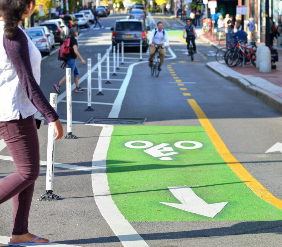
El uso de bicicletas y vehículos sin motor repunta como opción rápida y segura para ir de un punto a otroPor Gerardo E. Alvarado Leónsábado, 30 de mayo de 2020 - 11:40 PM[caption id="attachment_4047" align="alignnone" width="940"] Los carriles exclusivos se crearían con elementos removibles, como drones anaranjados, vallas o conos, entre otros, que separen los autos de los peatones y ciclistas. (Shutterstock.com)[/caption]A nuestra audiencia: El Nuevo Día te ofrece acceso libre de costo a su cobertura noticiosa relacionada con el COVID-19. Si quieres apoyar nuestra misión de brindarte información verdadera, pertinente y útil ahora y después de la emergencia, te exhortamos a suscribirte en suscripciones.elnuevodia.com.En momentos en que más sectores de la economía reabren y el gobierno insiste en las medidas de distanciamiento social para frenar los contagios de COVID-19, el uso de bicicletas, monopatines y vehículos no motorizados repunta como alternativa de movilidad rápida y segura, particularmente en las ciudades.Con eso en mente, la organización Muévete en Bici Puerto Rico y la firma de diseño urbano Plusurbia Design unieron esfuerzos y elaboraron recomendaciones para la movilidad urbana, que procuran –en esencia– expandir las áreas y espacios para quienes se transportan sin auto durante las distintas fases de reapertura.La propuesta principal es la designación de carriles exclusivos o ciclovías.Aunque las recomendaciones son ideales para contextos urbanos, portavoces de ambas entidades indicaron que podrían implantarse en cualquier municipio, sujeto al desarrollo de un plan de movilidad. En esa línea, resaltaron que las sugerencias están alineadas al Plan Comprensivo de Peatones y Bicicletas de Puerto Rico, adoptado, en 2018, por el Departamento de Transportación y Obras Públicas (DTOP) y la Autoridad de Carreteras y Transportación (ACT).“Para usar la bicicleta necesitamos vías seguras, y eso es lo que estamos promoviendo. En Puerto Rico, cuando se decretó el ‘lockdown’ (cierre forzoso), muchas empresas dejaron de funcionar y se detuvo el transporte público, pero en otros países no. Lo que hicieron fue reducir el número de pasajeros y fomentar el uso de la bicicleta; hubo países que se las regalaron o prestaron a sus ciudadanos”, resaltó la fundadora de Muévete en Bici Puerto Rico, Ylenia González.El portavoz del DTOP, Alex Castro, confirmó el recibo de las recomendaciones y que están “en proceso de evaluación”. Ciclovías temporalesEn opinión de David Soto, jefe de la División de Movilidad de Plusurbia Design, los carriles exclusivos o ciclovías temporales se convertirían en extensiones de las aceras, que no garantizan el espacio recomendado de seis pies de distancia para evitar los contagios con el coronavirus SARS-CoV-2, que causa COVID-19.A su vez, las ciclovías proveerían una infraestructura segura para quienes no tienen auto o aquellos a los que el desempleo –debido a la pandemia– no les permita seguir costeando los gastos de mantenimiento de su vehículo individual.González y Soto explicaron que los carriles se crearían con “elementos removibles”, como drones anaranjados, vallas o conos, entre otros, que separen los autos de los peatones y ciclistas. Aseguraron que se trata de una alternativa de bajo costo y fácil implantación. Además, al ser removibles, dan la oportunidad de colocarse, por ejemplo, en horarios y días específicos y sacarse posteriormente, según las necesidades del municipio.“Estamos hablando de proveer una alternativa para que la gente pueda seguir moviéndose. Hemos visto un incremento en la gente con bicicleta, y lo que necesitamos es que se cree un carril para asegurar que puedan llegar al trabajo, supermercado o practicar recreativamente en el horario permitido”, dijo González.Como beneficio adicional, Soto mencionó que las ciclovías “liberan las calles” de las emisiones de los autos que agravan el sistema respiratorio y, al mismo tiempo, promueven la actividad física, que redunda en una mejor salud mental y un sistema inmunológico fortalecido. “Vemos esto como una respuesta de salud pública a una crisis de salud pública”, acotó. Rutas “centrales”En cuanto a la elección de rutas, señalaron que deben ser “centrales”, a fin de alcanzar los lugares cuya reapertura ya se autorizó y los que reanudarán operaciones en las próximas fases. Recomendaron que sean parte de las rutas más usadas por el transporte colectivo y que provean acceso directo a los comercios locales, por ejemplo, restaurantes.También, las ciclovías deberían crearse en carreteras con más de un carril para no interrumpir el tráfico de autos, que ha disminuido debido al cierre de escuelas y universidades y el aumento de personas trabajando desde sus hogares.Muévete en Bici Puerto Rico y Plusurbia Design realizaron una encuesta entre usuarios de bicicletas –a través de redes sociales– para conocer no solo la deseabilidad de su propuesta, sino también para identificar potenciales ciclovías, específicamente en San Juan.De ese ejercicio, resultó que el primer carril exclusivo para bicicletas, monopatines y vehículos no motorizados debe crearse en la avenida Ponce de León, que conecta a las comunidades del casco urbano de Río Piedras con Hato Rey, Santurce y Miramar.“La avenida Ponce de León conecta con la ciclovía que ya existe en San Juan y, por eso, se recomendó un carril ahí como primera fase. Luego, (se haría) en las calles que conecten con esa vía por las que pasa el transporte público y en las que hay hospitales, supermercados, farmacias, escuelas y agencias”, dijo González.Como segunda fase, se recomiendan ciclovías para las avenidas que intersecan la Ponce de León: De Diego (Santurce y Río Piedras; PR-37 y PR-47), Gándara y Domenech. La tercera fase incluye las avenidas Barbosa y Ana G. Méndez.Soto mencionó que países como Alemania, Argentina, Bélgica, Canadá, Colombia, Ecuador, Francia, Inglaterra, Italia, México, Nueva Zelanda y Perú han creado ciclovías temporales tras la declaración de la pandemia de COVID-19.Estados Unidos y Canadá también son parte de la tendencia. En ambos países, detalló, 49 ciudades han creado estos carriles y 39 han ajustado sus operaciones de transporte colectivo, según datos de la entidad Smart Growth America. “Esta es una alternativa para reducir pasajeros del transporte público… es una estrategia de gestión de transportación”, declaró. Recomendaciones adicionalesGonzález y Soto expusieron que “lo ideal” es que sus recomendaciones sean acompañadas de cierres de algunas calles en los cascos urbanos, lo que les permitiría a los restaurantes abrir y utilizar los espacios para colocar mesas separadas. Los clientes podrían llegar caminando o en bicicleta hasta los establecimientos.En Estados Unidos y Canadá, según Smart Growth America, 21 ciudades están prescribiendo estrategias para apoyar a pequeños comerciantes con zonas de recogido y entrega, así como la ubicación de sillas y meses al aire libre en espacios que solían ser estacionamientos.González contó, entretanto, que durante el pasado año colaboró con el Municipio de Caguas en la implantación de una ordenanza que estableció una ciclovía temporal. Hasta justo antes de que entrara en vigor el cierre forzoso por el COVID-19, un tramo –de una milla– en la avenida José Mercado se cerraba, todos los últimos domingos de mes, por cuatro horas.“La avenida tiene cuatro carriles y se cerraban todos para que las familias o individuos vinieran a correr, caminar, tomar clases y hacer otro tipo de actividades. Venía mucha gente de otros pueblos, porque era una zona segura para practicar el ejercicio y recuperar la salud”, dijo.González y Soto manifestaron estar disponibles para trabajar con los municipios en proyectos demostrativos. Además, instaron al gobierno central a facilitar los permisos para esos y otros proyectos de “urbanismo atractivo”. Una nueva ciudadPara el planificador urbano y arquitecto Pedro Cardona Roig, la propuesta de Muévete en Bici Puerto Rico y Plusurbia Design refleja cómo deben ser las nuevas políticas de transportación pospandemia.“Hay un aspecto fundamental que ha estado malamente atendido por décadas: el espacio y las necesidades del peatón”, dijo el también exvicepresidente de la Junta de Planificación. Añadió que, en estos días, es tema de conversación en foros internacionales cómo lograr que la infraestructura que –por años– estuvo dedicada “de manera monofuncional al uso del auto” se dedique o combine con otros sistemas de movilidad, como bicicletas, monopatines o rutas para andar a pie.En esa “perspectiva de futuro”, recalcó, el sistema de transporte público y los espacios peatonales son “esenciales”, y ambas áreas han sido históricamente desatendidas en la isla.Reconoció, por otro lado, que las ciclovías “no son una opción” para personas con problemas de movilidad o de edad avanzada, entre otros grupos que dependen del transporte público para ir de un lugar a otro. En esa línea, sugirió que el futuro del transporte colectivo sea con vehículos más pequeños que permitan reducir los viajes, que haya lectores de temperatura, mayor de protección para los conductores y que se reduzcan los tiempos de abordaje y descarga de pasajeros.“A lo que debemos aspirar es a estar bien servidos en un radio caminable. Pero eso supera, por mucho, las posibilidades de Puerto Rico porque carecemos de elementos básicos, y este es buen momento para tener la conversación sobre cómo cambiar”, indicó Cardona Roig. Para leer artículo en línea por favor haga click aquí.
BY PHILIP KUSHLAN AND VICTOR DOVERMAY 12, 2020 01:38 PM , UPDATED MAY 12, 2020 05:21 PM[caption id="attachment_3976" align="alignnone" width="933"] A southbound view of Southwest 157th Avenue running next to the Bird Basin Park, the proposed route of the 836 State Road extension in Miami-Dade County. PEDRO PORTAL PPORTAL@MIAMIHERALD.COM[/caption] The recent court ruling against the proposed State Road R836 Tollway extension into the Everglades should be the death knell for this ill-conceived waste of taxpayer and toll payer money. The judge ruled, based on evidence and testimony taken over an eight-day trial, that the project would do more harm than good.We believe that Miami-Dade County and the Miami-Dade Expressway Authority should accept the ruling and move on.For years, MDX claimed that the tollway extension was the answer to traffic congestion in West Kendall. It insisted the extension would ease congestion while protecting environmental resources. But Suzanne Van Wyck, an administrative law judge for Florida, found both claims to be false. She ruled that the extension would provide only “meager” congestion relief. She found “no support” for the claim that the new tollway would improve “the commute time to downtown and other employment centers.” The judge also found that, worse, extending the tollway would exacerbate congestion on existing SR 836. She wrote, “Commuters will drive 13 miles, outside of the [urban development boundary], through active agricultural lands, through environmentally-sensitive lands, and through the West Wellfield, only to connect with the existing expressway operating at [a level of service] lower than it operates at today.”While County Mayor Carlos Gimenez and MDX have extolled express bus service to be included on the extension, Van Wyck found no evidence that such facilities would actually be used. She found the Tollway would not, as the county’s land-use plan requires, “shift the travel mode” in that part of the county “from single occupancy vehicle to mass transit.”She also found that, contrary to MDX’s claims, the agencies responsible for the Comprehensive Everglades Restoration projects to which the Tollway poses an enormous threat, had not approved the Tollway. Each of those agencies — the Florida Department of Environmental Protection, the South Florida Water Management District and the U.S. Department of the Interior — have actually raised major concerns about building a highway through sensitive Everglades wetlands. The federal Environmental Protection Agency has said that the Tollway would pose substantial and unacceptable adverse secondary impacts on the Greater Everglades. Van Wyck ruled the county’s decision to approve the Tollway without these agencies’ approval violated the law.She also found that the Tollway extension would destroy wetlands critical to threatened or endangered species and conflict with the county’s policy to protect and enhance areas that recharge the West Wellfield. She specifically held that the extension “creates a risk of contamination to the [county’s drinking water] wellfields.” Based on the judge’s rulings, it is impossible to see how the federal and state wetland and endangered species permits this project would require could ever be legally obtained.Trials have a way of sifting spin from fact. The county and MDX were granted every opportunity to put on their strongest case in support of the extension. The trial proved that the extension’s claimed benefits are illusory while its environmental harms are real and unavoidable.There is hope. During the hearing, evidence was presented by urban planner Juan Mullerat of PlusUrbia regarding the feasibility of mass-transit solutions using rights-of-way on Southwest 137 Avenue to connect segments of the county’s SMART plan. While no silver bullet exists, and the wisest approach is a zealous and fully funded implementation of the SMART Plan, smaller, less ambitious, but collectively meaningful transit and road and signalization improvements could, in the meantime, provide initial congestion relief.It is time for MDX, which already has squandered more than $7 million on consultants to plan this ill-advised attempt to meet modern transportation needs with another car-oriented highway, to pull the plug on the project. The Miami–Dade County Commission should do the same by repealing the comprehensive-plan changes that have now been found to violate the law. We call upon the County Commission and the MDX Governing Board to withdraw all applications seeking approval for the SR 836 Tollway Extension, to cease all planning for the expansion and to declare the proposal explored, rejected and withdrawn.Philip Kushlan is president of Friends of the Everglades. Victor Dover is a fellow of the American Institute of Certified Planners. Click here to read or listen to the full article online.

The city’s development boom has finally caught up to a lush haven of shade trees and cafes. Some worry the neighborhood growth is too fast.[caption id="attachment_3857" align="alignnone" width="864"] CocoWalk, an open-air mall in Miami’s Coconut Grove neighborhood, is scheduled to reopen this year after a makeover. Angel Valentin for The New York Times[/caption]By Jane MargoliesMarch 24, 2020, 9:00 a.m. ETWith its profusion of parks and shade trees, Coconut Grove is celebrated for being one of the greenest parts of sun-baked Miami.It has some of the best schools in the city, drawing students from all over the metropolitan area. And it has long been a magnet for artists, writers and musicians who have given the neighborhood a bohemian vibe.But lately, Coconut Grove has become known for yet another thing: a real estate boom.The area did not experience much of the pre-recession wave of development that swept other Miami neighborhoods. But now, luxury residential towers by renowned modernist architects have been rising in Coconut Grove along Biscayne Bay, a snazzy hotel recently opened, and a well-known shopping center is getting a makeover.And boutique office buildings are going up, attracting brand-name tenants in the tech, finance and creative industries.The office square footage is a small fraction of that of nearby Brickell or downtown Miami, but the development is occurring in an area under six square miles, much of it zoned for low- and midrise construction.The fast pace of growth and gentrification is pushing out longtime residents. And it is raising a question about the neighborhood’s identity: Can the Grove grow without losing its groove?Juan Mullerat, the founding principal of PlusUrbia Design, which worked with Perkins & Will, a global design firm, on a master plan for the business improvement district a few years ago, expressed concern about vacant storefronts.In some cases, short-term investors may be sitting on properties, waiting for their value to rise before flipping them. Some owners are offering only short-term leases, Mr. Mullerat said, “making it difficult for businesses to make investments in their stores.”Follow the link to read the full article: https://www.nytimes.com/2020/03/24/business/miami-coconut-grove-development.html

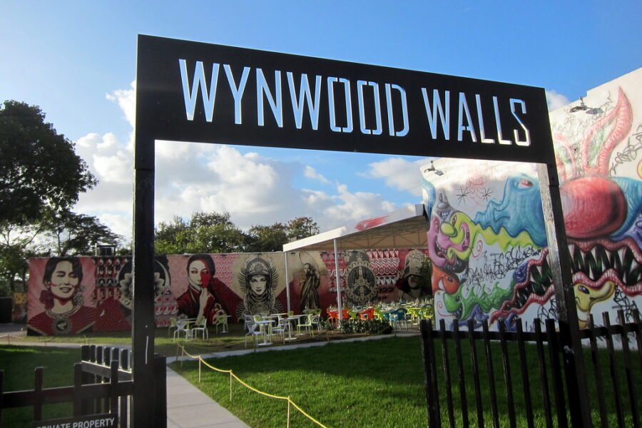
February 20, 2020by Travis DagenaisEach December, the art world descends on Miami Beach for Art Basel’s American installment, Design Miami. In late 2018, Cuban-American artist Xavier Cortada wanted to loop a social statement into the cresting euphoria.Cortada created blue and green yard signs; each listed a number, designating how many feet of sea level rise would submerge a given property in his Pinecrest Gardens neighborhood. He incorporated designs from “Ice Paintings,” an artwork he had completed in Antarctica that was composed of sediment from melting glaciers.[caption id="attachment_3798" align="alignleft" width="446"] Artist Xavier Cortada's studio in Pinecrest, with an “Underwater HOA” sign indicating how much sea rise will submerge the property[/caption]Cortada and his neighbors staked these signs in their front yards, and with that, his Underwater HOA project punctuated Design Miami with a reminder of looming danger. “By mapping the crisis to come, I make the invisible visible,” Cortada says. “Block by block, house by house, neighbor by neighbor, I want to make the future impact of sea level rise something no longer possible to ignore.”Among American cities, Miami emerges as a particular case study in how and where we will house people as climate pressures mount. Its famous beaches and waterfront condominiums will struggle with sea level rise in the next 50 years—and inland regions will feel pressure, too, as coastal residents search for dry ground. Already, salt water routinely floods Miami’s streets and bubbles up in family yards, permeating the porous limestone bedrock deep underground. While basements and garages flood, developers proceed headfirst into seaside condo projects.As temperatures, oceans, and anxieties rise, might designers help anticipate—and adapt to—what is now considered the inevitable? In Miami and Miami Beach, what will happen to neighborhoods, like Cortada’s, expected to be underwater within their residents’ lifetimes? Can new buildings, and new strategies, emerge from competing dialogues?Stoked by this dilemma, Harvard Graduate School of Design professors Eric Höweler, an architect, and Corey Zehngebot, an urban designer and architect, organized a GSD investigation into issues of housing, resilience, and adaptability, using Miami as an urban laboratory. Their investigation, the Fall 2019 option studio “Adapting Miami: Housing on the Transect,” engaged a cohort of 12 GSD students in months of research, site visits, and critical review.Students generated housing-focused proposals that offer a portrait of Miami’s risks and opportunities. They collaborated with and drew research insights from a concurrent seminar led by Jesse M. Keenan, recognized as a leading researcher on questions of climate and real estate; he has worked to shape a global discourse on the relationship between climate change, social equity, and applied economics.The geographical and conceptual heart of their study is a periscopic transect of the city created by two of Miami’s most iconic streets—Flagler Street to the north, and 8th Street, also known as Calle Ocho and the Tamiami Trail, to the south—which bracket a swath of Miami's fabric, cutting westward from the City of Miami’s high-density eastern coastline, through Little Havana, West Miami, and Tamiami, and into the Florida Everglades. This transect captures a range of natural ecosystems and urban conditions while representing the constraints of Miami’s built and natural environments: hard boundaries of high-density urban development at some edges (east, north, and south) and water everywhere else—the Everglades to the west, the Atlantic to the east.It is along and between these corridors where interesting opportunities for different housing typologies emerge, opportunities that are intertwined with mobility, streetscape design, density, infrastructure, ecology, resiliency, and adaptation, Zehngebot observes.[caption id="attachment_3799" align="alignnone" width="947"] For the studio's December 2019 final review, participants organized their projects along a model of the full Flagler/Calle Ocho transect[/caption]“We are invoking the transect in order to provoke a concept rooted in the New Urbanist ideology of Andreas Duany and Elizabeth Plater-Zybek, whose firm is appropriately based in Miami,” Zehngebot says. “We are appropriating the transect from the New Urbanists just as they appropriated it from ecology and environmental planning because it is a useful framework for understanding the transition from urban to rural and how might housing typologies manifest themselves at different moments or zones along a streetscape continuum. This is further complicated in Miami, a city that feels the effects of water from all sides, and whose areas further from the coast are counterintuitively more vulnerable where the water is coming not from the sea, but from the ground.”With the constraints of space and time, and the limits of human and financial resources, where might there be opportunities to rethink how we plan the buildings, cities, and regions of the future?An American City’s Formative Years: The Legacy of the AutomobileAs American cities go, Miami is young. The City of Miami was officially incorporated in 1896 and named for the Miami River—derived, in turn, from Mayaimi, the historic name of Lake Okeechobee and the Native Americans who had lived in the region for centuries. So-called lot-and-block development took hold of the city’s early planning, with civic infrastructure like transit and public space an afterthought.Despite its youth, Miami is a city with an organic relationship to change—natural, political, and otherwise. The city’s tradition is to live on or with water, and with nature. As the seas ebb and flow, so does Miami’s urban rhythm.But today, Miami’s freedom to change is increasingly constrained. It is arguably one of the few cities in the United States with a truly limited supply of land. Its 1920s-era “garden cities,” like Coral Gables, began percolating along the eastern shore and spread westward, growing more densely packed as they approached the Everglades. Now, out of necessity, the city is looking to move eastward back toward the sea, infilling its limited land with higher-density housing.With a renewed interest in fitting as many people as possible on limited land, many Miamians are realizing that the city’s traditional housing forms may no longer be sufficient. The single-family, low-rise house that dominates Miami’s urban fabric—a herald of the “American Dream”—may fail to sustain successive waves of younger, more transient citizens and new, expanded forms of family. Meanwhile, the high-rise towers that stand along the shoreline will be exposed to rising seas and stronger, more frequent storms. The modernist, Art Deco styles that flavor the city with clean, simple geometries don’t lend themselves to climate-resilient architecture, either.Compounding these pressures is the city’s lack of cohesive, holistic city planning. Miami offers a mix of vibrant, diverse communities, but they have competing municipal priorities and policies.Then there’s the legacy of the car. As Miami matured into the 1900s and the so-called era of the automobile, the car shaped the city’s spatial dimensions: long, straight avenues and single-family houses with driveways. One result is that rather than an urban center with spokes and connective tissues, Miami’s urban design resembles a large city composed of multiple, smaller cities—a sort of architectural accident.“Miami didn’t have the chance to develop without the impact of the automobile,” says Juan Mullerat, founder and director of urban design firm PlusUrbia. Among the projects that Mullerat and PlusUrbia have developed are Miami’s Little Havana Revitalization Master Plan and Transit Oriented Development (TOD) Guidelines for the City of Miami. The firm’s work on Miami’s Wynwood Neighborhood Revitalization District earned the American Planning Association’s 2015 America’s Great Places Award.Overlooking a lush Little Havana tree canopy from PlusUrbia’s offices, Mullerat explains to the GSD studio that, in his native Spain and throughout Europe, cars and parking are considered amenities, like a swimming pool, rather than standard elements. When you allot less space for cars, he continues, you get more space for people. “The neighborhood itself becomes the amenity,” he says.As Mullerat guides the studio through neighboring Little Havana, MArch candidate Aria Griffin pays attention to a series of hulking parking garages, standing like monuments to a car-centric history—unavoidable, but also largely unused. She’s wondering if residents might benefit from something other than parking.Griffin’s concurrent research on medical care had led her to the conclusion that, in essence, hospitals are the most expensive form of housing in the nation. She turned this equation into opportunity by proposing a mid-rise tower, containing both housing and a hospital, at the corner of 12th Avenue and Flagler Street in East Little Havana. Griffin proposes replacing the currently existing Walgreens with the tower, also modifying the current on-grade, covered parking lot surrounding the store in order to generate a friendlier streetscape. Final model of Aria Griffin's proposed project Griffin’s project would work to combat issues of loneliness and disenfranchisement in addition to promoting healthier living for those most at-risk ahead of the climate disasters expected to loom in Miami’s future: the elderly, the disabled, and the homeless.“I knew I wanted to propose a project that would provide housing, integrated health services, as well as public space to East Little Havana,” Griffin says. “I believe that such institutions must be integrated in the city’s fabric to better serve its communities.”Griffin observed other considerations at play. Building inland helps defray flood risk—a theme observed throughout the studio’s investigation—while the character of East Little Havana, marked by a lively streetscape and vibrant community life, makes it appealing for residents. She also addressed questions of mobility and accessibility issues. Rather than densifying the entire Calle Ocho corridor with a transit line, she instead prioritized nodal transit connections that would improve circulation.[caption id="attachment_3803" align="alignnone" width="948"] Mullerat and Griffin chat during the studio's final review, December 2019[/caption]Westward down the transect, MArch candidate Don O’Keefe saw a similar opportunity locked within the Florida International University (FIU) campus. Three large parking decks greet visitors at FIU’s main entrance. By replacing these with low-rise but high-density housing, O’Keefe aims to transform FIU into a transit- and pedestrian-oriented community in which student housing, classrooms, and public space is intermingled.As Griffin seeks to integrate medical infrastructure with housing—literally and conceptually—O’Keefe sees a parallel opportunity with higher education, a staple of Miami’s economy. O’Keefe’s project also anticipates coming storms, with housing designed to be adaptable: classroom and public spaces allow for the expansion of FIU's existing so-called “Living Learning Community” scheme. Meanwhile, common areas within the dorms could be flexibly rearranged and partitioned for use as overflow housing for nearby residents in the case of disaster, expanding FIU's existing policy on neighborhood assistance during major storms.[caption id="attachment_3804" align="alignleft" width="300"] O'Keefe's master plan shows one stage in the campus development. New buildings shield the massive existing parking deck from surrounding neighborhood and establish a new pedestrian oriented street grid.[/caption]Removing parking, though, reignites long-standing questions over mobility and accessibility, especially for aging populations. The East Little Havana intersection of Calle Ocho and Flagler Street offers a snapshot: it throbs with commercial activity, but to get there, pedestrians need to cross the wide, constantly trafficked Seventh Avenue, a vestige of Miami’s car-centric urban design. Instead, Höweler asks the studio, could Flagler emerge as a transit corridor, facilitating urban nodal connections and opening Little Havana to greater mobility and connectivity?[caption id="attachment_3805" align="alignnone" width="896"] Don O'Keefe discusses the research behind his FIU proposal during the studio's final review, December 2019[/caption]This question speaks to how space and typology interact: why start at the scale of the house and scale upward from there instead of planning larger, more connective institutions or infrastructures first and embedding housing within? How does the urban fabric respond when cities and regions invert the scale at which they design?In Miami, questions like these intersect where so much of the city finds inspiration: at the water.Living with, and on, WaterMiami’s tropical climate invites comparison to cities like Bangkok and Singapore, where high-density buildings sit beside broad, rainforest-like public spaces. Accordingly, throughout Miami’s urban growth, buildings have been spaced far enough apart to enable air circulation between plots.Extra space around buildings, though, means less collective space for public commons—and today Miami, like many American cities, is renewing its interest in public space. A trio of GSD students saw Miami’s city waterfront, where the Miami River meets Biscayne Bay, as an opportunity to add public space at the water.With their proposal, “Loop Within,” Adam Jichao Sun, Pengcheng Sun, and Shunfan Zheng pursued the chance to connect Miami more with nature, and to symbolically and literally unify water with people. They also wanted to experiment with the concept of a “vertical city,” extending the concept of high-rise towers into a more urbane and public, rather than cloistered, experience.“Loop Within” presents three high-rise towers on top of an undulating podium, with a single, publicly accessible walkway connecting the towers at varying heights, forming a continuous physical loop within the building. The walkway would be accessed by an oblique elevator facing the Miami River waterfront, as well as an elevated railway station at the project’s podium platform. The platform itself, with its physical ebbs and flows, navigates people from the river walk upward toward cultural and other public programming within the towers.[caption id="attachment_3806" align="alignleft" width="217"] Section plan for “Loop Within”[/caption]The proposal’s connectivity works at the master-plan scale as well. Rather than an enclave-type development, “Loop Within” bridges what are currently segmented city blocks to generate a connected river-walk experience. Cultural programming is distributed at nodes along the waterfront in the interest of creating a destination out of the waterfront.“Articulated as a cultural loop, our proposal emphasizes physical accessibility and visual attraction to the urban context,” the team writes. “The juxtaposition of public and private development, as well as a broad spectrum of dwelling units, renders the super-block into a ‘city within one building’ concept.”The team also sensed the needs that building projects in Miami must resolve—namely, limited housing and rising seas. “Loop Within” fills the bulk of its towers’ interiors with housing, while the walkway’s physical infrastructure includes a seawall to mitigate flood risk.[caption id="attachment_3807" align="alignnone" width="963"] Juan Mullerat interrogates “Loop Within” during the studio's final review, December 2019[/caption]“Loop Within” stands as a bit of a metaphor for Miami today: incorporating both people and water, it synthesizes questions of economics, culture, and the risks of the future, pulling them together in new ways to make or suggest new forms of city-making. With a sense of temporality and adaptability baked into the design, the project both represents and responds to the city’s relationship with change. It also pivots away from the possessive, land-centric model of previous real estate development.[caption id="attachment_3808" align="alignleft" width="270"] “Loop Within” would offer a spectrum of housing-unit types[/caption]“The project’s dynamic relationship with water is largely achieved by articulating its podium as one undulating typography with programmatic flexibility under different water height conditions,” the team observes. “The undulating surface presents a welcome gesture to the potential sea-level rise and unveils different modes of flow: flow of water, and flow of people. Both the existing multi-ground-level condition and the potential sea-level rise spontaneously render the feasibility of a ‘vertical city’ that dynamically interacts with the water.”Colleague Yuebin Dong, an MAUD candidate, offered a complementary project that would extend this symbolism further: a school on the water. Currently existing KLA Kindergarten and Elementary School, near Brickell City Center, has been threatened with demolition; in maintaining its physical presence, Dong advocated for civic democracy, prioritizing education among the various features of Miami’s iconic waterfront while also building in spaces that could double as public amenities, like a library or a gymnasium.Water presents opportunity in Miami, but also threat—and inland regions will feel the pressure, too.MArch candidate Grace Chee followed the transect to its Everglades terminus, arguing that development into the Everglades is inevitable in the near future, as suggested by the proposed expansion of the Urban Development Boundary in Miami-Dade’s 2020/30 Land Use Plan. Her proposal, “Sub-Urbia,” proposes an environmentally responsible model of housing development that minimizes disruption to the natural ecology and explores the implications of living in a state of both suspension and floatation. She drew design inspiration from traditional housing in the Mekong floating villages of Vietnam, seeking to replicate the complex and ephemeral relationships between different housing types within the village, with varying degrees of permanence and attachment to land.“With its daily and seasonal tidal fluctuations, the marshland provides an opportunity to create a prototype for amphibious living in Miami in response to rising sea levels, one that also offers an alternative suburbia to that which lies on the other side of the UBD,” Chee writes.Fellow MArch candidate Kofi Akakpo brought a similarly critical eye to the relatively inefficient land usage of cemeteries, especially those located in urban cores where land is at an increasingly high premium. Thus, Akakpo’s studio proposal, “Can the Living Live with the Dead?,” reinvents the horizontal cemetery as vertical, a phenomenon already happening in countries like Brazil and India. With this reinvention, Akakpo asks another vital, if macabre, question: with cemeteries and other burial grounds, what happens to all of those bodies as water creeps inland?“Aside from the inefficient use of land that is ground burial in traditional cemeteries, as flood waters come and ground waters rise with the sea-level, we run the risk of a lot dead bodies, particularly from old caskets, siting within the water table, contaminating ground water sources,” Akakpo writes. “A lot of these bodies will have to be moved to protect our fresh water sources.” It's an observation that gets at some of the less-obvious but unquestionably threatening impacts of rising waters.[caption id="attachment_3809" align="alignnone" width="900"] A view across the retaining pond of Akakpo's proposal[/caption]Akakpo’s project would deliver a ring of housing, centered by publicly accessible green space and adjacent to a grid of vertical ossuaries into which bodies would be relocated from underground burial plots. A retaining pond at the middle of the ossuaries would provide both a slice of visual beauty, as well as a floodwater safety valve.Akakpo’s proposal highlights the reality that water may prove unstoppable, its march inland carries various layers of risk, and our waterfronts are hardly the only consideration at stake.Art as InstigatorIf Miami is shaped by water, it is fueled by art.Miami’s Wynwood neighborhood looks a lot more colorful, and welcomes many more visitors, than it did a decade ago. Abandoned lots and buildings have been transformed into a sort of ever-evolving outdoor museum, with masterfully designed graffiti art covering almost every available surface. Funky dining spots and retail shops have sprung up. Some would say Wynwood actually feels like a neighborhood. Its transformation started with little more than creativity and paint.[caption id="attachment_3810" align="alignleft" width="205"] Srebnick guides the studio around Wynwood Walls during the studio's September 2019 Miami visit[/caption]“Art is energizing, it creates a sense of place, and it brings people together,” says Jessica Goldman Srebnick as she guides the GSD studio through Wynwood Walls. Srebnick is founder and CEO of Goldman Global Arts, which operates Wynwood Walls; her father, Tony Goldman, collaborated with art curator Jeffrey Deitch to spark Wynwood Walls in 2009. In recent years, Srebnick started inviting graffiti artists from around the world—many of them never before exhibited—to color Wynwood, literally and otherwise.As Srebnick worked to make Wynwood a new Miami destination, businesses started paying attention. She turned down Starbucks and 7-Eleven and, instead, kept looking for talent from around the world who might want to bring their slice of creativity to Miami. Today, Srebnick and Goldman Global Arts welcome millions of visitors to Wynwood Walls each year, free of charge.[caption id="attachment_3811" align="alignnone" width="971"] Wynwood Walls. [Photo by BonzoESCFollow_. Available under a Creative Commons Attribution-NonCommercial 2.0 Generic (CC BY-NC 2.0)][/caption]The result is a neighborhood where, Srebnick says, you can feel a sense of place, not unlike New York’s SoHo or Los Angeles’s Arts District. “You see a lot of people wandering around Wynwood now,” Srebnick observes. “Art has made the neighborhood itself an amenity.” She adds that not a single Miami resident has been displaced in the process.Historically, Miami has lacked a single, unified cultural district, though the city’s cultural and artistic production is globally renowned. Streams of intense creative production and spirit thread through the city, and individuals like Srebnick have established their own sorts of pocket districts, which in turn attract business and cultural attention. It’s a pattern that jibes with the city’s generally laissez-faire, homegrown attitude toward city development.A few blocks north of Wynwood Walls, the Bakehouse Art Complex hums with a quiet focus. Bakehouse was founded by and for artists in 1986 and, with support from the City of Miami and Miami Dade County, transformed an industrial, Art Deco–era bakery in a then-blighted neighborhood into a home for talented artists, helping address the difficulty of finding space for creating and developing a practice.Now, more than 30 years later, Bakehouse is trying to maximize use of its 2.3-acre campus in the heart of Miami’s urban core to address the city’s affordability crisis, says acting director Cathy Leff. As a result of the organization’s access to and engagement with its community of artists, city officials, and surrounding neighborhood—as well as with Harvard GSD’s ongoing “Future of the American City” initiative—the organization is on a path to rezone its site to be able to add residential uses, specifically affordable housing for artists, Leff says.“If successful, Bakehouse can become a true cultural anchor in a multigenerational and multicultural community, embedded in and embraced by the community to become a more robust and public commons for critical discourse, community dialogue, and exchange,” Leff observes.MArch candidate Brian Lee saw such opportunity with the famed Miami–Dade County Auditorium, at the corner of West Flagler Street and 27th Avenue. Opened in 1951, the auditorium’s architecture shouts Art Deco revival, while the surrounding neighborhood bears vestiges of an automobile era: a relentlessly square grid that serves cars but complicates connectivity among the area’s art and cultural destinations and transit options. Lee saw an opportunity for greater neighborhood connectivity as well as higher-density housing.[caption id="attachment_3812" align="alignnone" width="980"] Presentation model of Brian Lee's proposal[/caption]Lee proposed a new theater to replace the auditorium after its lifespan, with a cap on parking spaces and a diagonal-cutting route that connects much of the area’s neighborhood development with local rapid-transit nodes. Housing would be integrated with Lee’s new auditorium, creating a courtyard that would double as an outdoor lobby.“More often than not, such multi-use developments are broken into their component parts, each of which is stacked or separated into large podium-tower configurations or segregated buildings,” Lee observes. “My project tries to challenge these types, by attempting to integrate the programs more closely so that residents can participate in this larger performance.”[caption id="attachment_3813" align="alignleft" width="260"] Brian Lee presents his reimagined Miami-Dade County Auditorium during the studio's final review, December 2019[/caption]In today’s Miami, art can offer a foundation, a catalyst, and a sustaining force for housing and sense of place. But art has also played the role of activist: the Bakehouse rose from the need to offer sustainable living for artists and their practices, while cultural institutions like Miami’s Knight Foundation have worked for decades to convene dialogue and programming that stirs debate and tackles urgent social and political issues. (Knight was founded by newspapermen seeking new ways to communicate and thus to stoke public awareness; as Knight’s Victoria Rogers observed during a panel discussion at Bakehouse, “engaged communities have always been critical to democracy.”)In parallel, themes of climate change and rising seas have permeated the Miami art world—as the activism of Cortada’s Underwater HOA exemplifies. Artists and designers like Cortada have emerged as powerful communicators to herald the urgency and possible solutions around Miami’s issues. With so many of the city’s famed institutions perched on the water, art, climate, and dialogue work together in a circular feedback loop, each informing and driving the others.The Immigrant Experience and the “New American Dream”In considering Miami’s waterfront as a democratic space, studio members emphasized a stitching together of segmented blocks. Indeed, throughout much of Miami’s urban fabric, segmentation and separation appear as rules—perhaps another vestige of the tropical-climate planning that favored spacing and subsequent air circulation, or more broadly of the city’s lack of holistic urban planning.Regardless of cause, one effect of physical segmentation is social and community isolation. Single-family homes and high-rise towers alike are generally private experiences with private or individual entrances, and lack of public spaces compounds this effect.For waves of immigrants and other newcomers, this urban fabric is hardly welcoming. Hua Tian and Jungeun Goo, both candidates for the MArch in Urban Design, and Haey Ma, an MLA candidate, saw this as a stimulus for a typology refresh.Tian’s “A Piece of Life: Collective Housing for New Immigrants” takes up the intersection of 8th Street and 12th Avenue. Marked by lively street life, authentic human interaction, and nearby public transit, it is also comprised of segmented, incoherent housing. She took inspiration from the architectural language of Havana, Cuba, to design a housing project incorporating repeated, arched facades and centered around a communal courtyard.[caption id="attachment_3814" align="alignleft" width="250"]
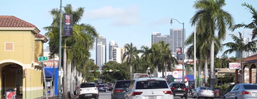
"The once predominantly Cuban enclave is changing fast, with Cubans moving out and high-rise developers trying to move in."Alan Gomez, USA TODAYUpdated 6:52 a.m. EST Jan. 31, 2020The USA TODAY Network series Hecho en USA, or made in America, focuses on the nation's growing Latino community. Roughly 80% of all Latinos living in the U.S. are American citizens, but media coverage of Hispanics tends to focus on immigration and crime, instead of how Latino families live, work and learn in their hometowns. Hecho en USA tells the stories of the nation’s 59.9 million Latinos – a growing economic and cultural force, many of whom are born in the U.S.MIAMI – Just past the row of Cuban restaurants, past the park where Cubans spend their days playing dominoes, past the crowing roosters and the Bay of Pigs Memorial, there's a cigar shop in the heart of Little Havana.Inside Casa del Tabaco, native Cubans spend their days rolling the cigars that have become as synonymous with the Cuban experience as rum, baseball and salsa dancing.But the tobacco leaves used to roll those iconic stogies hold a secret: The seeds are from Cuba, but the plants are grown in Nicaragua, Ecuador and the Dominican Republic. The store itself has another surprise: Its owner, René Diaz, isn't Cuban either. He's from Chile.That same dichotomy plays out on a larger scale throughout Little Havana. The once predominantly Cuban enclave has changed dramatically in recent years, and development threatens to plow over the historic neighborhood as the population has morphed into a hodgepodge of people from Mexico, Central America, South America and the Caribbean.[caption id="attachment_3763" align="alignleft" width="396"] Aleida Francisco and Rodolfo Amaro Beltrán, both native Cubans, create handmade cigars at Casa del Tabaco in Little Havana. The staff are all Cuban, but the owner, René Diaz, is from Chile and wants to keep the Cuban culture of Little Havana alive. "This is the closest they'll get to the Cuban culture without going to Havana," Diaz said.SANDY HOPPER, USA TODAY[/caption] Little Havana isn't even majority-Cuban anymore. Officials estimate that the neighborhood of 60,000 is only about a third Cuban.Diaz said he met a lot of resistance from Cubans when he entered the cigar industry, more so when he opened his store in the middle of Little Havana last year. He made clear that he wants to preserve the Cuban rhythm of the neighborhood to honor its history – and to make sure tourists keep coming."This is the closest they'll get to the Cuban culture without going to Havana," he said.[caption id="attachment_3767" align="alignright" width="634"] SOURCE maps4news.com/©HERE[/caption]Little Havana, which is set to receive a fresh wave of tourists as Miami hosts Super Bowl LIV, is a microcosm of the shifts in immigration felt throughout the country and the race to revitalize – or gentrify – urban cores.Cubans once made up the majority of immigrants in Miami, but the area has been flooded in recent years by immigrants from Central and South America. In the same way, Mexicans make up the majority of Latin American immigrants to the nation as a whole, but Central and South American migration has increased rapidly. In 1980, there were approximately 354,000 Central Americans living in the U.S. By 2017, that number had exploded to more than 3.5 million, according to the nonpartisan Migration Policy Institute, changing the makeup of cities big and small across the country.That trend can be seen clearly in a three-block stretch of the historic Calle Ocho that cuts through the middle of Little Havana. There's a Honduran restaurant, a Salvadoran one, a Mexican one, even a Colombian-Nicaraguan restaurant that serves food from both countries.Marcia Romero, 58, moved into the area 18 years ago from her native Nicaragua because she knew it was a friendly place for immigrants. Back then, it was all Cuban. Now?South Florida’s immigrant Hispanic population shifts during three decades[caption id="attachment_3769" align="alignnone" width="532"] SOURCE Pew Research Center[/caption]"This one is Honduran, this one is Honduran; across the street, there is a Salvadoran family," Romero said outside the small house she rents with her son and grandson. "Oh, wait, that house is still Cuban."When the owners of Mi Rinconcito Mexicano opened in Little Havana 13 years ago, critics questioned whether it could survive in the Cuban community. The restaurant thrived, employing workers from Honduras, El Salvador, Nicaragua, Guatemala, Mexico and Cuba."That's the beauty of Miami," said Jocelyn Mendoza, the manager at Mi Rinconcito who is originally from Mexico. "People come here and adopt each other's traditions." "That's the beauty of Miami. People come here and adopt each other's traditions." -Jocelyn Mendoza, manager at Mi Rinconcito MexicanoSady Guerra, 29, a construction worker from Honduras who arrived in the U.S. last year with his wife and daughter to request asylum, said he thought he would land in an area dominated by Cubans. After getting to know his new neighborhood, he realized how much had changed."Maybe it's time to change the name," he joked. "Little Havana worked back then, but now, it's so mixed, that doesn't really apply anymore."The fact that Little Havana's demographics are changing represents the latest evolution in the neighborhood's history.Little Havana, the heart of the Cuban-American community in Miami, is no longer majority Cuban. Locals are fighting development to save their history.SANDY HOOPER, USA TODAYLittle Havana not as Cuban as it used to be, but clinging to cultureThe area was first populated by Southern Americans willing to take a risk and move to swampy South Florida shortly after it was founded in 1896. The neighborhood transitioned into a working-class Jewish enclave, filled with transplants from New York and other northern cities.As those Jewish residents moved up the economic ladder, they moved out to newer suburbs developed on the western edges of Miami-Dade County. That exodus happened as Fidel Castro took over Cuba in 1959, which prompted hundreds of thousands of Cubans to flee his communist regime. So many of them landed in the homes vacated by the Jewish residents that it didn't take long before the neighborhood was dubbed Little Havana.[caption id="attachment_3777" align="alignnone" width="864"] Little Havana locals play dominoes in historic Domino Park, "a great gathering place for older Cubans," a Miami historian says. SANDY HOOPER, USA TODAY[/caption]"The table was set for them," said Paul George, the resident historian at HistoryMiami Museum.Most of those Cubans came empty-handed, their possessions confiscated by the Castro regime. That meant the neighborhood maintained its blue-collar feel, only with more Spanish spoken and plantains for sale.Cuban businesses and restaurants opened, people moved into the two- and three-story apartment buildings that fill the area, and in 1963, they started playing dominoes in a park that is still in operation."That's a great gathering place for older Cubans," George said. "Obviously, within this ethnic group, there's tremendous camaraderie, probably much more so than say the typical American who is sort of suburban-oriented."Just as the Jewish residents of Little Havana moved up and out, so did the Cubans. As the years went on and they established themselves economically and politically, many moved to tonier neighborhoods west and south of the area.That left a gap that the immigrants from Central and South America quickly filled."Communities are organic things," said Carlos Fausto Miranda, a Cuban American real estate developer who is heavily invested in Little Havana. "They change and they evolve over time. Little Havana wasn't always Cuban, and it's less Cuban now, but that doesn't mean it's any less Cuban. These are not mutually exclusive ideas."That helps explain why Julio Cabrera picked Little Havana last year when he wanted to open a Cuban restaurant designed to capture the spirit of the legendary bars of pre-Castro Cuba. The renowned cantinero, or bartender, looked at all the hip, popular areas of South Florida and decided to open "La Trova" in Little Havana because he said the neighborhood is still the best embodiment of Miami's Cuban roots."The Cubans moved out, but the essence, the soul of Cuba remains here. That never left."-Julio Cabrera, a Cuba native who opened La Trova last year"The Cubans moved out, but the essence, the soul of Cuba remains here," said Cabrera, a Cuban native who emigrated to the U.S. 15 years ago. "That never left."What that means for the future of Little Havana remains unclear as neighborhood leaders grapple between nostalgia and profit.For decades, the area has been neglected by city leaders, falling into a state of disrepair throughout the 1990s and 2000s. It experienced a resurgence in the past decade as more bars and restaurants opened, and double-decker tour buses made the neighborhood a regular stop on their tours of Miami.[caption id="attachment_3778" align="alignnone" width="874"] Construction lines Calle Ocho, a historical strip of Little Havana. SANDY HOOPER, USA TODAY[/caption]That drew the interest of real estate developers. Miami's biggest business, aside from tourism, has always been real estate.A couple of miles east of Little Havana along Calle Ocho sits the Brickell neighborhood, a towering collection of glass-covered, high-rise condominiums and office buildings. One by one, those gleaming towers supplanted the older buildings that made up Brickell's waterfront skyline, which looks nothing like it did when it featured prominently in the opening credits of "Miami Vice."Many worry that Little Havana will become "Brickell West" as developers pounce on the new financial opportunities."We don't want displacement. We don't want to move the people out of there," said Juan Mullerat, whose Plusurbia urban design firm created a master plan for the neighborhood last year. "You need to try and protect it as much as you can.""We don't want displacement. We don't want to move the people out of there. You need to try and protect it as much as you can."-Juan Mullerat, whose Plusurbia urban design firm created a master plan for the neighborhood last yearHolding off eager developers is difficult for a neighborhood that's received little attention from the city. According to Mullerat, the Miami government has conducted 23 planning studies since 1997 of the nearby Coconut Grove neighborhood, which features wealthier residents, high-rise condominiums and restaurants that cater to high-priced tourists.Over that same time, the city has conducted only one such plan for Little Havana: the master plan his firm published last year, which hasn't been adopted by the city.Part of the problem is that Little Havana remains a working-class neighborhood, where 80% of residences are occupied by renters and more than 87% of rental properties are priced at less than $1,000 a month, according to Mullerat's study. That's good news for Miami residents desperate for affordable housing, but it makes it difficult for residents to band together to pressure city leaders to ensure that remains the case.In 2015, the National Trust for Historic Preservation, a Washington-based nonprofit group that works to preserve historic sites, listed Little Havana as one of its 11 most endangered historic places. The organization argued that the neighborhood faced "development pressure, demolition of historic buildings, displacement of existing residents, and zoning changes that could impact its affordability, cultural richness, and character."Locals say that threat remains. That's why Miranda and other real estate developers have tried to preserve Little Havana's identity on their own."You don’t need to come in here and bulldoze city blocks to build brand new sparkling businesses with ground-floor Chipotles and Starbucks," he said. "We’re showing, and we’re proving, that people thirst for authenticity and thirst for vibrant, urban environments."[caption id="attachment_3779" align="alignnone" width="857"] Historic Calle Ocho in Little Havana was once a predominantly Cuban neighborhood, but that's changed because of development and demographics. Cubans make up only a third of the population in Little Havana. SANDY HOOPER, USA TODAY[/caption]Bill Fuller, another developer, helped ignite the revitalization of Little Havana, reopening the Ball & Chain nightclub that was a fixture in the neighborhood in the early part of the 20th century but was closed for decades. He keeps his office a block away and owns and operates many of the commercial properties in the neighborhood.Though he calls himself an avowed free-market capitalist, he said other developers in the region know to keep their skyscrapers out of Little Havana."I know some of the developers that have built some of the stuff around us … and I've told them, 'Listen, you can build where you want, and I'm not going to put up the public battle, but if you come into these three blocks, you're going to hear from me,' " he said. To view the article online please follow the link below:https://www.usatoday.com/in-depth/news/nation/2020/01/31/miamis-little-havana-no-longer-majority-cuban-but-roots-remain/4587792002/
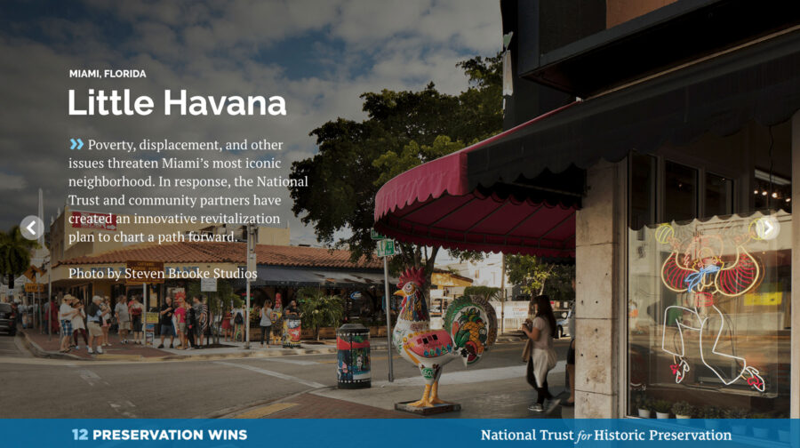
November 18, 2019 More:We're Saving Places By:Julia Rocchi Thanks to supporters and advocates like you, we at the National Trust are celebrating a year with wide-ranging victories, from hands-on work that enlivened old buildings, to legal successes that strengthened protection, to creative thinking that re-interpreted, re-imagined, and re-invigorated places telling America’s full history.To mark the occasion, we’re spotlighting 12 of our proudest preservation moments that epitomize our movement’s dedication and determination—and they’re all made possible by your support.8. Little HavanaMiami, FloridaAn international symbol of the role of immigrants in the American story, Little Havana—named a National Treasure in 2017—is Miami’s most iconic neighborhood. Yet poverty, displacement, and other issues threaten this vibrant community, prompting the National Trust to create a road map for improving life for Little Havana’s residents while protecting this one-of-a-kind place.In partnership with local organizations led by PlusUrbia Design, and developed with input from more than 2,700 residents, stakeholders, and public health advocates, the award-winning revitalization plan focuses on building a healthy, equitable, and resilient neighborhood that retains its unique character. Drawing on best practices from a variety of fields, the plan increases incentives, lowers barriers, and respects the existing heritage of Little Havana. With this innovative tool in hand, Little Havana now has a path forward that will help future generations continue to thrive.

BY ANDRES VIGLUCCISEPTEMBER 19, 2019 06:30 PM, UPDATED SEPTEMBER 19, 2019 06:43 PMSandwiched in between bustling Midtown Miami, the ultra-upscale Design District and the sizzling-hot Wynwood arts district, residents of the other Wynwood — its overlooked working-class residential enclave — figure it won’t be long before the redevelopment wave smacks them full bore.So they’re already gearing up for it.Rather than wait for the forces of gentrification to strike, residents and property owners in the Wynwood barrio section have organized in anticipation of its arrival. They formed a broad-based association, hired a prominent planner to draw up a map to guide revitalization, and will lobby public officials for zoning and other reforms to make sure they benefit and don’t get overrun.To distinguish themselves from the hipsters’ Wynwood to the south, and to reaffirm their neighborhood’s Hispanic immigrant and Puerto Rican roots, they’ve also given it a new name:Wynwood Norte.The new name made its formal debut Thursday evening, when the year-old Wynwood Community Enhancement Association unveiled a comprehensive vision plan for the neighborhood. It runs between Northwest 29th and 36th Streets from Interstate 95 to Miami Avenue, in the heart of Miami’s historic urban core.The roughly 35-block area includes three public schools and the Bakehouse Art Complex, which is planning a major expansion, as well as hundreds of single-family homes, duplexes and small apartment buildings. It was home for decades to Puerto Rican and later Cuban and Central American workers who labored in the garment district in the warehouses and factory buildings south of Twenty-ninth Street — what everyone today knows as Wynwood — before the industry went into sharp decline in the 1980s.Organizers of the unusual effort say they hope it will allow the low-income community of about 4,200 residents, one of Miami’s poorest, to retain not just its low scale and neighborly feel, but its people, too, even as it draws desperately needed new investment, homes and families to a neighborhood that’s been wanting for years.“I’ve seen all the changes, the ups and downs,” said association member Will Vasquez, an Army veteran who grew up in Wynwood. He owns several rental properties there and spends most weekends at his 90-year-old father’s home in the neighborhood. “Things have taken a big turn for the good. New people, investors are coming in. I am very excited.”But, Vasquez added, longtime stakeholders like himself don’t want dramatic changes, and that’s why they’ve banded together now.I would like to see the neighborhood kept more residential,” he said. “I don’t want to see Midtown or high rises. We have enough of that. I would like to see Wynwood Norte have its own identity. We want to make Wynwood Norte a place where people can come visit, eat at a restaurant. Very friendly, very walkable. And we hope to encourage people to fix their homes.”RESIDENTS LEAD CHARGEThe initiative in Wynwood Norte was prompted in part as residents watched other nearby neighborhoods attempt to fight wholesale changes only after rents and displacement shot up or major projects were already announced. By getting ahead of the game, they hope to set a template for developers and avoid divisive battles like that over the massive and controversial Magic City Innovation District plan in Little Haiti.Wynwood Norte residents and property owners huddle with planning consultants during a public workshop in May at Jose de Diego Middle School. COURTESY PLUSURBIA DESIGN They were also inspired by property owners in the Wynwood arts district who organized a business improvement district and got the city to approve special new zoning rules that encourage development of apartments and shops and foster improvements in the public realm, but restrict the scale and mass of new construction to ensure compatibility with the existing aesthetic.Wynwood Norte residents and property owners enlisted the support of the one large developer that’s announced plans for a significant project in the neighborhood. In 2017, Texas-based Westdale Real Estate Investment Management bought a block of mostly rundown residential properties and obtained city zoning approvals for a plan to raze them and build a low-scale housing and retail complex aimed at a range of incomes, including so-called workforce housing.A Westdale partner is a Wynwood Norte association director. The firm paid for the neighborhood vision plan by Plusurbia Design, the Miami planning firm that also developed the award-winning Wynwood arts district zoning plan, as well as a community-driven master redevelopment plan for Little Havana.Steve Wernick, an attorney who has represented Westdale and has been involved in the Wynwood Norte effort as a consultant and volunteer, said the developer’s interests mesh with those of the neighborhood: to ensure compatible development that will enhance the value of its project and its chances of success.But he stressed the impetus and direction are coming from the community, including leaders of nonprofits and service agencies in the neighborhood, such as Bakehouse interim director Cathy Leff, who is an association leader.Separately but in coordination with the association’s initiative, the Bakehouse has worked with Wernick on a strategic plan to renovate its historic building, an Art Deco former industrial bakery that houses some 60 artists’ studios, and add affordable housing for artists.“There is no other neighborhood that is planning the way this community is, “ Wernick said. “The community is saying, ‘Things are going to change, so let’s plan for that change. How can we grow in an appropriate way that allows the community to stay?’“It’s an invitation to the city and the county and the school board to take a look at neighborhood, to work with the association to implement the community vision. It’s definitely a balanced approach.”The Bakehouse Art Complex, housed in a former industrial bakery, in the Wynwood Norte neighborhood. BAKEHOUSE ART COMPLEX NOT ITS HEYDAYWynwood Norte has seen better days.Many Puerto Rican garment and factory workers owned homes in the neighborhood’s heyday, earning it the nickname of Little San Juan. But most Puerto Ricans are long gone, replaced by Cubans and later Central Americans, though the borincano flavor remains, mostly in names of places and institutions taken from the island.The city park, which includes a baseball diamond, is named Roberto Clemente Park, after the Puerto Rican major-league hall of famer. The local Catholic church, Mission San Juan Bautista, takes its name from Puerto Rico’s patron saint and its architecture from the island’s Spanish Colonial period. El Jibarito food market, named after the island name for its peasants, is still a draw on the neighborhood’s main street, Northwest Second Avenue. José de Diego Middle School honors a leader of Puerto Rico’s movement for independence from Spain. The San Juan Bautista Catholic mission church in Wynwood sits just north of the block that a Texas developer wants to redevelop. GALERIA DEL BARRIO But the Puerto Rican community that gave rise to the historic names is mostly a thing of the past. As the garment industry declined and disappeared, so did the garment workers who lived in the neighborhood. As it declined, Wynwood was plagued by crime, gangs and drug trafficking. In 1988, days of rioting ensued after undercover police bludgeoned a neighborhood drug dealer to death.Today, much of the population is a transient one, planners say. Over 80 percent of Wynwood Norte residents are renters, the association’s study says, though the population is trending younger. The neighborhood is dotted by vacant lots where houses were demolished; about 10 percent of Wynwood Norte is vacant land. Much of the remaining housing stock is deteriorated, though a few homes have been renovated in recent years by new owners moving into the area.Wynwood Norte residents today are among the city’s poorest. The median household income in the neighborhood is $19,800, and the median rent is $672, according to city of Miami planners. Fully a quarter of dwellings are officially designated affordable housing, including some public housing units, though some of it is not in good condition, the Plusurbia study says.Neighborhood businesses are faltering or disappearing. Dracula Video, for instance, long a mainstay on Northwest Second Avenue, moved out last year after the building that housed it was purchased, Vasquez said. Even the public schools are undersubscribed. Hartner Elementary and the Young Men’s Preparatory Academy are only at 50 percent capacity, planners say.Though there is plenty of low-cost housing, it’s in such bad shape that the neighborhood is attracting few families, Wernick said. That means it can’t capitalize on its status as one of Miami’s last largely residential zones in the urban core, he said.”It has remained very sleepy, but not in a way people are happy about,” he said. “There are lots of absentee landlords. Families that want to live in the neighborhood, they don’t have a lot of options. Professionals who want to live and work in the urban core don’t have a lot of options.” CAPPED HEIGHTThe Plusurbia plan would seek to foster compatible redevelopment through zoning tweaks to encourage incremental infill rather than large-scale projects, the typical Miami model. It calls for increasing allowable density while capping heights at four to five stories, and allowing developers extra square footage in exchange for payments into an affordable housing fund for the neighborhood.The plan also urges creation of a program of small grants to homeowners to underwrite repairs and renovations, and loosening of zoning rules to permit the addition of detached “in-law” quarters in single family home lots that allow for multi-generational living, or can be rented to boost family income and provide more affordable housing options.On the public side, the plan says the city and Miami-Dade must replace the neighborhood’s cracking sidewalks, improve street lighting and add to its thin tree canopy.The recommendations are the result of community consensus hammered out in public workshops, one-on-one meetings with local leaders, an online survey and walking tours of the neighborhood during which planners interviewed people on the street, said Plusurbia principal Juan Mullerat.“Everyone understood it needs to densify. Everyone was fearful additional density would displace them,” Mullerat said. “But overall we found there is room to grow within the neighborhood without displacing residents.“The whole idea here is that almost every recommendation is about mitigating displacement, increasing the affordable housing stock and supporting the existing residents.”One large problem that the plan would address, Mullerat said, is the suburban zoning assigned to Wynwood Norte by the city’s Miami 21 code, which does not allow sufficient density. The reason there is so much vacant land and little new housing in the area, he said, is that the rules make it unfeasible to develop there — a common problem in similar neighborhoods across the city, such as Little Havana.Those rules, Mullerat and other critics say, require too much parking onsite and too little building, making it almost impossible to physically fit it all in on a typical lot. That’s one reason why the typical Miami model of redevelopment is for an owner to amass multiple lots and build on a large scale, which displaces residents and helps drive up the cost of new housing.But that’s what’s likely in store for Wynwood Norte if the rules are not amended, Mullerat and Wernick argue.“If current conditions remain, doing nothing will lead to displacement, in my mind,” Wernick said.Yet Wynwood Norte already has the basics for success, stakeholders say. It is centrally located, dense, compact and eminently walkable, even if the sidewalks are cracking and the tree canopy thin. Social services, including a senior center, and Clemente Park are located on the business district main street. It’s a short stroll to Midtown Miami’s shops and restaurants and to Wynwood nightlife, both sources of jobs as well as diversion for residents.“It is because the location,” Vasquez said. “Wynwood is like a small little island, but there’s something always happening around it. Anybody that lives in Wynwood, you have everything at your fingertips. You don’t even need a car. You can take an Uber everywhere you need to go.”ARTISTS’ COLONYThe Bakehouse, meanwhile, has an ambitious plan that aims to turn it into a true community anchor.The center opened in 1986, after it was purchased by the city for an artists’ nonprofit to address a need for affordable working studios. At the time, artists were being pushed out of Coconut Grove by rising rents and redevelopment. Today, they’re being pushed out of the Wynwood arts district and downtown Miami.As Miami’s art scene grows, but affordable neighborhoods become increasingly rare, the need for housing for artists is a bigger need than ever, Leff said. The center is seeking zoning changes for its property to allow construction of up to 250 units of housing.Under a covenant signed when the city turned over the property, the bakery building must be preserved for artists’ use. So the development plan envisions a new residential building on the site, much of which is a parking lot or underused property, Leff said. The center expects to recruit investors or a developer to take on the housing portion, she said.The residential building would tie the Bakehouse more closely to the neighborhood, which would also benefit from the addition of hundreds of new residents to patronize businesses, Leff said.“We don’t want to overdevelop. Everybody recognizes the unique character of the neighborhood. We want to make sure whatever we do is in sync with the neighborhood,” Leff said.If the Wynwood Norte plan succeeds, Mullerat hopes it will become a new model for redevelopment in Miami — saving and enhancing what’s already there, instead of tearing it all down and building on a massive scale.“It’s been really a ground-up project. The neighbors have been very involved. It’s not developer-centric,” Mullerat said.“You are not going to do it tomorrow. We must create funding mechanisms that can fund all these lofty goals. It’s going to take time. But we need to start appreciating what we have.”
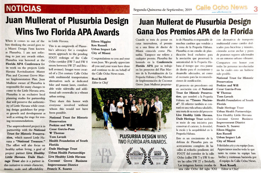
PlusUrbia's Megan McLaughlin contributed to the 2019 edition of Dade Heritage Trust Preservation Today Magazine.Her article is about the Vera Building, located in the OMNI Arts and Entertainment District of Miami. Read more about it below: Dade Heritage Trust was a key partner in the effort to create the Little Havana Me Importa Revitalization Plan. PlusUrbia is proud to collaborate with Dade Heritage Trust, helping to make Miami better, one step at a time.
Plusurbia Design was featured in the French magazine Urbanisme April, May, and June of 2019 issue. The article, written by Eric Firley, a Professor at the School of Architecture of The University of Miami, talkes about the City of Miami and its urban growth in spite of its battle with climate change. Plusurbia, along with other great firms in the City dedicated to urbanism, is mentioned for its groundbreaking work on the Wynwood Neighborhood Revitalization District, Little Havana Me Importa: Revitalization Master Plan, as well as the study of three Transit Oriented Development areas in Miami.

National Trust for Historic Preservation, PlusUrbia Design and local partners issue report with input from over 2,700 Little Havana residents and stakeholders.Miami (June 11, 2019) – With the goal of promoting the revitalization of the Little Havana neighborhood for current and future residents, the National Trust for Historic Preservation and PlusUrbia Design today released a master plan focused on building a healthy, equitable and resilient neighborhood community in Little Havana. The plan, put together over the course of more than two years and with the input of over 2,700 neighborhood residents and stakeholders and several local partners, brings together best practices and the latest thinking from a range of fields—from public health to urban planning to architectural design and historic preservation. It is the first plan of its kind to focus specifically on revitalizing and improving the quality of life for people in Miami’s most iconic neighborhood.The revitalization plan includes input from a collection of civic and non-profit organizations currently working in Little Havana, including: The Health Foundation of South Florida, Live Healthy Little Havana, Urban Health Partnerships and Dade Heritage Trust.From the time the National Trust named Little Havana a National Treasure in January of 2017, the Trust and its local partners led by Plusurbia Design, a local planning firm, have been focused on ways to retain the things that make this place one of America’s most beloved neighborhoods. While it is an iconic historic place, Little Havana is also a dynamic urban neighborhood whose residents face a range of challenges and threats, including poverty, sub-standard housing, displacement, poor transportation options and insufficient open space. This plan is an attempt to comprehensively address these challenges by bringing together an integrated set of national best practices from a diverse array of professional perspectives. Rather than a regulatory approach, the plan relies on increasing incentives, lowering barriers and respecting the existing heritage of Little Havana.“Little Havana is the heart and soul of Miami. It is also a longstanding symbol of the immigrant experience and one of the most essential places in America,” said Robert Nieweg, NTHP. “But there is no denying that this important place is also facing a range of threats, and its residents confront significant challenges on a daily basis, from sub-standard housing to poor transportation options to a lack of green space. In developing this plan, we listened to the concerns of thousands of local residents and stakeholders, and took advantage of the latest thinking in fields from public health to urban planning to architectural design and historic preservation to find solutions to these concerns. This is the first report of its kind, and webelieve it can be a road map for making life better for current and future Little Havanaresidents”"La Pequeña Habana is one of the best-known Latin-American barrios in the United States,"said Juan Mullerat, principal at PlusUrbia Design. "Though the neighborhood is one of Miami’spremier tourist destinations, those who spend time there know that its real value lies in itspeople and the legacies they have built over many generations in the neighborhood. This plan isinspired by the culture of Little Havana, and it seeks to ensure that this unique place and thepeople who created it will always have a home here." ABOUT THE NATIONAL TRUST FOR HISTORIC PRESERVATIONThe National Trust for Historic Preservation, a privately funded nonprofit organization, works to save America’s historic places. www.SavingPlaces.orgABOUT PLUSURBIA DESIGNPlusurbia Design is a Miami-based planning firm that designs contextual cities, towns and neighborhoodscollaboratively to create lasting value. www.plusurbia.comMEDIA CONTACTS: VIRGIL MCDILL, NATIONAL TRUST, 202.294.9187, VIRGILMCDILL@GMAIL.COMJUAN MULLERAT, PLUSURBIA DESIGN, 305.444.4850, JUAN@PLUSURBIA.COMRelated articles:WLRNhttps://www.wlrn.org/post/little-havana-revitalization-plan-released-will-now-go-actionThe Real Dealhttps://therealdeal.com/miami/2019/06/11/little-havana-could-be-redeveloped-like-wynwood/El Nuevo Heraldhttps://www.elnuevoherald.com/noticias/finanzas/acceso-miami/comunidades/article231432093.htmlWJCThttps://news.wjct.org/post/little-havana-revitalization-plan-released-will-now-go-actionCBS Miamihttps://miami.cbslocal.com/video/4102931-city-of-miami-unveils-plan-for-revitalization-of-little-havana/NBC Miamihttps://www.nbcmiami.com/on-air/as-seen-on/Mayor-Unveils-Plan-to-Revitalize-Little-Havana_Miami-511153152.htmlArchinecthttps://archinect.com/news/article/150141827/revitalization-plan-for-miami-s-little-havana-to-focus-on-more-affordable-housing-and-healthy-urban-livingCalle Ocho Newshttps://calleochonews.com/new-revitalization-plan-little-havana-me-importa/
BY ROB WILE AND JOEY FLECHASAPRIL 18, 2019 06:30 AMTri-Rail has yet to arrive at MiamiCentral Station, where Virgin/Brightline has long promised a downtown home for the stalwart commuter rail.But Tri-Rail continues to look ahead to stops that could serve rising populations along the way. A new study commissioned by the public rail company recommends potential local train stops in two Miami neighborhoods: Midtown and Little River.Coral Gables-based Plusurbia Design authored the report, which evaluates two spots in the Midtown corridor as suitable locations for a train platform in the near future, with some caveats. The planners wrote that any train stops must come with broader upgrades along surrounding streets, including redone sidewalks, better lighting and safer crosswalks, to encourage people to walk to the platforms.“You can put a station anywhere,” said Plusurbia principal Juan Mullerat. “But if you make it unpleasant to get there, then it will fail.” The study proposes a new train hub in Little River further in the future, with redeveloped residential and commercial buildings surrounding a station, all carefully planned with significant public input and sensitivity to residents who wish to stay in a gentrifying neighborhood.The report offers a vision of what transit-hungry citizens clamor for: connections that allow people to ditch cars and easily move between downtown and some of Miami’s most well-known neighborhoods.The business side of the idea is the tricky part. Plans for these train stops are contingent upon Tri-Rail’s access to tracks owned by Brightline, a private transit company. Planning from the two entities have moved at a pace Miamians have come to expect from big-picture mass transit projects: The date for Tri-Rail’s debut at MiamiCentral station, once expected in 2017, has been pushed back several times.A representative for Tri-Rail said there is now no projected date for when its first train will pull into downtown Miami. But in response to questions from the Miami Herald, a Brightline spokesman said it is working to install required safety controls for Tri-Rail to use its tracks, and is aiming to finish the work before the end of 2020.Still, politicians and local businesspeople endorse Tri-Rail’s idea. Last year, the Transportation Planning Organization — a countywide government agency that approves federally required plans and transportation policies — agreed to pay half the cost of smaller-scale pilot projects across Miami-Dade that would demonstrate people’s appetite for mass transit along corridors outlined by the countywide transportation blueprint known as the SMART Plan. Cities with the projects would pay the other 50 percent. Among those projects: A temporary train platform somewhere in the area of Midtown or the Design District.Miami Mayor Francis Suarez said that regardless of the operator, there’s an urgent need for traffic relief along the increasingly congested Biscayne corridor.“From a public policy perspective, from a quality of life perspective, it’s really important that this get resolved,” he said. “We cannot let this asset go underutilized.”Plusurbia’s report highlights two potential Midtown locations that could work for a train platform, if some significant changes were made — on the north end, bordering the Design District under the I-195 overpass, or further south, between Northeast 29th and 27th streets. Planners believe both would have a built-in ridership from the growing number of residential and commercial developments in Midtown, Wynwood, Edgewater and the Design District — along with the people from downtown and further north who wish to visit the area. The plan suggests there are fewer obstacles for a permanent platform south of 29th Street than under the I-195 overpass. The overpass site is north of Northeast 36th Street near a five-point intersection with Federal Highway and Northeast Second Avenue — the site of daily rush hour traffic snarls. The space on either side of the tracks between 27th and 29th streets would require the government to either acquire land or work with property owners to develop a station.One of those owners is interested. Bill Rammos, who’s invested in the Miller Machinery & Supply warehouse at 127 NE 27th St., told the Miami Herald he would be open to adapting the “old, underdeveloped warehouse” into a train station with commercial space.“I think that would help the whole neighborhood,” he said.Rammos considers the report a confirmation of what he sees every day: a growing community with new and obvious needs for those who live there, as well as people visiting the area — and cars are not the long-term solution.“More parking lots and garages for more cars ... we’ve been doing that for years,” he said. “And it’s not working.”For the temporary platform being pursued by the city of Miami, municipal planners still prefer the site north of 36th Street because the city’s parking authority already has land leased from the Florida Department of Transportation.“The report concludes that based on potential ridership, number of residents, and concentration of jobs, a location between Northeast 27th and 29th could better support a train station and would be better served by a train station than a location near 36th Street,” said city spokeswoman Stephanie Severino. “However, the specific station location near 29th would require land acquisition and there is not currently parking on-site.”.Plusurbia’s recommendations could guide the selection of a site for both a temporary and permanent platform, Severino said.Farther north and further into the future, the urban planning firm deemed a strip of land along Little River just north of Northeast 79th Street a viable home for a train stop accessible to residents of Little Haiti, Palm Grove, the Upper Eastside and Shorecrest. Planners see the potential for a transit hub, which could include a redevelopment of the Midpoint shopping center with new commercial and residential space, that balances gentrification already in motion with keeping current Little Haiti residents and the fabric of their neighborhood intact.The report emphasizes that maintaining the area’s cultural character and scale is crucial in a part of Miami already under pressure from developers, a point underscored by a current controversy about a large planned development about 17 blocks south of 79th Street. Plans for the massive Magic City Innovation District have fueled an intense debate among Little Haiti activists who agree the roughly 18-acre project would forever transform Little Haiti but not whether that change would be for better or for worse. Another 22-acre redevelopment proposal on Northeast 54th Street stalled last summer when activists objected.The need for reliable public transportation would likely have broad community support, though, as long as it does not come with real estate projects that would displace longstanding residents, the activists said. Meaningful community input would be key.“Any effort to relieve traffic that will not intrude on people’s way of life would be welcome,” said Marleine Bastien, a longtime area activist and director of the Family Action Network Movement.Last year, Northeast 76th Street resident Alisa Cepeda told the Herald she thought administrators ought to consider a train stop within walking distance of her neighborhood. With a station at 79th Street, she’d be able to make the seven-mile commute to work on just one train and a half-mile walk from MiamiCentral to her job on West Flagler Street. She’d have a much simpler commute than her current public transportation option of transferring from a trolley to a Metrobus to the Metromover to get to Government Center.A Metrorail passenger train rolls by the Brightline terminal in downtown Miami in March. Jose A. IglesiasJIGLESIAS@ELNUEVOHERALD.COM“I think it’s an absolutely wonderful idea,” she said Tuesday.It’s not a new idea, but the process to build a train platform is complicated by the ownership of the tracks, which forces public agencies to negotiate access to private infrastructure.Florida East Coast Industries (the parent company of Brightline, which is being renamed Virgin Trains USA) owns the tracks that Tri-Rail, operated by a public tri-county transit authority, wants to use. Tri-Rail was supposed to have arrived at MiamiCentral by 2017, according to one of the earliest presentations Tri-Rail published showing both Brightline (then All Aboard Florida) and Coastal Link projects.Today, Tri-Rail executive director Steven Abrams says Tri-Rail and Brightline have a “cooperative, complementary relationship.”“We really serve different residents in South Florida,” he said. “Our service is very much for the daily commuter. We stop every two miles along our route in various cities, we have a lower price point on our ticket. Whereas Brightline, it’s three stops, it’s more geared toward the tourist or businessperson in the area.”While there is some overlap, one that would increase as Tri-Rail serves as a conduit for Brightline passengers, “coexisting is fine.”“They made it possible for us to go into MiamiCentral Station by reserving a platform and working cooperatively with us,” he said. “They think the same of us. If you asked, they have a cooperative relationship with Tri-Rail.”Yet the opportunity is huge.“We would grow tremendously if we were able to extend our existing service through downtowns of major coastal cities,” he said.Aileen Boucle, executive director of Miami-Dade’s Transportation Planning Organization, said the goal has remained for Tri-Rail riders to have another stop before downtown on the day the train first pulls into MiamiCentral, even if it’s a temporary location while a permanent station is planned.“Having that service would allow residents and commuters to benefit from that project immediately,” she said.For Suarez, one of several Miami-Dade municipal politicians who sit on the planning organization’s board, at least a stop in the Midtown/Wynwood/Design District is necessary today — so much so that he thinks a temporary platform should be built wherever most feasible in the short term to demonstrate the potential ridership.“I’d rather have something to start proving the concept now than wait for something permanent,” he said.A Tri-Rail train heads north from the Northwest 79th Street station in Miami-Dade. C.M. GUERREROEL NUEVO HERALDRead more here: https://www.miamiherald.com/news/business/article229002739.html#storylink=cpy
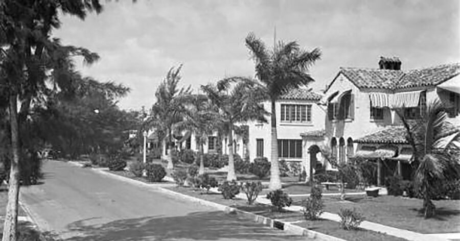
Miami's Shenandoah: a neighborhood ahead of its timePlusUrbia is excited to be working to survey the Shenandoah neighborhood along with Dade Heritage Trust.POSTED ON MARCH 21, 2019 AT 1:18 PM.WRITTEN BY THE NEW TROPIC CREATIVE STUDIOA look at the 1800 block of SW 11th Terrace between 1920-1930 in the Shenandoah neighborhood of Miami. (Photo by Gleason Romer)WHAT IT IS: Shenandoah, a neighborhood just southwest of downtown Miami, is one largest collections of 1920s and 1930s architecture that the city or state hasn’t studied or documented.Megan McLaughlin moved to the neighborhood 10 years ago because she exhausted of her 90 minute commute to downtown. With two toddlers, she felt like she was missing out on so much time with them. So she and her husband moved to Shenandoah, where they can walk everywhere and catch a bus to downtown.McLaughlin and Chris Rupp from the Dade Heritage Trust have partnered to survey the neighborhood and put together a report with the data they collect. With a grant from the state, they’ll create a file for each of the 650 properties in Shenandoah that will include the history of the house, previous owners and residents, and the prominent architectural features.MOST SURPRISING FACT: According to McLaughlin, Shenandoah is one of the most diverse neighborhoods in Miami, a city that’s already very inclusive of all ethnic and cultural backgrounds. McLaughlin said that city directories show that the neighborhood was at some point home to Jewish, Middle Eastern, and Russian families. Cuban and other refugee families also settled there in the 1960s.WHY IT IS IMPORTANT: Shenandoah was one of the first suburban developments outside of downtown and has always been ahead of its time, McLaughlin said.“It was different from Coral Gables and Miami Shores and some of these other maybe more known suburbs because it was diverse from the beginning,” she said. “You had already a mix of duplexes, houses, little apartment buildings, corner stores, all of these things that I think the new urbanism and other planning folk talk about that now as the gold standard of a ‘good urban neighborhood’ but Shenandoah had it 100 years ago.”HOW TO GET INVOLVED: If you’re interested in volunteering to help conduct the survey or organize the collected data – or organize a similar survey for your own neighborhood – McLaughlin said you can contact the Dade Heritage Trust.Find out more information by reading the article written by THE NEW TROPIC CREATIVE STUDIO through the link below:https://thenewtropic.com/neighborhood-spotlight-working-to-document-shenandoahs-historic-architecture/
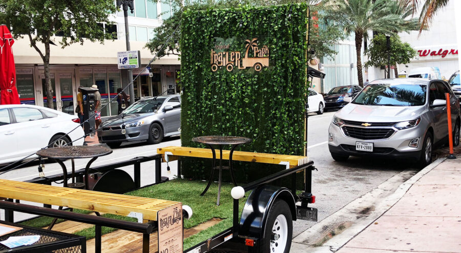
MIAMI - PlusUrbia Design’s unique vision to create a parklet out of parking spaces in urban Miami will be unveiled this month. The Miami-based studio’s solution for a low-cost, high-impact urban oasis will open to the public at 10 a.m. Friday September 21 on NE 3rd Avenue and NE 1st Street in Downtown Miami.While legislation to regulate parklets is still being ironed out, the innovative studio brainstormed ways of making a demonstration parklet that didn’t need a permanent location. The studio has designed and built a 70 SF parklet on wheels – a tiny park that fits into no more than two parking spaces.The idea for the Tropical Trailer Park was the winner of the 2016 Miami Foundation Public Space Challenge.The Tropical Trailer Park will move to different locations, many lacking open space, to inspire people to find ways of making their neighborhood more livable. This Do It Yourself method of providing open space where none exists provides a quick solution to areas starved for civic amenities. “Miami’s lack of open space has an adverse effect on our health and livability. Our studio decided to build a parklet that provides a mobile solution to enhance our streets – a park on wheels - as a gift to our city.”-Juan Mullerat, Principal of PlusUrbia Design PlusUrbia is known for its urban interventions and advocacy in Miami including the Master Plan of Little Havana, Coconut Grove, the redesign of Calle Ocho and Complete Districts. Looking for more information on the Trailer Park? Follow the link! trailerparklet.com Related articles: The Big Bubble Miami
Glad our capacity crowd workshop and innovative online survey drove a plan that the Grove BID can use to steer economic development, preservation, walkability and unique village character for the next decade.

PlusUrbia Design was honored by the Miami Today's 2018 Gold Medal Awards competition earning the Bronze Medal for an organization.Our boutique studio was eligible for the award because it won the 2017 American Planning Association’s APA National Economic Development Plan Award for its Wynwood Neighborhood Revitalization District plan. PlusUrbia earned the Gold Medal Award for its context-sensitive, community-based planning. It submitted a brief portfolio to the Miami Today judges that emphasized innovative urban design that promotes multimodal mobility, affordability, and connectivity that enhances quality of life. Our studio has emphasized healthy living through access to open space, public transit, affordable housing, mixed-use development, active recreation and safe complete streets.“My father, a lawyer and published author, wrote about ethics and the social role and responsibilities of Corporations, instilled in me a sincere sense of Community Service,” said PlusUrbia Founding Principal Juan Mullerat. “This instilled in me this sense of service, which we practice in our studio through non-profit projects.”PlusUrbia has donated more than 1,000 professional hours to the ongoing Master Planning for a Healthy and Resilient Little Havana, in collaboration with the National Trust for Historic Preservation and the Health Foundation of South Florida. Our 12-person studio has devoted more than two years listening to residents and crafting an Action Plan to improve the lives of one of the poorest, most unique, socially and demographically rich neighborhoods in the nation.“Our office has worked very hard and continues to push the envelope, delivering innovative solutions on issues that shape our built environment,” Mullerat said. “Our projects focus on transportation, affordable housing strategies, open space – all of which have profound impact on everybody’s life.”Whether it is a Transit Oriented Development, Community Redevelopment Agency, Business Improvement District, Transit Corridor, Action Plan or Visioning Exercise – PlusUrbia’s work focuses on outcomes that support healthy living in urban areas.Miami Today, celebrating its 35th year, is a weekly newspaper that reaches more than 68,000 readers and covers government, development, design, real estate, business, finance, health care and related issues that impact the future of Miami. Link to digital article: http://www.miamitodaynews.com/2018/06/05/gold-medal-awards-to-six-tibor-hollo-named-lifetime-achiever/

KEYS TO A LIVABLE COMMUNITY FOR ALLBy Steve WrightPhoto by Andy RyanYou’ve just moved into your new home. In addition to guiding you through the offer/ counter offer, financing, inspection and closing — your enlightened REALTOR® has found a dwelling that meets your needs as a person with a physical disability.There's at least one level entrance, wider doorways, a modified bathroom with a roll-in shower, raised commode with safety grab bars and a sink you can roll up to from a wheelchair. Though it has taken a ton of research, only half the battle is won. The inside of the home you purchased might be a show case of barrier-free access, but what about your neighborhood? Is there a nearby commuter train or major bus route? Are they accessible? Can you get to them safely via wide sidewalks and pedestrian-friendly crosswalks? Is the neighborhood park readily accessible, or filled with barriers?For a person with a disability — and according to the U.S. Census, there are 57 million disabled Americans — nothing is more relevant to quality of life than the old real estate adage “location, location, location.” But savvy REALTORS® know that location does not mean merely good schools, low crime and rising real estate values. When serving a client with a mobility impairment — and 16 million Americans use wheelchairs, canes, crutches, or walkers for mobility — a real estate professional should be familiar with the concepts of Universal Design and Inclusive Mobility. A real estate professional should be familiar with the concepts of Universal Design and Inclusive Mobility.Universal Design is the design of products and environments to be usable by all people. Universal Design is defined as: “The design of products and environments to be usable by all people, to the greatest extent possible, without the need for adaptation or specialized design.” The concept was developed by the late architect Ronald L. Mace, founder of the Center for Universal Design at North Carolina State University. The beauty is that Universal Design is not some segregated approach only relevant to wheelchair users. Its principles make spaces welcoming and easy to use for elderly people, young children, parents pushing strollers and others.Inclusive Mobility is an approach to designing the public realm in a way that is accessible to all people — from the moment they leave their door until they arrive at their destination: work, school, the supermarket, the park, shops, etc. The approach combines increased pedestrian access and safety with barrier-free public transit. Complete Streets is the concept that the roadway should not be designed primarily for cars — with mobility for pedestrians, bicyclists, transit riders and others merely an afterthought. Complete Streets — a rapidly-growing concept in the planning and transportation fields — advocates for calmed traffic, wide sidewalks, dedicated bike lanes, safe crosswalks, curb ramps for disabled folks and well-defined transit stops, ideally with shelters to protect all riders from the elements.Inclusive Mobility extends to public transit, which is especially important to commuters in larger cities where traffic congestion is doubling and tripling commute times. Although the Americans with Disabilities Act (ADA) has been federal civil rights law since 1990, transit is far from perfect for people with disabilities. In New York, a city that thrives on subway trains moving millions of people to work, just 117 of its 472 subway stations are fully accessible. Only 67 percent of Chicago’s train stations are fully accessible to people with disabilities. The key is to work with elected officials to retrofit stations. Some communities have gotten meaningful results. Washington D.C.’s 91 Metro train stations are 100 percent accessible.Even in medium-sized cities, public transit often is the only affordable way for a wheelchair user to get from home to work, college or other crucial destinations. Accessible consumer van upgrades — installing lifts, ramps, safety tie-downs, and automated systems that allow for transfer from a wheelchair to the driver’s seat — can cost upward of $75,000, and thousands more per year to fuel, maintain, insure and park. That makes it cost-prohibitive for low- to moderate-income families and barely attainable to even middle- to upper-income households.Courtesy of Metropolitan Transportation AuthorityCourtesy of Metropolitan Transportation AuthorityMany government officials embrace ride-share and transportation network companies, like Uber and Lyft, as the solution to the expense of vehicle ownership, traffic congestion and the high cost of adding transit lines. But these app-based services are provided by independent contractors who typically drive sedans and SUVs, meaning virtually no ride share vehicles can accommodate those who use power wheelchairs or other large motorized devices.Activist John Wetmore produces Perils for Pedestrians, a public affairs series on public access cable television stations in 150 cities in the United States. While the videos are aimed at pedestrian safety for all, Wetmore is acutely aware that something as simple as a public sidewalk full of obstructions can eliminate freedom of mobility for a person with a disability.“Often those responsible for blocking the sidewalk will say that it is alright because they meet the minimum legally required by the ADA. That is like bragging that you passed because you got a D on your report card,” Wetmore said. “We should expect better than that. Rather than striving for a D, they should attempt to get an A by putting the obstructions entirely out of the sidewalk.”Wetmore’s companion website has galleries that illustrate bad design examples, such as a parking meter in the middle of a sidewalk, a curb ramp constantly prone to flooding storm water, a street so full of sidewalk café tables that a wheelchair user has no room to maneuver, concrete so damaged and poorly maintained that it blocks wheelers and creates a tripping hazard for all. Another photo shows a streetlight control panel placed in the center of a heavily-traveled sidewalk right where a wheelchair user would crash into it after negotiating a curb ramp.Along with many blunders, Wetmore highlights an excellent example of a wheelchair-accessible sidewalk in Augusta, Georgia, that meets pedestrian access standards in the PROWAG (Public Right of Way Accessibility Guidelines) under the ADA.Everything about transportation — both urban and rural — will likely be transformed over the next decade. Transportation service providers such as Uber and Lyft, and autonomous self-driving vehicles are already changing the landscape. Some fear that suburban transit service will disappear altogether.WMATA photograph by Larry LevineSo what exactly does the future hold, and how do we serve everyone? These are some of the questions that land use and transportation planner Jana Lynott AICP, MA, seeks to answer.Lynott manages the American Association of Retired Persons’ (AARP) transportation research agenda. She is responsible for the development of AARP’s policy related to transportation and other livable communities issues.“It’s one thing to understand the law and the regulations, but another to understand the design experience. All of us as planners need to wrap our heads around the principles of universal design and think through what that means,” said Lynott.Lynott believes that these principles are essential to the design of better, more disability-friendly transit systems. For example, even compliantly designed buses may miss the mark if they service a bus way where poorly designed stops result in bus ramps that must be extended at a steep slope.Said Lynott: “The devil is in the details with design.”Lynott believes that if design is to truly be inclusive, it must balance the sexy with the sensible. This applies to developments on the cutting edge, such as self-driving vehicles, like autonomous buses and shuttle buses.Some of the vehicles currently in beta incorporate hip design details such as papasan, or bowl chairs. But the chic design doesn’t serve all riders. Public transit often is the only affordable way for a wheelchair user to get from home to work. WMATA photograph by Larry LevineAccessible civic space is crucial to providing a highly livable community. “An older adult — even one who walks — may have difficulty getting back upright from the seats. Standard transit bus designers have already figured out how to design accessible seating. We shouldn’t forget what we’ve already done that works,” said Lynott.The National Association of City Transportation Officials (NACTO) has developed “The Transit Street Design Guide” for the development of transit facilities on city streets, and for the design and engineering of city streets to prioritize transit while improving transit service quality for all.The NACTO guide incorporates universal design features, which are critical throughout the transportation network, making it possible for any street user to comfortably and conveniently reach every transit stop. Universal street design facilitates station access, system equity, and ease of movement for all users, especially people using wheelchairs or mobility devices, the elderly, people with children and strollers, and people carrying groceries or packages.While clear pedestrian paths, safe crosswalks and public transit that is accessible — via gently-sloped ramps to boarding stations, elevators, or lift-equipped buses — is a key part of the equation, accessible civic space is equally crucial to providing a highly livable community for people with disabilities and their families.Michael Van Valken burgh Associates placed so much emphasis on Universal Design in its creation of Brooklyn Bridge Park that the park’s website has a prominent link that details all of the accessible features on its piers and greenway that stretches for more than a mile along the East River waterfront.Crown Fountain in Chicago's Millennium Park was recognized by the Paralyzed Veterans of America for its Universal Design. Photo courtesy of PVA.Handrails and gentle slopes provide Universal Design on Squibb Park Bridge designed by Michael Van Valkenburgh Associates. Photo by Andy Ryan.“Ramped pathways and bridges are less prone to technical difficulties, and they also create a stronger continuity of landscape experience that is part of the enjoyment of being in a park,” said the Van Valkenburgh team. “Once you decide that it is important to connect two spaces through the landscape, it seems worth the effort to make sure that everyone can use it.”The Van Valkenburgh firm embraces creative approaches to designing for all, opting for landscape-based solutions to accessibility that use gentle slopes instead of lifts or elevators that require more maintenance and are much more likely to break down.Photo by Andy RyanCrown Fountain in Chicago's Millennium Park is noted for being accessible to visitors of all ages and mobility. Photos courtesy of Millennium Park Foundation.Accessibility requirements provide opportunities to build pathways that are more engaging. “In some cases, accessibility requirements provide opportunities to build pathways that are more engaging — for instance a curved pathway that directs your views to the landscape context rather than a straight procession with an unchanging perspective,” the Van Valkenburgh team said. “We are strong advocates for building accessibility into the fundamental structure of a project, rather than looking at it as an obligation or an afterthought. Ultimately, the goal is to make accessibility feel effortless so that everyone can enjoy the landscape on the same terms.”Toronto, Canada-based nonprofit 8 80 Cities has challenged more than 250 cities on five continents to design their streets and public spaces to be easily accessible for both an eight-year-old and an 80-year-old.“We focus on children and older adults because we know that modern childhood and older adulthood in cities around the world is increasingly characterized by limited freedom and independence, reduced opportunities for social engagement and physical activity in public spaces, and few opportunities to participate in community building and decision-making,” said Amanda O’Rourke, executive director of 8 80 Cities.She said children, older adults and people with disabilities often have the most to benefit from living in connected, walk able and bike able communities with access to great parks and public spaces.Crown Fountain in Chicago's Millennium Park is noted for being accessible to visitors of all ages and mobility. Photos courtesy of Millennium Park Foundation.“One of the famous quotes from our Founder and Chair of the Board Gil Penalosa is ‘we have to stop building our cities as if everyone was 30 years old and athletic,’” O’Rourke said. “Streets often account for at least 25 percent of a city’s public space (in some cities close to 40 or 50 percent) and that means they are spaces that belong to all of us. The way we have designed cities for the last 60 years has been much more focused on the mobility of cars, than on the health and happiness of people. And this car-centric planning has been disproportionately bad for vulnerable road users — children, older adults, people with a disability and low-income communities.”Chicago’s 25-acre Millennium Park earned a Barrier-Free America Award from the Paralyzed Veterans of America — presented to architect Edward K. Uhlir, executive director of the Millennium Park Foundation.The park’s original grandiose design featured lots of grand staircases and other elements that were not conducive to Universal Design. The late Uhlir is credited with working with additional designers to greatly increase accessibility via ramps, gentle slopes and barrier-free play areas.“My office saw (the original plan with grand staircases and other barriers to mobility) and said ‘no way are you going to build a big park in downtown Chicago with stairs that are not accessible to people with disabilities,’” said Denise Arnold, a private practice architect and inclusive design specialist who worked for Chicago’s Mayor’s Office for People with Disabilities while Millennium Park was being developed. We have to stop building our cities as if everyone was 30 years old and athletic. The Crown Fountain, designed by Catalan artist Jaume Plensa and executed by Krueck and Sexton Architects of Chicago, is composed of a black granite reflecting pool placed between a pair of 50-foot glass brick towers that display digital videos on their inward faces.“The fountain is the coolest thing in the world and (the reflecting pool) has no more than quarter inch lip at any place,” Arnold said of the grand piece of usable public art. “The fountain has giant glass block towers where water spouts 12 feet high off the ground and comes down on kids. It is a completely accessible mini water park. You see people of all abilities running around that fountain and playing in it.”James Corner Field Operations, the New York-based landscape architecture and urban planning studio that is best known as the project lead for the High Line in Manhattan, has heavily incorporated universal design into the Underline in Miami. The Underline’s vision is to transform 10 miles of land below Miami’s Metrorail into an iconic linear park, world-class accessible urban trail, to be completed by 2022.The future South Miami Hospital "Healing Garden" will feature native therapeutic plants and will open onto The Underline, promoting interaction between users of both spaces.Photos © James Corner Field Operations, Courtesy of Friends of the Underline.“The key criteria for the design of these two primary components are to provide a safe environment for users navigating the trail at different speeds and physical abilities,” says Isabel Castilla, lead designer for the Underline and a senior associate at James Corner Field Operations.The Underline will replace an underutilized, not universally accessible paved trail known as the M-Path. The existing M-Path is hampered by dozens of street crossings that are very dangerous for wheelchair users, children, and slow-walking pedestrians. Field Operations’ plan will increase safety and improve visibility at intersection crossings, meeting the needs of people with visual, hearing, cognitive, and other impairments, as well as mobility difficulties, Castilla said. Steve Wright is an award-winning journalist and the communications leader for PlusUrbia Design, a Miami-based urban design firm that incorporates Universal Design and Inclusive Mobility into its work. The studio’s Wynwood Neighborhood Revitalization was honored with the 2017 APA National Economic Development Plan Award.www.plusurbia.com The future approach to Brickell Station will be a gathering space for residents, showcasing the existing oolite outcrop.Photos © James Corner Field Operations, Courtesy of Friends of the Underline.Link: http://www.oncommonground-digital.org/oncommonground/summer_2018_fair_housing_and_more/MobilePagedReplica.action?pm=2&folio=46#pg46
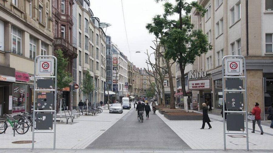
BY ANDRES VIGLUCCIaviglucci@miamiherald.comMarch 08, 2018 05:30 PMUpdated 11 hours 21 minutes ago Some time in the very near future, Wynwood will get something quite avant-forward, at least for Miami: A street in which cars, bikes and pedestrians share the pavement on an equal footing.It’s called a “woonerf,” it’s inspired by the Dutch, and it’s coming to four blocks in the heart of Wynwood. On Thursday, Miami commissioners approved a contract with a Brooklyn, N.Y., firm that will design the city’s first true shared street.In a woonerf (pronounced voo-nerf), planters, landscaping and bollards serve to slow down motorists enough so that people on foot and in cars or on bikes can mix freely and safely.For the formerly industrial Wynwood district, now a flowering arts and entertainment mecca, the woonerf affords an opportunity for badly needed green and welcoming public space. It would also provide a secondary focus for its lively street life west of the neighborhood’s main drag, Northwest Second Avenue.The idea is to transform the scruffy Northwest Third Avenue right-of-way between Northwest 29th Street, the district’s northern border, and 25th Street, where the street dead-ends, providing a natural terminus for the woonerf. The street is today distinguished largely by the Wynwood Building, the warehouse prominently painted in a zebra-stripe design. The zebra-striped Wynwood Building sits on Northwest Third Avenue, which will be transformed into a “woonerf,” a street in which cars, bikes and pedestrians share the pavement on an equal footing. Ger Ger Getty Images But can the woonerf concept stand up to the belligerent carelessness of so many Miami motorists? Experts say the devil is in the design details, but woonerfs have proven themselves all over the world, and are increasingly popping up in U.S. cities.It does require care and alertness by all users, but that’s why the woonerf works, they say. Beyond some basic principles, their design can be tailored to local circumstances.“There’s no real guidelines for what a woonerf needs to be, so you can be creative,” said Juan Mullerat, principal at Coconut Grove-based urban design firm PlusUrbia, which first came up with the idea for a Wynwood woonerf when it drew up a new zoning plan for the burgeoning hipster district. “The idea is slow cars down and provide an equal use of the street.”For the Wynwood blueprint, the city is turning to Local Office Landscape and Urban Design, whose co-principal, architect Walter Meyer, grew up in Miami. The firm won a competition for the $392,900 design contract.Separately, the commission also approved a $615,140 contract with Miami-based Arquitectonica GEO for a broader tree and landscape master plan for Wynwood, a former warehouse district sorely lacking in greenery.Local Office, which designed the temporary Grand Central Park in downtown Miami, also collaborated on the design for the recently completed makeover of Miracle Mile and a block of adjacent Giralda Avenue in Coral Gables.Giralda, the suburban city’s famed restaurant row, was redesigned in a woonerf-like fashion, with no curbs or sidewalks and trees planted in the center of the street. But the city has closed it off to cars in a two-year experiment, turning it into a pedestrian plaza filled with outdoor cafe and restaurant tables.The recently remade restaurant row in Coral Gables, Giralda Plaza, was designed as a shared street but is functioning as a car-free pedestrian plaza in a two-year experiment.Courtesy City of Coral Gables This modern version of the shared street originated in the Netherlands in the 1970s, thus the Dutch name. It has spread around the world, though the concept of people on foot mixing it up with horses, carriages, bicyclists, trolleys and, yes, even motorcars is an old one.Before urban streets were segregated for use primarily by cars, with pedestrians relegated to sidewalks, different modes of transportation mixed in freewheeling fashion in cities across the world and in the United States.Modern woonerfs are intended to put the pedestrian first. They often have no signage and no curbs, to avoid tripping obstacles and to provide a feeling of expansive shared space. Often they contain cues such as colored pavement or bollards to demarcate primary areas for pedestrians and cars.A rendering of a concept for a woonerf in a new pedestrian friendly zoning district in eastern Hialeah.PlusUrbia Because of Miami-Dade County road-safety rules, though, the Wynwood woonerf may have to provide separate primary zones for motor vehicles and pedestrians, perhaps through markings or signage, said Jorge Kuperman, an architect whose office sits on Giralda Plaza and who served on the steering committee for the makeover.“We are the country of regulations, but it can be as minimal as landscaping,” Kuperman said. “It’s a great model, obviously. You can go to Lisbon or Madrid. All you see are urban interventions that are absolutely curbless. They are not from last year. They’re from long ago. And they’re designed mainly for the life of pedestrians.” Link to article: http://www.miamiherald.com/news/local/community/miami-dade/article204194634.html

PlusUrbia Design Communications Leader Steve Wright, and his wife: Americans with Disabilities Act expert Heidi Johnson-Wright, co-authored the Planning Magazine February Cover story. Inclusive Mobility is the title of the article on applying Universal Design to every aspect of mobility – from complete streets to commuter rail to buses and safe sidewalks. The article interviewed a half dozen experts and shared best practices for delivering seamless barrier-free mobility to the nearly 57 million Americans who have some kind of disability.Planning, the publication of the American Planning Association, has previously published the Wright’s guide to better urban design of public spaces for people who use wheelchairs, canes, crutches, walkers and other assistive mobility devices. Johnson-Wright, an attorney by training and longtime advocate for people with disabilities, has used a wheelchair for her mobility for four decades. Wright, an award-winning journalist, blogs daily on urban design, travel, human rights and related issues at http://urbantravelandaccessibility.blogspot.com.Inclusive MobilityApplying universal design to how people get around.Illustration by Lana Gwinn; map source: WMATA. By Steve Wright and Heidi Johnson-Wright John Morris, a Florida-based travel writer (wheelchairtravel.org), uses a power wheelchair for mobility. He has explored the accessibility of dozens of public transit systems while on the road in both the U.S. and on four continents. He says that virtually every city in America has a long way to go before they truly offer inclusive mobility. "City planners often fail to recognize the true cost of accessibility barriers in transportation and movement. Just like our able-bodied counterparts, people with disabilities are on a schedule and have places to be: jobs, meetings, appointments, dinners, movies, concerts, sporting events, flights to catch, etc.," Morris says. "Barriers to accessibility disrupt freedom of movement and place additional hardships on those who use wheelchairs or other assistive devices."People with disabilities are a signification part of the population: Nearly 16 million Americans use wheelchairs, canes, crutches, or walkers. Millions more have vision, hearing, or cognitive disabilities that impact how they get around.Supporting the mobility of all people, regardless of ability, is arguably one of the most important urban planning issues facing public- and private-sector professionals.John Morris at the Amputee Coalition National Convention last August in Louisville, Kentucky. Photo courtesy Amputee Coalition.Embracing a new philosophyFrom the 1950s to recent times, mobility was largely defined by the ability to buy, finance, maintain, fuel, insure, and park an individual automobile. Outside of very large, older Eastern Seaboard cities, public transit was given second-class status and streets were designed to move more cars faster — sacrificing pedestrian and multimodal mobility.A huge shift in philosophy — to make life more affordable, accessible, and healthy — has begun to bring about a focus on universal design that aspires to give urban and suburban people who commute — by foot, by wheelchair, by bicycle, and by public transit — equal standing or priority over automobiles.This seismic shift can have a profound positive impact on people with disabilities. The complete streets movement, which embraces wider, well-maintained sidewalks; safe, well-marked crosswalks; more accessible bus stops; and better elevator access to underground or elevated commuter rail, also facilitates universal design, giving people of all abilities increased access to housing, jobs, civic opportunities, medical care, recreation, and more.But for the nearly 57 million Americans who have some kind of disability, challenges remain.Well-meaning designers who seek to activate the pedestrian realm with more plantings, decorative furniture, and sidewalk cafes sometimes block the wide, accessible path of travel needed for people who use wheelchairs for mobility.At times it's a simple lack of communication and coordination among the professional disciplines — planners, architects, traffic engineers, public works field staff, downtown development authorities, community reinvestment authorities, and private developers changing or designing rights-of-way.And then there are ride-share and transportation network companies, like Uber and Lyft. Many planners embrace these as one answer to both traffic congestion and the conundrum of getting people to and from transit — the so-called first and last mile. But these services are provided by independent contractors who typically drive sedans and SUVs, making few ride-share vehicles able to accommodate those who use power wheelchairs or other large motorized devices.Poorly designed sidewalk and crosswalk infrastructure make it more difficult for people with limited mobility. For example, a utility pole blocking the middle of a narrow sidewalk might not pose an issue for an able-bodied person, but a wheelchair user, a person with a walker, or a mom pushing a stroller would have to find another route, or walk in the street to get around the pole.Likewise, a pedestrian activation button on a raised sidewalk out of the ADA-accessible part of a curb ramp makes it nearly impossible for a wheelchair user to cross under the safety of the "walk" light. Photos courtesy Perils for Pedestrians, Pedestrians.org.Making transit inclusiveFor more than half a century, Los Angeles has been famous (some would say infamous) for being the most car-centric place in the Western world. That makes getting around a lot harder for people with disabilities. Accessible consumer van upgrades — adapting for lifts, ramps, safety tie-downs, and automated systems that allow for transfer from a wheelchair to the driver's seat — can cost upward of $75,000, and thousands more per year to fuel, maintain, insure, and park.But all of that is changing with development of the Los Angeles County Metropolitan Transportation Authority's 105-mile Metro Rail system. In 2016, county voters approved a sales tax that will generate nearly $1 billion per year for transit and related improvements. Measure M, the dedicated tax, will roll out another 32 miles of rail service in the next decade alone — all of it fully accessible. At full build out, Measure M could potentially double the rail network in Los Angeles County, and add bus rapid transit lines and pedestrian infrastructure.One hundred percent of the Metro Rail train stations are wheelchair accessible under the Americans with Disabilities Act, thanks to elevators or boarding platforms with gently sloped ramps at all 93 stations.That isn't the case for older, legacy systems, notes research published in London's The Guardian. In Paris, nine of 303 metro stations are fully accessible and only 50 out of 270 London Tube Stations are. New York gets a poor grade, too, with just 117 of its 472 subway stations fully accessible.But progress is being made in other major U.S. cities. Washington D.C.'s 91 Metro train stations are 100 percent accessible, and in Chicago, where some elevated and other rail stations were built long before the ADA was passed in 1990, 67 percent of the Chicago Transit Authority train stations are fully accessible to people with disabilities."We need to design transit systems that everyone in a community — regardless of money, or physical or cognitive ability — can use," says Jana Lynott, AICP, manager of AARP's transportation research agenda.Fixing the first and last mileBut transit is only one part of mobility. Another challenge is bridging the gap between where riders live and work and the stations they might use."People who have mobility constraints really need access to transit," says Bill Delo, AICP. "They are a big market for transit ridership — but only if they can get from their home to transit to their place of work, on wide sidewalks with safe crosswalks." BEST PRACTICES FROM LAThe First Last Mile Strategic Plan addresses multimodal access and the need to design in a way that mainstreams people with disabilities.The plan advocates for universal design, stating: "Most public transportation stations, trains, and buses are accommodating to manual wheelchair users; however, they have historically been treated as an isolated group, with limited number of spaces on buses."As the population ages and more manual and electric wheelchair users ride public transit, new seating configurations and storage may be required. Sidewalks and routes to transit nodes must maintain smooth and clear rolling surfaces, accessible curb ramps, and signal times conducive to safe street crossings." LA County tackled this head-on when it adopted the First Last Mile Strategic Plan (tinyurl.com/ya68mr7n) in 2014. The plan focuses heavily on inclusive design to serve people with disabilities. The progressive, innovative plan was honored with the American Planning Association's 2015 National Planning Excellence Award for Best Practice (www.planning.org/awards/2015/firstlastmile.htm).Delo, who led the project for the Irvine office of IBI Group, a Canadian-based, technology-driven urban design and engineering firm, notes that universal design should be inclusive of the needs of a great span of mobility."We looked at this as an opportunity to go beyond the typical mobility plans that look at bike and pedestrian mobility then stop ... to increase access for people who use wheelchairs, scooters ... even skateboards," he says. "We wanted to improve accessibility for everyone who commutes by transit [in] Los Angeles."Delo says that a key to a better first- and last-mile experience is widening sidewalks and making sure they are well maintained. "People have many different ways of getting around without a car, but they all — other than bicyclists — are restricted to the sidewalk."Sidewalks in LA are narrow in some places, and many have cracks, gaps, and obstructions or are poorly maintained, he adds. The plan acknowledges this and recommends replacing insufficient sidewalks, but doesn't include an implementation strategy or funding to do so. (The problem of absent and insufficient sidewalks is hardly limited to LA, although the authors know of no national database that tracks sidewalk statistics.)Communities too often wait for private redevelopment to improve sidewalks along transit corridors, Lynott says, instead of initiating improvements to rights-of-way. This often means neighborhood connectivity fails to meet minimum standards."I see many communities that need to invest in access for people with disabilities to both public transit and sidewalk networks. And they need to have Americans with Disabilities Act transition plans that are updated on an ongoing basis," says Lynott.An ADA transition plan is a state or local government's self-evaluation of its facilities, programs, and services to assess whether the government is in compliance with ADA rules. Problems and shortfalls are identified and a plan is put in place — with action steps and deadlines — to address them. "Transition plans serve to connect people with disabilities to jobs and services," she says. "This has a direct, positive economic impact."Venice Boulevard in Venice, California, now provides shorter pedestrian crossings, mid-block crosswalks with signaling buttons, narrowed traffic lanes, protected bike lanes, and other complete streets features that make it safer for all pedestrians, including those using assistive mobility devices. Photo courtesy LADOT. Beyond the ADAGabe Klein earned a national reputation for being an innovator who favored inclusive mobility, focusing on putting people before automobiles on city streets, when he ran two of the largest transportation departments in the U.S.: Washington D.C., then Chicago.According to Klein, far too many agencies and planners still look at design for people with disabilities as a last-minute item, even on a new project."I think when agencies focus only on the Americans with Disabilities Act, they can get too focused on just meeting minimum ADA requirements. That's when we lose track of truly making a place accessible for people with disabilities," says Klein, cofounder of CityFi, an advisory services platform for urban change management, and author of Start-Up City: Inspiring Private and Public Entrepreneurship, Getting Projects Done, and Having Fun."In Chicago, I had a great relationship with the Mayor's Office for People with Disabilities," he says. "We focused on practical solutions. We didn't want to just look at numbers in a book, we wanted to have people with disabilities come in and help with our design from the ground floor. That way, you didn't just have a ramp to meet the ADA laws, you had a ramp that functioned, even in the Chicago winters.""When we came up with our complete streets guidelines, the idea of designing for people with disabilities wasn't an afterthought. It was a priority to design inclusively from the start, because we found if you design for people with disabilities, the able-bodied people will be just fine," he adds.In 2015, the National Complete Streets Coalition, a part of Smart Growth America, published "Complete Streets Help People with Disabilities." The complete streets approach, says Emiko Atherton, the coalition's director, "means that transportation decisions, plans, and procedures are aligned and designed to accommodate all users of all abilities."The two-page guide notes that "Complete Streets policies provide flexibility to transportation professionals and give them room to be creative in developing solutions that promote accessible travel," noting that designers should think about important details at intersections (like audible or tactile signals for blind pedestrians); smooth, obstacle-free sidewalks; and ample space to wait and board safely at transit stops.Further, such policies "remove barriers to independent travel by considering the needs of all users at the outset of every transportation project," the guide reads. Considering all users helps keep people connected, which improves livability, and can reduce "dependence on more costly alternatives, such as paratransit or private transportation service."According to Lynott, communities that want to make a real commitment to providing effective, inclusive mobility must take compliance with the ADA seriously. They need to educate staff in planning and other departments about the standards and about universal design to align those concepts in zoning, development review, and comprehensive planning."It's one thing to understand the law and the regulations, but another to understand the design experience. All of us as planners need to wrap our heads around the principles of universal design and think through what that means," says Lynott.Seattle Department of Transportation engineer Johanna Landherr uses a wheelchair to test a new curb ramp. Photo courtesy SDOT. Looking past the curveEverything about transportation — both urban and rural — will likely be transformed over the next decade. Disruptive transportation technologies are already changing the landscape. Some say suburban transit service will disappear altogether.Benjamin de la Pena is the deputy director for policy, planning, mobility, and right-of-way at the Seattle Department of Transportation. The agency just published the New Mobility Playbook (newmobilityseattle.info), a planning document that addresses rapidly evolving transport technology (like autonomous vehicles), app-based transportation network or ride-share services (Uber and Lyft), car-share firms (Zip Car and Car2Go), and private-sector microtransit start-ups that use vans or small buses to transport passengers."One of our chief concerns is equity, says de la Pena. "The city has a very robust equity plan and our concern about these new options is that they offer mobility."He notes that ride-share companies currently offer few options for people who use power wheelchairs. He wants autonomous vehicle technology to consider disabled users, too.The playbook's suggested solution is to develop a "Wheelchair Accessible Taxi program to reduce operating costs, meet customer expectations, and work more efficiently across jurisdictional boundaries." The playbook acknowledges that while much of tech-driven new mobility is owned and operated by the profit-minded private sector, government "must ensure that shared mobility services provide dignified, reliable, and affordable transportation options that are accessible to all."Further, the New Mobility Playbook notes that "mobility options and technology must fight against the displacement of vulnerable communities and develop the living wage transportation workforce of tomorrow," and its Strategy 1.1 notes that best practices for cities and regions grappling with the onslaught of smartphone-app-driven mobility must "advance shared mobility equity programs targeting people of color, low-income, immigrant, refugee, youth, and aging populations, women, LGBTQ, and people with disabilities."Working directly with people of diverse abilities also helps inform the planning process in Seattle. Inclusion is not only a best practice, it is required, notes de la Pena. The city's advisory boards "have members who use wheelchairs for mobility, people with low vision, people with other disabilities. And we listen to them."De la Pena urges other cities to include significant input from community members with disabilities when designing and implementing inclusive mobility initiatives.It's a practice John Morris certainly advocates."ADA compliance consultants should have a personal experience with disability and be able to understand the needs of the disabled population," he says. "In larger cities with a large population of disabled citizens, multiple consultants should be brought on board, each specializing in an area of accessibility, but also participating in team planning and discussions.""The perfect ADA team," he adds, "might include a wheelchair user, deaf/blind expert, and an expert in intellectual disabilities."Steve Wright is an award-winning journalist and the communications leader for PlusUrbia Design. Heidi Johnson-Wright is an attorney specializing in ADA issues. She has used a wheelchair for mobility for more than 40 years and frequently lectures on the intrinsic value of universal design and inclusive mobility.RESOURCESMetro: A Customer's View: A wheelchair user navigates the bus and rail system in LA. youtu.be/QE12ktreN2cLA County's First Last Mile Strategic Plan: tinyurl.com/ya68mr7nSmart Growth America/National Complete Streets Coalition's "Complete Streets Help People with Disabilities:" tinyurl.com/yb9z9ctfAARP's Planning Complete Streets for an Aging America: tinyurl.com/y8ckxblvSeattle's New Mobility Playbook: tinyurl.com/y7vjbssbThe Center for Inclusive Design and Environmental Access at Buffalo: idea.ap.buffalo.eduLink to article: https://www.planning.org/planning/2018/feb/inclusivemobility/
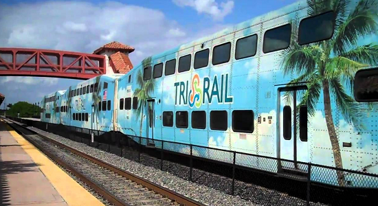
PlusUrbia’s Juan Mullerat presented “Complete Districts – a New Placemaking Practice” to the South Florida Regional Transportation Authority’s Planning Technical Advisory Committee. SFRTA is the agency that operates Tri-Rail.The concept focuses on a network of clean, safe, but unique streets that together create a Complete District. Simply put, cities are a balance between public and private land, entities, enterprises and services. This balance is symbiotic where all elements are part of a system and they depend on each other to function. It is only when all are well-tuned and calibrated that they make great places.The concept of Complete Districts creates this balanced equation by taking a holistic approach that couples the public with the private realms. It was conceived and formulated by PlusUrbia Design’s team while working through workshops and design exercises for a number of Transit Oriented Developments (TOD) and award-winning District Revitalization projects that created compact, mixed-use, vibrant districts.For more information on Complete Districts, please visit: https://plusurbia.com/project/complete-districts/
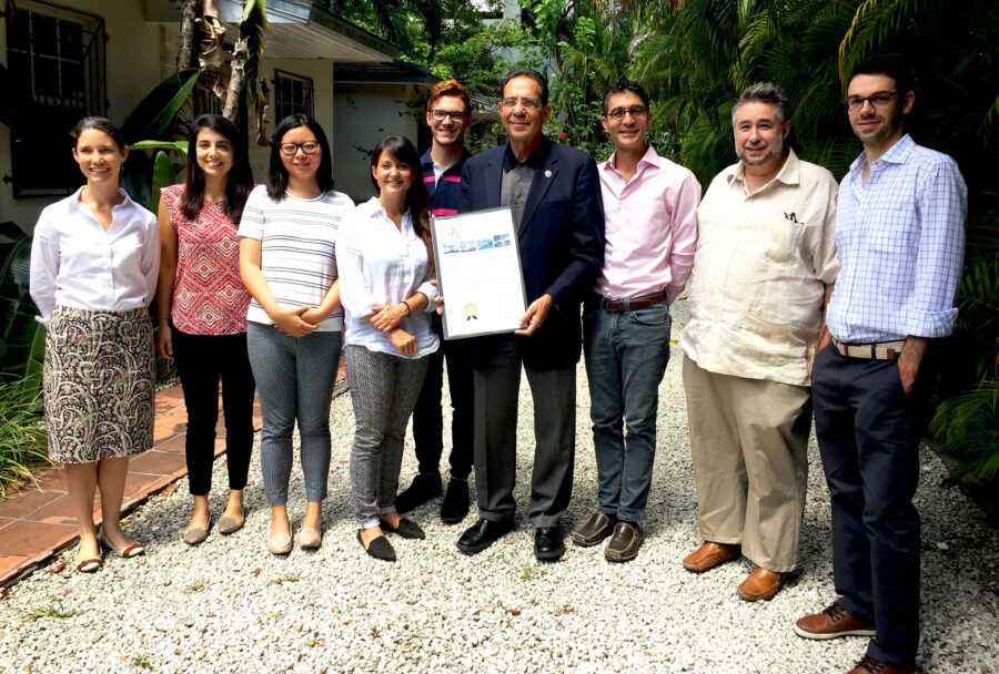
PlusUrbia was gratified to welcome Commissioner Xavier L. Suarez to its studio this morning. Commissioner Suarez presented a Proclamation recognizing PlusUrbia Design and its partners for being honored with the American Planning Association's National Award for Economic Development Planning, the highest achievement in our profession.Thank you Commissioner Suarez for taking the time to visit our office and sharing your vision of a prosperous, transit-rich, well-planned Miami.
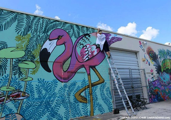
City and county approved a new community redevelopment agency for 121 acres in east HialeahMarch 17, 2017 04:30PMBy Francisco AlvaradoA long-neglected industrial and manufacturing district in Hialeah could serve as a catalyst for new commercial and residential development in the blue collar, predominantly Hispanic city, according to elected officials.Hialeah Mayor Carlos Hernandez and City Councilman Paul Hernandez (no relation) discussed their efforts to attract transit-oriented, mixed-use projects and create an arts district in the east side of the city, during a luncheon on Thursday hosted by the Commercial Industrial Association of South Florida.The goal is to create a community where millennials can afford to live, work and play, Carlos Hernandez said. “In Miami-Dade, we haven’t built for the younger generation the last few years,” he said. “It has all been dedicated to building for the investors. If we don’t start building for the millennials, they are going to leave.”His city could be the answer to Miami-Dade’s lack of affordable workforce housing for young adults, he said. “I think Hialeah is the perfect place for that market,” Carlos Hernandez said. “This is something that the private sector has to work with us on.”To get developers interested in the area, the city and the Miami-Dade County Commission approved a new community redevelopment agency for 121 acres in east Hialeah so tax dollars are redistributed to public and private projects within the CRA boundaries. In the heart of the CRA’s area is the Hialeah Market Tri-Rail Station at 1200 Southeast 11th Avenue, which sits on an 462,363 square foot predominantly vacant lot.The city also approved master plans for transit-oriented developments near Hialeah Market Station and Tri-Rail/Metrorail Transfer Station at 1125 East 25th Street. Designed by PlusUrbia, the plans call for more residential and commercial projects, pedestrian-friendly streets, enhanced public space, taller building heights and reduced parking requirements. As a result, two developers have already submitted plans.The first, Bridge Crossings, is a seven-story mixed-use project totaling 71,116 square feet with 74 apartments and 1,100 square feet of ground-floor retail, about a block north from the transfer station linking Tri-Rail and Metrorail. The 22,318-square-foot former lumber yard is owned by A&B 2701 Investment LLC, which paid $85,000 for the property in 2014.Mitchell Sabina’s MS Development and L. Michael Osman are teaming up on a proposed six-story development a block west of Market Station and across from a Home Depot. The developers paid $1.8 million for the 1.14-acre site in 2014. Called Apogean Pointe, the project would entail 59 apartments, nine live-work units, 4,000 square feet of commercial space and 102 surface parking spaces.Paul Hernandez recapped his initiative to create the Leah Arts District, a swath of industrial warehouses and car shops in east Hialeah that can be converted to live and work spaces for artists priced out of Wynwood and other emerging neighborhoods in Miami. He pointed out the popularity of Flamingo Plaza, a shopping center offering a milieu of thrift stores and discount outlets popular with Miami millennials, as a driving force behind his idea.Commercial brokers who specialize in Hialeah said sales for industrial and light manufacturing properties are on an upswing, but leasing rates are stagnant. “Sales prices have continued to climb and we’ve sold properties in the $70, $80 and $90 a square foot range,” said Joel Kattan, a senior advisor with Sperry Van Ness Commercial Realty. “However, rental rates don’t seem to be moving up quite as much as sales. Rents seem to be hovering around $6.50 a square foot.”Kattan represented the seller of a 31,000 square-foot warehouse who got $96 a square foot. Located at 1395 East 11th Avenue in the Leah Arts District, the property is now home to Unbranded Brewing, a new craft beer joint set to open later this year. Link to article: The Real DealFor more information on the Hialeah TODs, please visit: https://plusurbia.com/project/hialeah-transit-oriented-development/
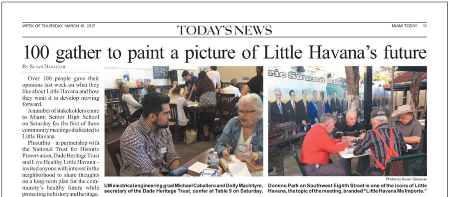
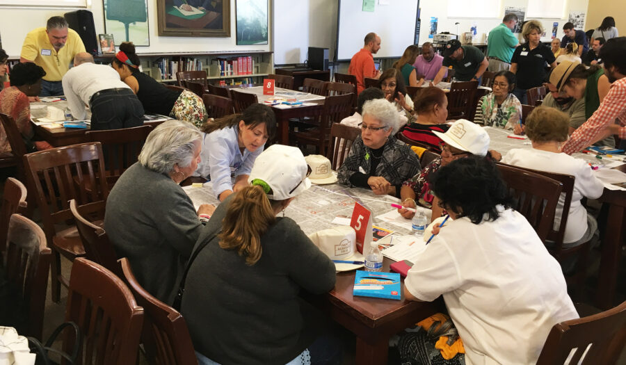
Plusurbia hopes to complete a final draft of the master plan by JulyMarch 14, 2017 12:45PMBy Francisco AlvaradoAs new development creeps into Little Havana, a master plan is in the works aimed at preserving the historic character and the pre-World War II architecture in Miami’s most famous neighborhood.On Saturday morning, more than 100 residents and merchants participated in a community workshop at Miami Senior High School to formulate big picture ideas for the master plan, which is being developed by urban planning firm Plusurbia Design in conjunction with the National Trust for Historic Preservation, Dade Heritage Trust and Live Healthy Little Havana.A majority of the participants reached consensus on restoring and reusing historic buildings, ensuring new construction is contextual and compatible with Little Havana, creating more affordable housing, community and cultural centers and making the neighborhood more pedestrian and bicycle-friendly.“At the end of the morning, we asked each table to give us their big ideas,” Megan McLaughlin, the project planning leader for Plusurbia, said. “We are going to use those to guide our reports and our suggestions to the city.”Plusurbia hopes to complete a final draft of the master plan by July, McLaughlin said. “We would present it to the city for them to consider,” she said. “The goal is to come up with heights, density, setbacks and floor lot ratios that matches what is there and is respectful of what is there.”More than a year ago, the national trust began efforts to designate Little Havana a national treasure, an honor that was officially bestowed in late January, McLaughlin said. At the time the designation was made, Live Healthy Little Havana awarded grants for the Plusurbia master plan and a streets plan being developed by Urban Health Partnerships. “The grant allows us to look at what zoning could be that is compatible with the existing neighborhood and allows healthy new development,” she said.Little Havana’s proximity to the urban core is making the neighborhood an attractive alternative for investors and developers, many buoyed by Greystar’s $89 million purchase late last year of the InTown apartment complex developed by Astor Companies. Nearby, a company controlled by Ana V. and Pedro O. Rodriguez has been approved to build a 12-story, 96-unit residential building at 45 Southwest Eighth Avenue that will also include 44,525 square feet of commercial space, 311 parking spaces and 15 bicycle parking spaces.During the workshop, PlusUrbia founder and director Juan Mullerat told attendees Little Havana hasn’t experienced the level of real estate development seen in Brickell, Edgewater and Wynwood because of the city’s zoning code, Miami 21.“Unfortunately, it has not led to much improvement in Little Havana,” Mullerat said. “We haven’t seen much investment in Little Havana, yet it is the second most dense neighborhood in Miami-Dade County.”The master plan would strike a balance between encouraging new development while giving property owners and developers incentives to preserve and renovate Little Havana’s signature three-story apartment buildings from the 1920s. “They are very unique,” Mulleret said. “You can’t find them anywhere else.”Lee Hernandez, a Little Havana homeowner since 1977, said the neighborhood needs an infusion of urbanism from Flagler Street to Northwest Fifth Street, between Northwest Fifth Avenue and Northwest 12th Avenue. “That area needs to be revitalized,” she said. “We need more greenery, we need more open spaces, and we need more places where people feel safe.”Hernandez said she would welcome rational development in Little Havana. “Developers are investing slowly, but surely,” she said. “I would like to see urbanization with consciousness. We don’t want skyscrapers. We need to keep the flavor.” Link to article: The Real DealMore information about the workshop: Little Havana Me Importa
By Jeana WiserThe sensory experience of walking the streets of Miami’s Little Havana neighborhood is unforgettable. The layered histories, the rich cultural expression, and the colorful architecture underscore the importance of this unique neighborhood. I am proud to say that the National Trust added historic Little Havana to our growing portfolio of National Treasures in January 2017. Not only is the historic neighborhood a new National Treasure but it is also an excellent example of our recent thinking about ReUrbanism. We are very proud to be working alongside strong partners in Little Havana to ensure that it remains thriving, healthy, and livable.A neighborhood store in Little Havana. | Credit: Steven Brooke StudiosThe National Trust first formally recognized the importance of Little Havana in 2015, listing it as one of that year’s 11 Most Endangered Places. At the time, Little Havana was threatened by a proposed zoning change that would have increased the likelihood of large-scale, new buildings noticeably out of scale with the existing human-oriented neighborhood. (Since then, support for the proposed up-zoning has subsided although the future of the neighborhood remains uncertain in the absence of a coordinated, smart, and contextual planning approach.)Building on the momentum following the 2015 11 Most announcement, the National Trust formed an internal team and, along with our local partner Dade Heritage Trust, began listening to and learning from Little Havana residents, property owners, civic leaders, and government officials. In those meetings, we learned about:Little Havana’s built environment—historic, human scale, and very close to downtown jobs;the concerns of Little Havana’s residents, including affordability and displacement; andthe broad and diverse cohorts of people dedicated to revitalizing Little Havana through building reuse; retrofit; and contextual, human-scale infill.Historic apartment building in Little Havana. | Credit: Steven Brooke StudiosUnveiling a National TreasureOn January 27, we launched the Little Havana National Treasure campaign with a morning press event that included remarks from Miami Mayor Tomás Regalado, City Commissioners Frank Carollo and Francis Suarez, Dade Heritage Trust’s Chris Rupp, PlusUrbia Design’s Juan Mullerat, local developer Bill Fuller, and the National Trust’s President and CEO Stephanie Meeks.Following the press event, we toured the neighborhood with the media, visiting three sites. Each tour stop was selected to illustrate a unique facet of Little Havana’s importance:high–Character Score blocks;bodegas and other neighborhood retail integrated with residential uses;successful examples of renovated historic courtyard apartments; andThe signature metric of the National Trust’s Preservation Green Lab, the Character Score encapsulates three key characteristics of the built environment: the median age of buildings; the diversity, or mix, of old and new buildings; and the granularity, or smallness, of the built fabric. These three metrics were drawn from the seminal ideas of Jane Jacobs, the renowned urbanist and author of “The Death and Life of Great American Cities.” Little Havana has many of Miami’s highest–Character Score blocks (shown in red) where there are concentrations of older, smaller, and mixed-age buildings.On the evening of the announcement, the National Trust and our partners staffed an interactive booth at Viernes Culturales, a monthly cultural festival that draws thousands to Calle Ocho, Little Havana’s cultural tourism hub. At the booth, passersby were invited to fill out notecards indicating what historic places in the community matter most to them. The responses were displayed for all to see, and participants were invited to spin a prize wheel to win Little Havana–themed giveaways.Notecards at Viernes Culturales. | Credit: Sehila CasperMessaging Through MapsBy all standards, the Little Havana Treasure announcement was a success. We raised awareness among international, national, and local audiences of little Little Havana as:a symbol of inclusiveness and a testament to the immigrant spirit that built our nation;dynamic, culturally rich, and affordable; andhistoric—more than 70 percent of its existing built fabric is more than 50 years old.The Preservation Green Lab’s research contributed to both messaging and context setting, in part through the use of maps.Blocks of modest, older, smaller buildings in Little Havana have the same level of population density as the nearby towers of Brickell—but in Little Havana, that density is contained in historic, human-scale buildings. In fact, the densest blocks of Little Havana have more than 40,000 residents per square mile, roughly 2.5 times the average density of San Francisco. More than half of Miami’s 100 densest blocks are located in Little Havana.Media outlets ranging from “The Miami Times” to Telemundo to the Associated Press attended the launch, spoke with our partners, and participated in the media tour. CNN captured a quote from Stephanie Meeks:“The National Trust welcomes the urban resurgence that is breathing new life into cities across the country, but we also believe that growth should not come at the expense of the vibrant historic neighborhoods like Little Havana that make cities unique and desirable places. As we work to preserve and celebrate Little Havana, we want to make sure it remains a healthy, vital and affordable urban neighborhood.”Little Havana is home to immigrants from all over Latin America and the world. It is one of four neighborhoods in Miami where more than 40,000 foreign-born residents live and one of three neighborhoods where more than 70 percent of the population was born abroad. The average block in Little Havana has more than 200 foreign-born residents, which is nearly three times the average density of immigrants citywide.Planning in Little HavanaThe National Trust is now beginning a neighborhood master planning process, in partnership with PlusUrbia Design, Dade Heritage Trust, and Live Healthy, Little Havana. We will co-convene public workshops, thematic and targeted focus groups, and continued one-on-one conversations with key stakeholders to gather more public input and information. The process of planning a healthy and vibrant future for this historic neighborhood will leverage the expertise and capacities of the National Trust. We will continue to use mapping and Preservation Green Lab analysis to inform the planning and outreach processes. We also intend to promote a broad range of tools to:Facilitate the rehabilitation and reuse of older and historic buildings;Enable the design and construction of contextual new buildings; andStrike a balance between the reuse of the older building stock and smart, contextual new development.Working with our local partners, we will publish a report and set of recommendations in July 2017. The materials will be available in both English and Spanish, and we will leverage them to inform decision-makers and empower stakeholders. We are looking forward to the next six months.Jeana Wiser is the senior manager of resilient communities at the National Trust’s Preservation Green Lab. Link to article: Saving Places
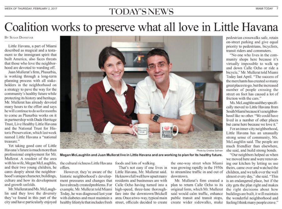
Watch Juan Mullerat and Megan McLaughlin's interview on PBS below or visit http://www.pbs.org/video/2365949292/
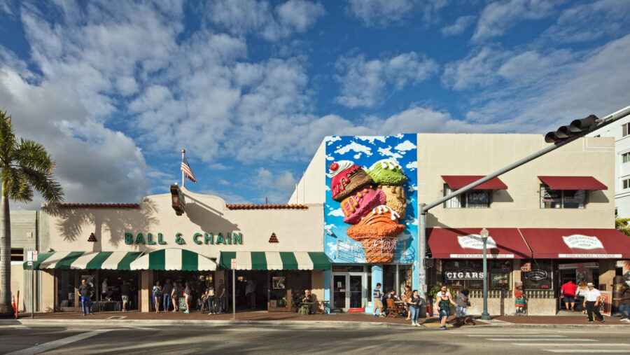
El barrio que acogió al exilio cubano y sigue siendo un punto receptor de migrantes y turistas acaba de ser declarado Tesoro Nacional. Por delante hay un plan de revitalización de sus calles y edificios y un reto: que las nuevas construcciones no acaben con su carácter ni echen a los vecinos de toda la vida.La Calle 8 se ha revitalizado en los últimos años como un punto recepción de turistas en Miami. Cortesía National Trust For Historic PreservationPor: Lorena ArroyoPublicado: ene 28, 2017 | 12:01 AM ESTMIAMI, Florida.- Olvídense del cafecito cubano, la salsa, los puros y el dominó. Más allá de los atractivos turísticos de la Calle 8, la Pequeña Habana está atrayendo cada vez más las miradas de quienes ven en las calles de este emblemático y céntrico barrio de Miami una oportunidad de desarrollo urbanístico.Ante el temor de que las grúas y el cemento derrumben el carácter único que le han dado durante décadas generaciones de inmigrantes, la Pequeña Habana fue nombrada este viernes Tesoro Nacional de Estados Unidos con una importante tarea por delante: que los planes urbanísticos que buscan revitalizarlo puedan conservar los edificios históricos y no supongan el desplazamiento de los residentes actuales.El objetivo del proyecto de revitalización de la Pequeña Habana es que no se pierda el carácter arquitectónico ni social del barrio.Cortesía National Trust for Historic Preservation "La Pequeña Habana es la Ellis Island de Miami, el lugar de llegada y establecimiento de muchos inmigrantes. La historia de estas calles es la historia de EEUU: hombres y mujeres que llegan en búsqueda de una mejor vida y trabajando duro para ellos y sus familias", afirmó Stephanie Meeks, la presidenta de National Trust for Historic Preservation (NTHP), una organización que trabaja en la conservación de lugares históricos.Como sucedía con la isla de Nueva York donde se inscribían los millones de europeos que llegaron en barcos a EEUU, este barrio de casas antiguas y pequeños edificios de apartamentos ha sido el lugar de acogida de las oleadas de exiliados cubanos desde los años 60 y de numerosos inmigrantes centroamericanos, principalmente nicaragüenses, en las últimas décadas. Hoy en día, el 70% de sus habitantes nació fuera de EEUU y el 98% es de origen hispano."Mientras buscamos conservar y celebrar la diversidad de la Pequeña Habana, queremos asegurarnos que sigue siendo un barrio próspero, enérgico y asequible", afirmó Seeks.¿Viejos y nuevos vecinos?Su organización, que en 2015 incluyó al barrio como uno de los lugares históricos de EEUU con más peligro de desaparecer, conoce bien las amenazas a las que se enfrenta.Y aunque el anuncio del nombramiento de la Pequeña Habana como Tesoro Nacional en el teatro Manuel Artime comenzó como un acto de celebración de la diversidad con la presencia de políticos, urbanistas, empresarios y periodistas, no tardó en chocar con la realidad.Fue cuando, durante un tour por la ciudad en el que la NTHP presentaba a los medios su plan a largo plazo para revitalizar la Pequeña Habana junto a sus aliados (la fundación Dade Heritage Trust, el estudio de arquitectos y urbanistas PlusUrbia Design, y la organización Live Healthy Little Havana), una vecina irrumpió en la conversación.Ally DiVizio, en la imagen pidiendo un cafecito en una ventana de un pequeño comercio, teme que los planes urbanísticos echen del barrio a los vecinos que llevan años ahí. Lorena Arroyo "Ustedes no saben cómo es este barrio y lo que pasó hace unos siete años... Downtown y Brickell se lo compraron", afirmó la mujer, que se identificó como Ally DiVizio, en referencia a dos barrios aledaños que han mostrado un rápido crecimiento urbanístico en los últimos años."Los comisionados vienen aquí todo el tiempo y, ¿qué han hecho? ¡Nada! Todo lo que quieren hacer es más construcciones hacia este lado y echan a la gente que no puede permitirse una renta aquí porque siguen subiendo los precios", añadió, visiblemente molesta.Ante sus quejas, Juan Mullerat, un arquitecto y urbanista que dirige Plusurbia, una de las firmas que trabaja en el plan de revitalización del barrio, invitó a la mujer a participar en algunas de las reuniones y grupos de discusión que pretenden hacer con la comunidad.Una apuesta para la ciudad"La idea es traer la suficiente gente como para saber cuál es la manera en la que tenemos que diseñar para que el futuro de la Pequeña Habana no solo sea contextual con la manera con la que está hoy, sino que también atraiga nuevas fuentes económicas y de inversión", le explicó después Mullerat a Univision Noticias. "La gente tiene que ser la propietaria del plan maestro, no nosotros"."La comodidad es la Pequeña Habana", se puede leer en el edificio que construye Andrew Frey. Lynne Sladky / AP Y aunque el temor de DiVizio a que La Pequeña Habana sufra un proceso de gentrificación puede entenderse solo con levantar la vista y ver el barrio enormes grúas de construcción para construir rascacielos en los vecindarios aledaños, el plan de la NTHP y sus aliados contempla buscar formas de incentivar el desarrollo local y la movilidad social para que los vecinos de toda la vida y los recién llegados puedan seguir conviviendo.Según el estudio que hicieron estas organizaciones, pese a ocupar el 7% de la superficie de Miami, el barrio tiene cerca del 20% de las viviendas de alquiler de la ciudad y más de una cuarta parte de las alquiladas por menos de 1,000 dólares mensuales."El 80% de la gente de la Pequeña Habana vive de alquiler porque las viviendas son baratas, pero con la reiversión, con la construcción que hay acá, esto no es sostenible. Nuestro estudio es en conjunto con el National Trust para poder mantener los edificios existentes y con la ciudad de Miami para encontrar métodos tanto económicos como sociales para mantener el tipo de vivienda que hay aquí hoy", explica el director de Plusurbia.Eso implica desde ayudas del gobierno local para hacer las viviendas más asequibles a los vecinos de menos ingresos a incentivos para que los promotores mantengan los precios bajos o reducir el costo de la construcción al hacer, por ejemplo, edificios pequeños sin parqueo.Frey apuesta por construir edificios sin parqueo. Lorena Arroyo Eso es lo que está haciendo Andrew Frey, un desarrollador urbanístico que está construyendo en el barrio. Aunque a muchos en Miami les pueda parecer una locura, el edificio boutique de ocho apartamentos que levanta en la Pequeña Habana no tendrá espacio para aparcar autos.Y es que, el proyecto de barrio impulsado que impulsan National Trust y sus aliados incluye nuevas ideas de urbanismo como que las ciudades son para las personas y no para los autos o que cada comunidad tiene tiene historias y lugares que importan y hay que respetarlos."Nosotros no ofrecemos piscina, gimnasio ni spa", explica orgulloso Frey. "La Pequeña Habana tiene historia, cultura. Tiene gente real y una narrativa que no puedes controlar", añade.Enlace: UNIVISION NOTICIAS Artículos relacionados: Agencia EFE, MARTÍ NOTICIAS (Miami), El Nuevo Herald (Miami)#1, El Nuevo Herald (Miami) #2, Telemundo Miami, Diario de Cuba, Cuba en Miami, Miami News 24
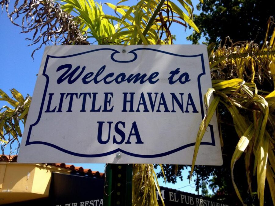
Union with the National Trust for Historic Preservation, Dade Heritage Trust and Live Healthy Little launches long-term planning process to create a thriving, healthy and livable community.Nation’s Leading Historic Preservation Organization Names Miami’s Little Havana a National TreasurePress Release | Miami, Florida | January 27, 2017Author: Virgil McDillNational Trust for Historic Preservation Also Unveils New Research Underscoring Little Havana’s Affordability, Population Density and Opportunities for GrowthMiami’s Little Havana—a neighborhood that stands as a testament to the immigrant spirit that built America and a place that remains a dynamic, culturally rich, and affordable neighborhood—was today named a National Treasure by the National Trust for Historic Preservation. In partnership with Dade Heritage Trust, PlusUrbia Design, and Live Healthy Little Havana, the National Trust is today launching a long-term planning process that seeks to work with neighborhood residents, civic leaders, and local partners to ensure that Little Havana can remain a thriving, healthy and livable community that embraces its past while planning for a brighter future. Despite Little Havana’s significance and its continued role as a home to thousands of Miamians, the neighborhood currently faces a range of threats, including development pressure, demolition of historic buildings, displacement of existing residents, and zoning changes that could impact its affordability, cultural richness, and character. To address these threats, the Trust is launching a planning process to work with neighborhood residents and other stakeholders on solutions that encourage continued growth while preserving the neighborhood’s unique character.The National Trust’s experience and research demonstrates that the rehabilitation and reuse of older and historic buildings is a key to revitalizing urban neighborhoods for the benefit of residents. Building on this, the Trust recently launched an initiative called ReUrbanism that emphasizes the many ways that creatively reusing older buildings can benefit communities. For example, ReUrbanism research in Little Havana suggests that a strategy based on preservation could retain the character, density, scale and affordability that have long defined Little Havana. Key findings include:Blocks of modest older, smaller buildings in Little Havana have the same level of population density as the nearby towers of Brickell, but in Little Havana, these levels of population density are contained in historic, human-scale buildings.More than half of Miami’s 100 most densely populated city blocks are located in Little Havana.Miami’s greatest concentrations of rental housing in general and affordable rental housing in particular are found in Little Havana. Though Little Havana takes up about seven percent of Miami’s land area, it contains close to 20 percent of the city’s rental housing stock and more than a quarter of the city’s housing rented for less than $1,000 per month.Little Havana is host to thousands of small businesses and hundreds of women and minority-owned businesses. The commercial corridors of Little Havana—Calle Ocho, 12th Avenue, Flagler, and others—have some of the city’s highest concentrations of such businesses.“Little Havana is a symbol of the immigrant experience in America and a thriving, entirely unique place that thousands of people currently call home,” said Stephanie Meeks, president and CEO of the National Trust for Historic Preservation. “The National Trust welcomes the urban resurgence that is breathing new life into cities across the country, but we also believe that growth should not come at the expense of the vibrant historic neighborhoods like Little Havana that make cities unique and desirable places. As we work to preserve and celebrate Little Havana, we want to make sure it remains a healthy, vital, and affordable urban neighborhood.”"As we work to preserve and celebrate Little Havana, we want to make sure it remains a healthy, vital, and affordable urban neighborhood.”“This historic designation enshrines the diverse culture and history of Little Havana,” said City of Miami Mayor Tomas Regalado. “Little Havana has been the destination for hundreds of thousands of Latin American immigrants since the 1960s seeking the promise of a new life in America. This national recognition confirms the neighborhood’s cultural significance in the immigrant experience.”"This partnership represents an opportunity to protect and strengthen one of the most authentic neighborhoods in America,” said Juan Mullerat, Director at Plus Urbia Design. “With development pressures encroaching from Brickell and Downtown and a zoning code that often favors tear down and replacement with out-of-scale superblock development, we are at risk of losing the rich cultural heritage of Little Havana. Little Havana is Miami's heart and soul, but it is in critical need of a visionary approach to planning and development. Today marks the beginning of people-focused contextual urban design that will preserve and invigorate this diverse urban neighborhood." “As Miami continues to evolve, preservation will be essential in maintaining Miami’s unique urban neighborhoods,” said Christine Rupp, Executive Director of Dade Heritage Trust. “Dade Heritage Trust will continue to work with our partners to inform residents and property owners about the cultural and financial benefits of preservation. Our long-term goal is to protect specific historic properties that tell the story of Little Havana and assist with the restoration of those historic buildings to ensure that Little Havana maintains its urban, multi-cultural heritage and vibe. The historic fabric in Little Havana is amazing. 1930's bungalows, 1920's central hallway apartment buildings, coral rock homes, early Miami wood frame houses and even Art Deco apartment buildings exist within the neighborhood. The preservation of this neighborhood has so many positives from saving these structures that represent different eras in Miami's history to ensuring working class people can remain in this urban, highly desirable area.”"Today marks the beginning of people-focused contextual urban design that will preserve and invigorate this diverse urban neighborhood."Additional Background on Little HavanaLittle Havana’s story is at the heart of the American experience. From its earliest days as a streetcar suburb, to its iconic role as a haven for Cuban Americans, to its more recent role as a home to immigrants from Central America and the Caribbean, Little Havana has been shaped by people striving to build a better life for themselves and their families. To this day, visitors to the neighborhood can experience a thriving neighborhood that is truly one-of-a-kind. The neighborhood’s unique buildings—local variations of recognized types like the bungalow, center hallway walk-up apartments, and small commercial buildings housing mom-and-pop stores—have served generations of residents who have adapted them to fit their needs. The Trust’s research suggests that these character-rich historic buildings can play an essential role in the future growth of Little Havana.https://savingplaces.org/places/little-havanaAbout The National Trust for Historic PreservationThe National Trust for Historic Preservation, a privately funded nonprofit organization, works to save America’s historic places.www.savingplaces.org About National TreasuresThe National Trust for Historic Preservation mobilizes its more than 60 years of expertise and resources to protect a growing portfolio of National Treasures that are threatened buildings; neighborhoods, communities, and landscapes that stand at risk across the country. Our National Treasures program demonstrates the value of preservation by taking direct action to protect these places and promote their history and significance.https://savingplaces.org/national-treasures#.WIuC-bYrKV4About Dade Heritage TrustDade Heritage Trust is a non-profit 501c3 organization founded in 1972. The mission of the organization is to preserve Miami-Dade County's architectural, environmental and cultural heritage through education and advocacy. Dade Heritage Trust is funded through memberships, private contributions, grants and public programming proceeds.For more information, call Christine Rupp, Executive Director, at 305-358-9572 or visit dadeheritagetrust.org.About Live Healthy Little HavanaLive Healthy Little Havana is an initiative coordinated by the City of Miami and supported by the Health Foundation of South Florida to promote healthier living in Little Havana. The goal is to strengthen community capacity to collaboratively plan and collectively carryout strategies to improve health. Residents and employees of Little Havana expressed concerns about the well-being of residents within the community at meetings and have identified health impact areas: physical activity, primary care, mental health & substance abuse and nutrition. LHLH has a focus placed on strategies that will foster changes in policy, systems, or the environment, with an emphasis on sustainability.https://www.livehealthylittlehavana.comLink to press release at National Trust for Historic Preservation website: NTHP Press ReleaseRelated articles: CNN, Curbed Miami, Miami Herald, AFP (Agence France-Presse), ABC Miami, CBS Miami, Christian Science Monitor, Florida Politics, Miami Agent, SKIFT (Travel Industry)
We use cookies
We use our own and third-party cookies to be able to correctly offer you all the functionalities of the website for analytical purposes. You can accept all cookies by clicking "Accept cookies", obtain more information in our
Website Policyor configure/reject their use by clicking on Settings".
Accept cookies
SettingsBasic cookie informationConfirm preferences
This website uses cookies and/or similar technologies that store and retrieve information when you browse. In general, these technologies can serve very different purposes, such as, for example, recognizing you as a user, obtaining information about your browsing habits or customizing the way in which the content is displayed. The specific uses we make of these technologies are described below. By default, all cookies are disabled, except for the technical ones, which are necessary for the website to work. If you wish to expand the information or exercise your data protection rights, you can consult our Website Policy.
Accept cookiesManage preferencesTechnical and/or necessary cookies
Always active
Technical cookies are those that facilitate user navigation and the use of the different options or services offered by the web such as identifying the session, allowing access to certain areas, filling in forms, storing language preferences, security, facilitating functionalities. (videos, social networks…).
Analytic Cookies
Analysis cookies are those used to carry out anonymous analysis of the behavior of web users and that allow user activity to be measured and navigation profiles to be created with the objective of improving websites.