our
news
AWARDS, ACCOLADES, PUBLICATIONS AND NEWS.
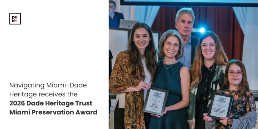
Plusurbia Design, together with the Miami-Dade County Office of Historic Preservation and the Miami-Dade County Department of Regulatory and Economic Resources, is honored to receive the 2026 Dade Heritage Trust Miami Preservation Award for the project Navigating Miami-Dade Heritage.
Each April, Dade Heritage Trust recognizes individuals and organizations whose work advances the protection and celebration of Miami-Dade County’s built heritage and natural environments. Being selected among this year’s honorees reflects the shared commitment behind this work.
The project reinforces a core principle at Plusurbia: successful planning begins with a deep understanding of place. Miami-Dade’s layered history—its neighborhoods, architecture, and cultural landscapes—actively informs how we approach preservation and planning.
We extend our appreciation to Dade Heritage Trust, Miami-Dade County, and the communities across the county whose trust allows us to help interpret and navigate what makes this region worth preserving.
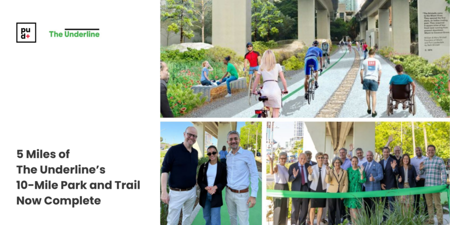
Proud to share that Friends of The Underline has recently reached a significant milestone, completing five miles of its 10-mile linear park and urban trail beneath Miami's Metrorail, connecting Brickell to Coconut Grove and Dadeland.
What began five years ago as a bold vision for how Miami could reclaim its public realm is now a living civic destination where mobility, recreation, culture, and community converge.
Plusurbia Principal and Founder Juan Mullerat, who serves on the Board of Directors of The Underline Conservancy, has been part of supporting this vision as it takes shape across Miami's neighborhoods. His work advancing walkable, connected, and inclusive urban environments reflects the same commitment that drives everything we do at Plusurbia: great places begin and end with people.
Five miles down. Five more to go.
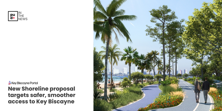
Plusurbia was recently featured in the Key Biscayne Portal in a piece covering the latest progress on The Shoreline, a proposed redesign of the Rickenbacker Causeway that would transform how people move to and from Key Biscayne.The article highlights several key concepts our team has been developing alongside HDR ENGINEERING and Friends of The Underline, including a split-level viaduct that separates fast-moving traffic from pedestrians and cyclists, 160% more beach space below, and improved access to destinations such as Virginia Key, Miami Marine Stadium, and MAST Academy.This project reflects exactly the kind of work Plusurbia was built to do. Complex, context-driven, and rooted in the belief that great infrastructure should serve people first. The Shoreline is not just a transportation solution. It is an opportunity to create a more connected, walkable, and resilient corridor for the tens of thousands of people who use the causeway every day.We believe that understanding a place and its context is critical in planning for the future. That means listening, analyzing, and designing with precision so that bold ideas can become implementable ones.The feasibility study is underway, and the conversation is just getting started.
Read the full article and follow the progress.
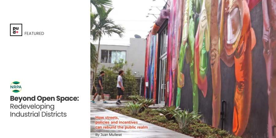
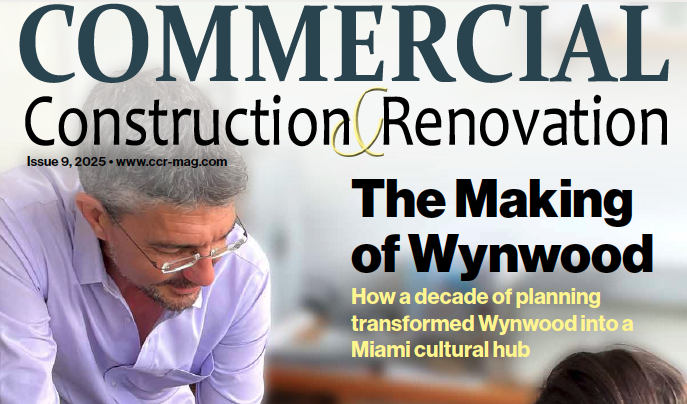
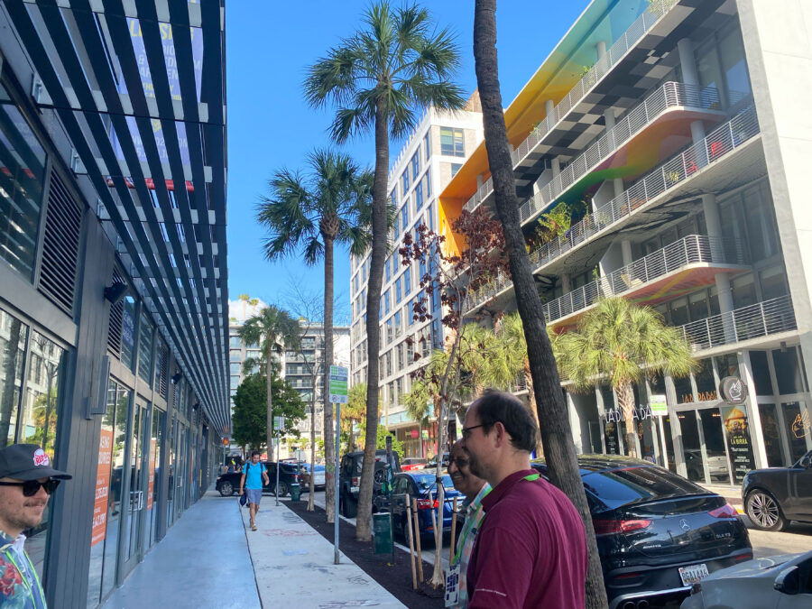
Plusurbia’s Wynwood Vision Plan and NRD-1, examples of how even small interventions can reshape the experience of a dense urban district, are explored further by Juan Mullerat in his latest piece in the May issue of the National Recreation and Park Association. The article examines Wynwood’s evolution from an industrial district into a mixed-use neighborhood, and what it reveals about the future of urban public space.
In places where parks were never planned, and land is limited, cities must take a different approach.
In a place surrounded by art to look at, people still need space to pause and experience nature.
By embedding public realm improvements into zoning, streets, and development, Wynwood reflects a broader shift in how cities can create more accessible, livable environments, where public space is not centralized but integrated into everyday life.
In a place built for visual engagement, the garden adds a space designed to pause and breathe.
Read the full article here.
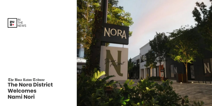
Plusurbia was recently featured in the Boca Raton Tribune in a piece spotlighting The Nora District. The article specifically references our role in shaping the master plan alongside the City of West Palm Beach.Districts like Nora don't happen by accident. They are the result of planning that begins with a deep understanding of place, its patterns of daily life, and its cultural context. When that foundation is in place, it creates the conditions for operators who are equally intentional about their concepts to want to be part of what the place can become.At Plusurbia, we believe the creation of great places begins and ends with people. That means listening and translating what we hear into environments where urban life can unfold naturally and where communities can genuinely thrive.Nora is a living example of what that process produces.
Read more: here
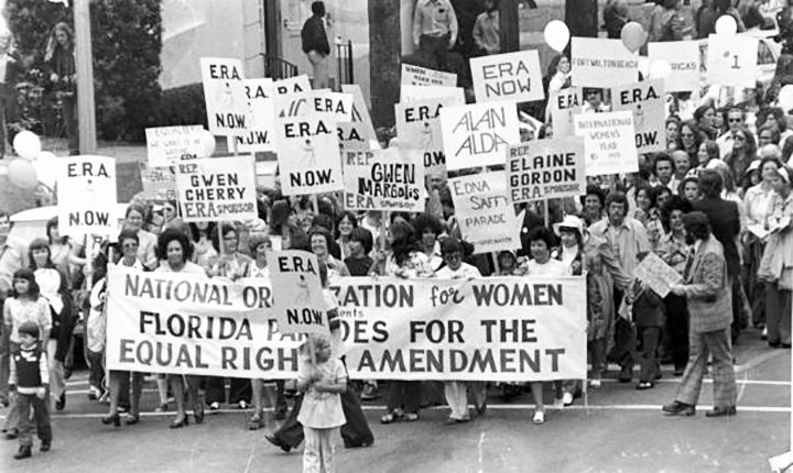
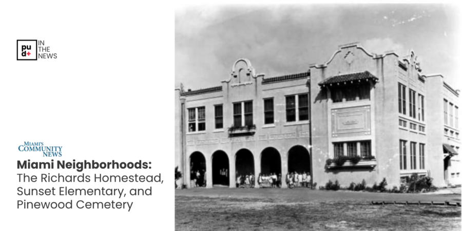
At Plusurbia Design, we believe that preserving historic neighborhoods means preserving the stories that define them. Recently, Megan McLaughlin, Director of Preservation Projects, examined how the history of Miami’s Brownsville neighborhood influenced the advocacy and leadership of pioneering civil rights champion Gwen Cherry.As Florida’s first African American woman elected to the state legislature, Cherry advanced causes that expanded opportunities for generations of Floridians, including efforts to establish Martin Luther King Jr. Day as a state holiday and support for the Equal Rights Amendment.Through preservation research and community storytelling, Plusurbia Design works to document and elevate the people, places, and events that have shaped our communities. Preserving these narratives helps strengthen civic identity and ensures that influential leaders like Gwen Cherry continue to inspire future generations.Read the full tribute to Gwen Cherry in Miami's Community Newspapers article here.
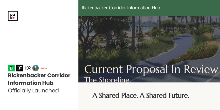
The Rickenbacker Causeway was designed to move traffic. Like most highways, it is defined by asphalt, speed, and capacity. But along Biscayne Bay, infrastructure also defines the health of the shoreline, and the quality of life for the people who use it.Today, the Causeway is more than a roadway. It is the primary connection to Virginia Key and Key Biscayne, and the front door to some of South Florida’s most important parks and coastal ecosystems. It carries vehicles, but it also shapes water flow, habitat continuity, and how people access, experience, and relate to the bay.The Shoreline concept asks a simple question: can infrastructure perform as both a mobility and green system, without compromise, and in a way that better serves people?By elevating through-traffic in strategic segments, it explores how the ground plane could be opened up, not by reducing lanes or capacity, but by reorganizing them. This creates room for restored shoreline conditions, native landscapes, stormwater absorption, and continuous public access along the water’s edge, while improving safety and connectivity for pedestrians and cyclists.This is not a typical highway project. It reframes infrastructure as part of a larger environmental system that supports ecology, resilience, and everyday public life.As part of this ongoing conversation, a new Rickenbacker Corridor Information Hub has been launched by the Key Biscayne Community Foundation, with support from the Knight Foundation, to provide a centralized resource on the corridor’s history, function, and future planning.This effort complements the feasibility study being conducted by Plusurbia Design, in collaboration with Friends of The Underline, exploring how the corridor can evolve as a more integrated system that supports mobility, ecology, and public life. The platform brings together key materials, timelines, and opportunities for public engagement as planning continues.Learn more at rickenbackercorridor.org
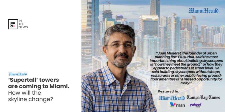
Miami’s skyline keeps making headlines, but cities aren’t experienced from above; they’re lived on the street.In a recent interview with Catherine Odom, Real Estate reporter with the Miami Herald, later syndicated across outlets including Tampa Bay Times, Yahoo News, and MSN, Plusurbia Design's Principal, Juan Mullerat, emphasized that a consistent oversight in high-rise development is that the relationship between towers and the street is often treated as secondary, when it should be fundamental.As new towers rise, their true impact is determined not by height, but by how they meet the ground. The base of a building shapes the public realm, influencing walkability, economic activity, and daily social interaction. When designed with intent, ground floors can reinforce the continuity of the street, support local businesses, and create environments where urban life can unfold naturally.At Plusurbia, this perspective begins with a deep understanding of a place, its people, patterns of daily life, and cultural history, and translates that insight into design that is built to endure.We believe buildings must add value to cities and must be built to serve the public at the street level.Read the article here.
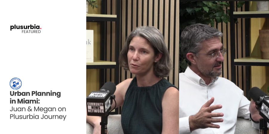
Real change in cities doesn’t happen overnight; it takes decades. At Plusurbia Design, we often talk about how planning is a long-term commitment, with impacts that can take 30 to 40 years to fully take shape.In a conversation with Harry Gotlieb from Miami's Community Newspapers, Juan Mullerat and Megan McLaughlin reflected on 20 years of progress made across Miami-Dade County and what still lies ahead.Because the cities we experience today were planned decades ago, and the decisions we make now will shape what comes next.
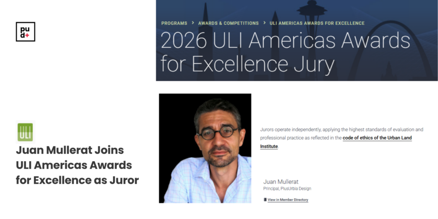
We’re proud to announce that Juan Mullerat, Founding Principal of Plusurbia Design, has been selected to serve as a juror for the Urban Land Institute Americas Awards for Excellence 2026.
ULI began the Awards for Excellence program in 1979 to recognize truly superior development efforts in the private, public, and nonprofit sectors. Winning projects represent the highest standards of achievement in the development industry—standards that ULI members deem worthy of attainment in their professional endeavors.
The jury brings together leaders from across the country to evaluate projects that are shaping how cities function and how they connect people, integrate nature, and respond to long-term social and environmental pressures.
A jury of ULI members chooses finalists and winners. Members of the jury are leaders who represent a broad geographic diversity and many areas of real estate and land use expertise, including finance, planning, development, public affairs, design, and professional services, among others.
In this role, Juan will help assess the ideas and approaches influencing the next generation of urban development, reflecting a broader shift toward more intentional and community-centered design.
His selection underscores Plusurbia’s continued focus on creating places that are grounded in context and designed to serve the communities around them.
We look forward to sharing perspectives from the process in the weeks ahead.Keep posted here.
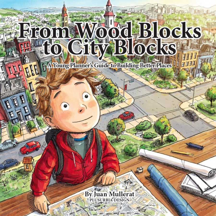
Cities shape children long before children understand what a city is.
They walk on sidewalks that may be cracked or smooth. They wait at bus stops without knowing why some have benches, and others do not. They cross streets designed by people they will never meet. These decisions influence their safety, independence, and sense of belonging long before they have the language to describe them.
Yet conversations about planning are usually reserved for professionals. By the time most people encounter zoning, infrastructure, or civic process, their assumptions about how places work are already formed.
We believe planning literacy should begin earlier. Planning is not only a professional practice. It is also a civic skill.
From Wood Blocks to City Blocks was created with that idea in mind. The book introduces young readers to the basic habits of good planning: observing, listening to others, identifying problems, and imagining practical improvements.
Over more than two decades of professional practice, our team has participated in charrettes, workshops, public meetings, and community engagement processes across many different settings. One pattern appears repeatedly. While public participation is encouraged, there are very few structured tools designed to involve children in meaningful ways. When children are included, their participation is often informal or symbolic. Yet children already experience the successes and failures of planning every day, often more directly than adults.
Yet children experience the public realm differently. They move at a different scale. They notice obstacles adults overlook. In workshops, they often point directly to problems in sidewalks, crossings, parks, and everyday infrastructure that professionals may have normalized.
For this reason, From Wood Blocks to City Blocks is not only a story, but it is also a practical engagement tool.
For planners. The book can support workshops, charrettes, and community engagement processes by providing activities that help children articulate what they observe and what they would change. For educators, it offers a framework for introducing civic responsibility, accessibility, and shared public space in language appropriate for younger audiences.
The story encourages children to observe closely, listen carefully, draw their ideas clearly, and begin with one small improvement. These habits mirror the fundamentals of responsible planning practice. Streets, parks, sidewalks, libraries, and schools are shared spaces. They belong to everyone. Understanding how cities work and how shared spaces can improve should not be limited to specialists or institutions.
For that reason, the digital edition of the book is offered freely. Planning knowledge should be accessible to the people who experience cities every day. It is shared under a Creative Commons license, allowing teachers, planners, educators, and community groups to use, print, share, and adapt it with attribution for non-commercial purposes. A low-cost print edition is also available for libraries, classrooms, workshops, and project teams that prefer a physical copy for public settings or community use.
Cities improve when more people are invited into the conversation. That invitation can begin early.
View the free digital edition, download the printable PDF, or order a print copy here.

const canvas = document.getElementById('snowCanvas');
const ctx = canvas.getContext('2d');function resizeCanvas() {
canvas.width = window.innerWidth;
canvas.height = window.innerHeight;
}
window.addEventListener('resize', resizeCanvas);
resizeCanvas();const flakes = [];
const flakeCount = 80; // number of snowflakes
for (let i = 0; i < flakeCount; i++) {
flakes.push({
x: Math.random() * canvas.width,
y: Math.random() * canvas.height,
r: Math.random() * 4 + 1, // radius
d: Math.random() * flakeCount
});
}function drawFlakes() {
ctx.clearRect(0, 0, canvas.width, canvas.height);
ctx.fillStyle = 'white';
ctx.beginPath();
for (let i = 0; i < flakes.length; i++) {
const f = flakes[i];
ctx.moveTo(f.x, f.y);
ctx.arc(f.x, f.y, f.r, 0, Math.PI * 2, true);
}
ctx.fill();
moveFlakes();
}let angle = 0;
function moveFlakes() {
angle += 0.01;
for (let i = 0; i < flakes.length; i++) { const f = flakes[i]; f.y += Math.pow(f.d, 0.5) + 1; f.x += Math.sin(angle) * 2; if (f.y > canvas.height) {
f.y = 0;
f.x = Math.random() * canvas.width;
}
}
}setInterval(drawFlakes, 30);
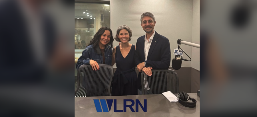
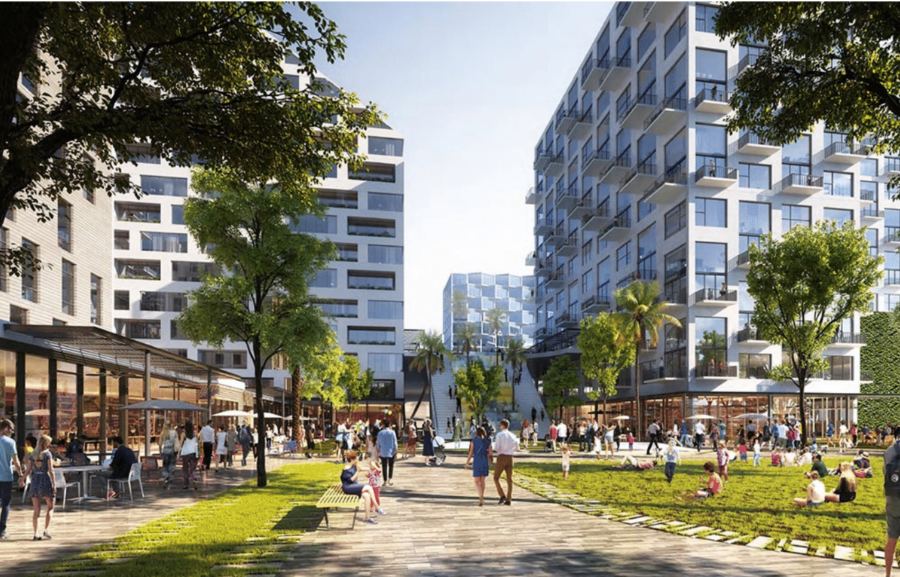
Plusurbia’s Megan McLaughlin and Juan Mullerat recently spoke with WLRN Public Media reporter Sherrilyn Cabrera about ten years of people-first design in Little Havana. From celebrating neighborhood successes to identifying opportunities for safer, more vibrant streets, they shared how collaborative, place-driven planning shapes a resilient and inclusive future.
“At Plusurbia, design begins and ends with people,” McLaughlin and Mullerat explain. By listening closely, understanding a community’s DNA, and translating ideas into actionable plans, Plusurbia creates spaces that honor cultural legacy while anticipating tomorrow’s challenges.The full interview will air in 2026. Stay tuned to learn more about how Plusurbia is helping shape Little Havana’s streets and public spaces for everyone who calls it home.
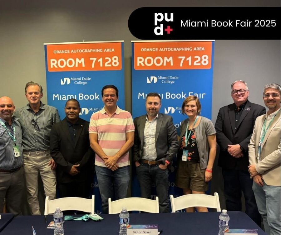
Sharing highlights from the Miami Book Fair on November 23, where Juan Mullerat, Principal of Plusurbia Design, joined the distinguished panel, “Cities, Mobility, and a Vision for a Better America.”
Presented by the Citizens' Independent Transportation Trust, the session brought together leading voices in urbanism: Angie Schmitt, Wes Marshall, Juan Mullerat, and Charles “Chuck” Bohl, with Victor Dover, FAICP, serving as moderator. The panel delivered an insightful and forward-looking conversation on the future of cities, mobility, and community-centered development.
During the program, Juan also presented his new book, The Urban Calendar: 365 Days That Shaped the Urban World, a collection of significant moments in urban history that continue to influence how cities grow, adapt, and thrive.A recording of the full session is available for viewing here:

Plusurbia founder Juan Mullerat was recently featured in Authority Magazine’s Cities of the Future series, discussing how walkable streets, active public spaces, and people-centered design contribute to more livable, productive, and sustainable cities.
In the Q&A, Juan reflects on the early influences that shaped his approach to urbanism, the importance of understanding a community’s DNA, and why collaboration and persistence are essential for meaningful, long-term change. He also highlights emerging Plusurbia tools, including LATTICE and THIRDPLACE, and shares insights on the evolving role of transit, multimodal mobility, and policies that help cities grow with intention and care.
Thank you to Yitzi Weiner for this illuminating feature.
Read the full story here.

Miami's identity is etched in its past. A vibrant history that continues to shape the Magic City’s present and future.
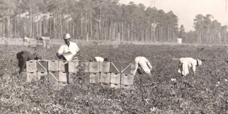
This year, Plusurbia partnered with the Miami-Dade County's Office of Historic Preservation (OHP) to develop four interactive StoryMaps that bring the county’s vibrant history to life. Each StoryMap explores a unique chapter in Miami-Dade’s development, from agriculture and architecture to land development and preservation, illustrating how the past continues to influence the region’s culture, economy, and urban form.
These StoryMaps aim to make local history more accessible to residents, students, and visitors alike—inviting everyone to explore, learn, and connect with the stories of our shared past.
You can explore the StoryMaps directly via the links below:Historic Preservation in Miami-Dade County
Miami-Dade County’s Architectural LegacyThe History of Agriculture in Miami-Dade County
1920s Themed Developments in Miami-Dade CountyAs part of this effort, Plusurbia also worked with the County and local municipalities to create a Historic Resource Guide. The guide provides residents and property owners with a detailed overview of every locally designated historic site in Miami-Dade County and how preservation works at the local level.
You can view or download the Historic Resource Guide here: Miami-Dade Historic Resource Guide (PDF)

Adopted in 2010, Miami 21 was the first form-based zoning code applied to a large U.S. city. It replaced outdated, car-centric regulations with a framework prioritizing walkability, mixed-use development, and cohesive neighborhood design. Miami 21 has since become a reference point for cities across the country exploring New Urbanism principles to guide growth in the 21st century.
Juan Mullerat, Principal of Plusurbia, has long championed zoning as a tool for equity, resilience, and livability. joined a distinguished panel with Lizz Plater-Zyberk, Code author David Snow, City of Miami's Planning Director, and Melissa Tapanes Llahues, Land Use Attorney, to reflect on Miami 21’s legacy, its evolving role in shaping the built environment, and what’s next for cities embracing form-based codes.
The discussion examined how Miami 21 has influenced urban design, transportation, housing, and public spaces over the past 15 years, while also looking ahead to the evolving needs of a dynamic and growing city.
Watch the full panel discussion here:
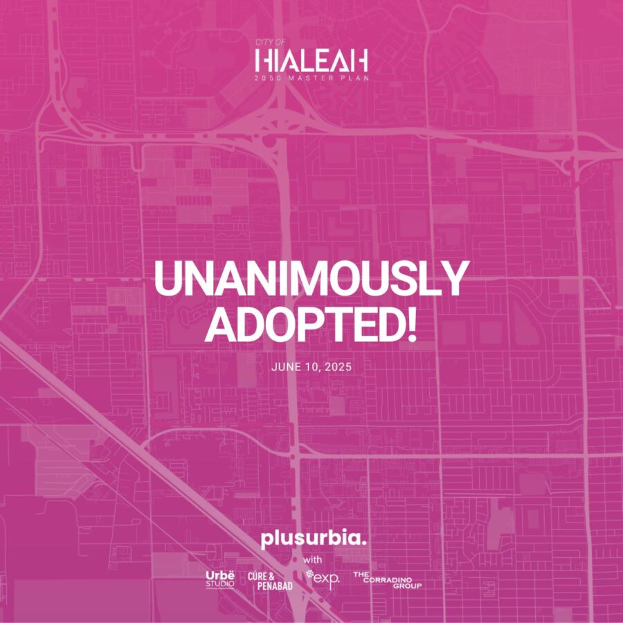
On June 10, 2025, the Hialeah City Council unanimously adopted the Hialeah 2050 Master Plan, marking a major milestone for one of South Florida’s most vibrant and evolving cities. The planning process, coordinated by Plusurbia in collaboration with the city and partners, guided the development of this transformative, long-range vision.Built over nearly two years of collaboration and community engagement, the plan reflects the voices of residents, stakeholders, and local partners. Grounded in equity, connectivity, walkability, and economic opportunity, the Hialeah 2050 Master Plan provides a community-first roadmap to guide the city’s growth through 2050 while fostering neighborhood pride and enhancing the quality of life for all residents.We extend our gratitude to the City of Hialeah Municipal Government and to Debora Storch and Claudia Hasbun, AICP, for their leadership and trust throughout this process. We also thank our exceptional project team, including Urbe Studio, EXP, Corradino, and CÚRE & PENABAD, whose expertise helped bring this vision to life.Finally, thank you to all residents, stakeholders, and partners who contributed their voices, ideas, and energy to shape this plan. Together, we are building Hialeah’s future.Explore the full plan at: www.hialeah2050.com
Plusurbia recently joined ULI Southeast Florida/Caribbean for the Technical Advisory Board Meeting in Hallandale, contributing to discussions on complex land use and development challenges.


Article was originally published in the Coconut Grove Spotlight
September 3rd, 2024 When my son gets hurt, I console him with the phrase “sana, sana, colita de rana,” which loosely translates to "heal, heal, little frog's tail." It makes no real sense, but it always makes him feel better. However, when he’s genuinely injured, we seek professional help.Similarly, the "Live Local Act" (SB102) bill, enacted with minimal input from city planners and architects, seeks to address Florida's housing crisis with good intentions but without professional precision and foresight. This law will reshape our cities by streamlining development and promoting higher-density housing in commercial and industrial areas without the expert insight to understand its impact on our communities and the essential services required for healthy urban strategic growth. It’s akin to saying, “Sana, sana, SB102 de rana,” hoping the housing crisis will be resolved without side effects.When tackling affordability, it is vital to prioritize healthy strategic growth. The bill’s authors, though knowledgeable about zoning, would have benefited from a deeper understanding of how cities function, their unique qualities, histories, and diverse characters. However, with 411 municipalities and over 10,000 neighborhoods in Florida, who could cater to the specific needs of each one? No one can, and that’s why a blanket approach to affordability is ill-conceived.Height and density aren't suitable everywhere. SB102 neglects resilient measures by promoting large-scale development in vulnerable coastal and flood-prone areas. It neglects essential infrastructure like roads, emergency services, schools, and parks—elements covered in Comprehensive Plans to guide strategic growth and ensure livability. Placing housing indiscriminately in commercial and industrial zones risks overwhelming infrastructure, worsening congestion, and straining utilities. Without careful planning and provision of these services, new affordable developments will be built in the wrong places without proper services, amplifying the issues SB102 aims to resolve.A critical flaw in SB102 is assuming that density requires height. Florida’s 1920s and 30s small-scale apartments show that small, high-density buildings exist compatibly within neighborhoods. With limited parking and minimal amenities, these buildings have low HOAs and construction costs and maintain affordable rents. For instance, Miami's 1920s central corridor buildings, like 2401 Overbrook St in Coconut Grove, achieve 60-150 dwelling units per acre with just 2-3 stories, blending seamlessly into the urban fabric. Options like ADUs, triplexes, and courtyard apartments further enhance neighborhood diversity and housing availability. This doesn’t mean less housing, but more integrated rather than concentrated in towering structures. Instead of SB102’s ‘super-size-it’ approach, efficient, quality affordable housing works better when introduced strategically throughout a community.By prioritizing maximum heights and large-scale developments, SB102 overlooks the diverse housing types that have historically made our neighborhoods vibrant and inclusive. These housing types offer various densities while maintaining a harmonious scale, ensuring that buildings complement rather than overshadow each other. The bill needs to provide solutions that address affordability while preserving neighborhood character. Large-scale developments often require extensive land assemblies, encouraging land banking, speculation, and displacement of existing residents and businesses, ultimately exacerbating the problems the law aims to solve—particularly in hyperinflated markets—undermining the character and scale of established neighborhoods.While the legislation encourages development near transit by reducing parking requirements, it must prioritize it. This is an opportunity to encourage growth around transportation nodes and corridors, gradually decreasing height to match the existing neighborhoods’ character with smaller, scaled-down infill projects that blend seamlessly into the urban fabric. Such a strategy would preserve the character of lower-rise areas, contributing to balanced growth and maintaining community integrity while accommodating new residents to support public transit. This approach would reduce congestion and promote sustainable transit-supportive environments, motivating cities to enhance transportation options and reducing car dependency and the need for onerous parking mandates.The law must seriously address the impact of parking on housing affordability. Mandating parking on any new development imposes significant financial burdens, driving up the cost of housing and making units less affordable. While parking may be desirable, especially in areas with limited public transit, existing stringent parking requirements increase development costs and exacerbate affordability issues. Parking should be optional, not mandatory. Numerous cities nationwide are eliminating parking minimums. Although not all cities may be ready for this, SB102 should require parking exemptions, at least in all TOD areas within half a mile, allowing the market to determine parking needs and compelling cities to invest in alternative mobility solutions. Parking should be considered an amenity, not a requirement, as the cost of structured parking—averaging $30,000 per space (or $60,000 if two spaces are required)—inevitably results in higher housing prices.A more profound issue lies in how 'affordable' is calculated. The current method using Area Median Income (AMI) is too broad and often fails to reflect real household economics, particularly in gentrifying or economically diverse neighborhoods where wealthier newcomers skew the median income. As a result, the 'affordable' units created under this legislation are often still out of reach. For example, in Miami-Dade, 'affordable' rents at 120% AMI are set at $2,554 for a one-bedroom and $3,063 for a two-bedroom unit. To afford this under HUD guidelines—where housing costs should be no more than 30% of income—a family of three would need to earn $122,520 annually, far above the county's median income of $79,400 and even more unrealistic in areas like the West Grove, at $50,000. Without a more precise approach considering local economic conditions, the housing produced under SB102 will remain inaccessible to those who truly need it, creating low-end market units rather than genuine affordable housing.Localized income assessments would ensure more realistic AMIs to achieve true affordability. The current thresholds could exacerbate displacement, pushing existing residents out of their communities. A fairer, more calibrated AMI and access to essential services like schools, parks, and transportation are crucial for creating sustainable and equitable housing solutions. Without these adjustments, SB102 risks perpetuating the housing crisis and worsening inequality.The law has sparked concerns among urban planners and local governments by overriding zoning laws and imposing a one-size-fits-all approach that disregards the unique needs of individual communities. This preemption limits local authorities' ability to develop strategies that align with their strategic growth plans, neighborhoods' character, and historical context, creating tension between state and local objectives.Much like the issues that led to the 1776 Declaration of Independence, where the 'consent of the governed' was crucial, this top-down approach from Tallahassee highlights a significant disconnect. Lawmakers in the state capital are not and cannot be attuned to the nuances of life in every community, much less in South Florida. Given the distinct challenges and opportunities here, perhaps it’s time to consider whether South Florida requires more autonomy to ensure that development policies are crafted with a deep understanding of our region’s unique context and needs.
By Andres Viglucci
June 22, 2024 5:00 AMMiami’s Wynwood may be the hottest, hippest neighborhood in America’s hottest city: A dynamic urban fusion of repurposed industrial buildings and warehouses interspersed with new, low-rise buildings housing shops, bars and restaurants, offices and apartments, all of it steeped in artful design and curated graffiti murals. Its success is no accident. The reinvigorated Wynwood, once a derelict industrial zone, is the deliberate result of unique planning guidelines and development limits painstakingly laid out a decade ago by district property owners and city of Miami planners. The special Wynwood regulations are backed by a distinct vision — for a dense yet human-scaled alternative to the new high-rise forests of Brickell and Edgewater. But just as they begin to bear fruit, the carefully laid plans for Wynwood are threatened by a controversial new state law, the Live Local Act, which overrides local building controls and encourages developers to supersize projects in exchange for setting aside apartments as ostensibly affordable housing. Critics say Live Local is a giveaway to developers and the promised affordable housing is anything but that.Read more at: https://www.miamiherald.com/news/local/community/miami-dade/article289287445.html#storylink=cpy
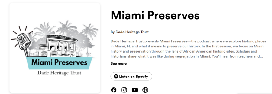
Dade Heritage Trust (DHT) proudly announces the launch of its new podcast, "Miami Preserves." This podcast, produced in collaboration with DHT’s Historic Places, Green Spaces education program, delves into the rich tapestry of Black history in Miami. Through captivating interviews and archival recordings, "Miami Preserves" illuminates the stories, struggles, and achievements of the African American community in this vibrant city.Inaugural Episode and Series LaunchThe inaugural episode features our very own Historical Preservation Specialist, Megan Mclaughlin. Listen to this insightful discussion on America's African American history, kicking off a content-rich four-part series. The trailer for this eagerly anticipated series has already been released, generating excitement for the first episode, which will be available on all major podcast platforms starting June 26, 2024.Listen and SubscribeListeners can access the trailer and subscribe to "Miami Preserves" here. This series aims to celebrate Miami’s African American cultural heritage, preserving and honoring the community's significant contributions to the city’s history and identity.Join the JourneyJoin DHT on this compelling journey as "Miami Preserves" brings to life the stories that have shaped the African American experience in Miami. Don't miss this unique opportunity to connect with the past and celebrate the vibrant cultural heritage that continues to enrich the city.
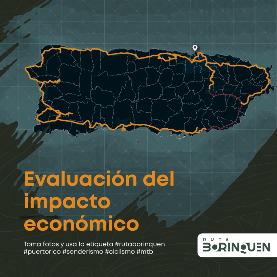
The Puerto Rican government is making strides in preserving its rich rail heritage with the introduction of House Bill (PC 2141). Filed by five representatives, this bill seeks to enshrine the preservation of 19th and 20th-century railroad routes as public policy. It also directs government entities to create a non-motorized transportation route for historical, cultural, and ecological tourism, proposing the development of the Borinquen Trail.Historical SignificancePC 2141 highlights that by the late 19th century, Puerto Rico boasted approximately 1,000 kilometers of railroads, positioning it as one of the regions with the most extensive railroad networks per square kilometer. These railroads were integral to the island’s development and historical landscape.Efforts by Plusurbia DesignPlusurbia Design has been working to preserve this legacy since 2018. The Borinquen Trail encompasses a 426-mile corridor aimed at safeguarding the historical importance of Puerto Rico’s old train tracks. This initiative seeks to enhance the island’s cultural heritage, support sustainable tourism, and engage the community.The Borinquen Trail: A Vision for the FutureThe Borinquen Trail will feature a multimodal ecological route designed for biking and pedestrian use, traversing the Puerto Rican archipelago. It will link various natural, historical, cultural, tourist, and gastronomic attractions along the old rail routes. This pioneering project promotes health, stimulates economic and tourist activity, and fosters a vibrant cycling and pedestrian community, all while preserving and celebrating Puerto Rico’s natural, historical, and cultural heritage.
On May 8 and 9, 2024, Miami hosted an insightful walkshop titled "Metamorphosis of a District: How the Design District, Midtown, and Wynwood Emerged as Miami's Preeminent Revitalization Experiments." This event, held as part of the National Association of City Transportation Officials (NACTO) Conference, was co-led by urban planning experts Juan Mullerat, Graham Jones from the City of Miami, and Cesar Garcia-Pons of Garcia+Pons and Associates, LLC.
This year has seen the birth of new connections, the strengthening of communities, and the laying of foundations for more resilient cities. Together, we've embarked on innovative projects that have not only shaped our path but have also contributed to the positive transformation of the spaces we touch. [video width="1920" height="1080" mp4="https://plusurbia.com/wp-content/uploads/2023/12/20231214-PUD-Holiday-Card-Photocard.mp4"][/video] We extend our heartfelt gratitude for your collaboration, support, and shared commitment to building a better future. May the holiday season bring you joy, peace, and moments of well-deserved rest.
Wishing you and your loved ones a festive holiday season and a prosperous New Year!
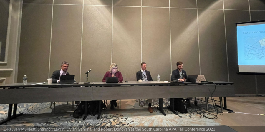
In a captivating session titled "Reimagining Greenville's Gateway: A Community-initiated Plan," urban design firm Plusurbia took center stage at the South Carolina APA Fall Conference. The event, held at the Westin Hilton Head Island Resort & Spa, featured Plusurbia's Juan Mullerat and Dylan Gehring, alongside key collaborators: Greenville’s City Manager, Shannon Lavrin, and local business owner and stakeholder Robert Donovan.The focal point of the session was the groundbreaking 2022 project, the "East Gateway District," a transformative initiative aimed at revitalizing Greenville's Gateway Area. The Community Vision Plan, presented by the Plusurbia team, emerged as a strategic blueprint that embraces the neighborhood's unique assets while implementing innovative strategies to seamlessly reconnect the built environment with the adjacent downtown.Revitalization began with the City’s downtown, and in the decades since, has grown outward from there in every direction; that is, except for the Gateway Area. Instead, Greenville’s most popular entrance, seeing 54,000 vehicles move through it daily, has continued to be defined by a series of disconnected development patterns, and includes a National Register-listed Historic Neighborhood, the City’s Arena, and the County’s Law Enforcement Center.Out of this, grew a community movement to plan for the area’s future, featuring a multimodal corridor, an entertainment district, and context-sensitive infill development, solidifying the connections between this new node and downtown.Plusurbia is grateful for the large turnout and exceptional questions, helping illustrate how the privately led collaboration with the City made this project different, and the key timeliness of completing the plan before the adoption of Greenville’s new development code.
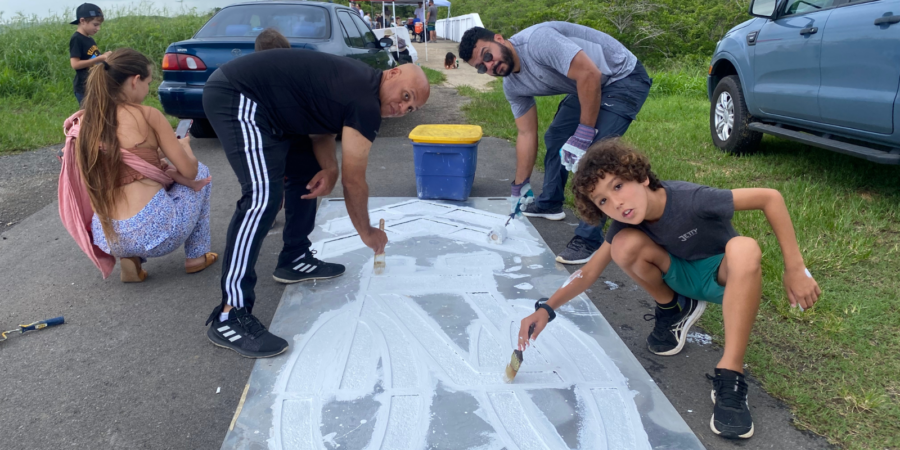
Tactical urbanism is part of the toolkit communities have to transform their streets, fostering innovation, awareness of pedestrians and micro-mobility on the road, and community belonging. Tactical urbanism revitalizes neglected spaces by empowering citizens to reshape their surroundings with small-scale, quick interventions. It cultivates a powerful civic pride, driving positive social change and sustainable development.At Plusurbia, we believe that tactical interventions can lead to long-term change. Establishing a long-term vision is critical before Tactical Urbanism interventions are considered. We work with our clients to create roadmaps that address communities' needs and create lasting change. Exercises such as mobility master planning, corridor studies, and comprehensive planning, are critical steps in generating the long term vision for mobility in any given city or township.Comprehensive and mobility planning are a careful balance between enhancing the existing public realm while anticipating future development needs. We combine best practices in complete streets design with local knowledge of network planning. As such, site visits and community outreach are core to the process of generating viable solutions that work for everyone. A successful study takes care to look beyond crash data analysis, towards travel patterns and safety audits to identify community needs that match community desires and support economic development.These planning strategies generate high-level recommendations, such as corridor selection and prioritization, necessary for the funding, design, and construction phases of projects. In addition, long-term visions are key to define objectives that lead to short-term implementations, such as pilot projects. This is where tactical urbanism is key, by creating projects that are implementable in a short period of time, which is key to demonstrate progress. This is why we are using tactical urbanism to advance the Borinquen Trail, an island-wide trail network for Puerto Rico.Tactical urbanism facilitates practitioners and governments, along with communities, to partner on advancing the implementation of soft treatments, such as pedestrian crosswalks, bicycle route symbols on pavements, and signage that will be the base for a future street improvements through reconstruction. Most of all, it is empowering to communities that wish to support safety advocacy efforts, and this empowerment leads to public policy success as communities adopt a culture of safe driving, rolling, and walking. As an added bonus, communities may adopt these tools as a means to continue the conversation beyond pilot projects, and these desires can be supported by governments through street improvement permitting and adopt-a-street initiatives.
Lake Wales Main Street was among winners of 2023 Florida Main Street Awards, which were announced during the Preservation on Main Street Conference in Ocala last week.Florida Main Street is a program administered by the Division of Historical Resources under the Florida Department of State, which currently oversees 57 communities throughout the state. By implementing the National Main Street Center's Four-Point Approach, Florida Main Street encourages economic development within the context of historic preservation through the revitalization of Florida's downtowns, cultural and heritage districts, which it describes as "the community's heart and soul."Lake Wales won a "Distinctive Preservation Award" in recognition of downtown mixed-use design standards in Category A. Those standards were recently adopted by the City of Lake Wales, and are intended to protect the historic designs of the downtown district while encouraging residential and new commercial uses that will reflect that history. The new standards were among recommendations contained in the Lake Wales Connected plan that have been adopted by the city commission.A variety of awards were given to programs across the state in recognition of individuals and projects ranging from single landmark building preservation to special events.Florida Secretary of State Cord Byrd was at the ceremony to present awards to this year's winners who achieved outstanding results in historic preservation and commercial activity through the Florida Main Street program."This year's winners have shown a remarkable commitment to preserving the distinct heritage, traditions, and culture that make their historic downtowns attractive places for commerce," said Secretary Byrd. "The Department of State is proud to showcase these success stories in the preservation and revitalization of Florida's historic downtowns."
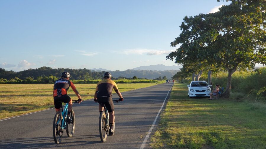
On Celebrate Trails Day (this Saturday, April 22), Rails-to-Trails Conservancy (RTC), the largest U.S.-based trails advocacy organization, showcases the impact of trails and trail systems on people, places and the planet by encouraging everyone to get outside on trails.Joining this year's celebration is the Borinquen Trail in Puerto Rico as part of its partnership with RTC. In addition, Borinquen Trail will collaborate with RTC on technical assistance initiatives and advocate for funding sources and best practices in trail implementation. Since 1992, RTC has helped advocate for more than $20 billion in funds to support more than 40,000 trail and active transportation projects throughout the nation.The Borinquen Trail is a 600-mile multi-use trail for walking and bicycling, endorsed by RTC. The trail repurposes former railroad right-of-way encircling the island, including breathtaking beachfront and historic tunnel segments. The route will connect 22 municipalities and, once fully implemented, could generate up to $673 million in annual user spending through direct, indirect, and induced economic effects. Adding to this sum will be the growth and creation of businesses associated with the outdoor recreation industry, including restaurants, sports equipment and bicycle rental establishments, history and tourism groups, hotels, and more. The trail could support between 4,708 and 7,294 jobs and is expected to spur an annual $21-41 million in new island and federal tax income.The implementation of the Borinquen Trail has already begun, a critical step in the island’s journey to a more sustainable environmental, and resilient future. Last month, planning for the Borinquen’s pilot project in Playa de Ponce (in the south of the island) was completed, and new local partners are joining to drive construction and designation of the trail. When finished, it will establish a multimodal connection between two historic centers: Playa de Ponce and the municipality’s town core.The Borinquen Trail has the potential to significantly increase tourism island-wide, create thousands of jobs, and improve public health across Puerto Rico. With the rail-trail already in motion, there is much to look forward to as its route unfolds over the coming years. To learn more and support this effort, visit https://www.rutaborinquen.org.Celebrate Trails Day is the annual celebration of the spring trail season, recognized on the fourth Saturday in April. The national celebration is organized by RTC, the largest U.S.-based trails organization—with a grassroots community more than 1 million strong. RTC is dedicated to building a nation connected by trails, reimagining public spaces to create safe ways for everyone to walk, bike and be active outdoors. Follow #CelebrateTrails on social media for updates, and connect with RTC at railstotrails.org and @railstotrails on Facebook, Twitter and Instagram.

INTERVIEW: Juan Mullerat
Date: 20230315
Can you share more about Plusurbia and the kinds of projects your team focuses on?
At Plusurbia, we focus on making cities better places to live and work by improving walkability, affordability, and context. Our projects range from creating walkable neighborhoods with a mix of housing types to creating inclusive public spaces that can be enjoyed by people of all ages and backgrounds. We also specialize in leveraging data to create targeted solutions for communities facing gentrification and displacement, such as developing tools to help assess the potential effects of development decisions on existing residents.Our firm has always balanced private, public, and pro-bono projects. We work for municipalities or the state, we work with private developers and property owners, and then, this is the exciting side of our studio: we get involved with non-profits or communities with limited or no budgets to help them improve their neighborhoods. We are currently involved in Ruta Borinquen, a not-for-profit effort to revitalize communities along a 426-mile stretch of the former railway in Puerto Rico. We are designing and implementing pocket parks in various neighborhoods, and we are working with some communities experiencing very aggressive displacement.Our team is committed to engaging local stakeholders throughout the planning and implementation process so that all voices are heard and community vision prevails. Ultimately, we aim to ensure that all communities become safe and accessible places with robust amenities and the tools to improve lives.
Gentrification and climate change are both at the forefront of planning. However, the combination of the two, climate gentrification, is still a fairly new term and a concept we're just now trying to wrap our minds around.
For our listeners, can you explain what climate gentrification means and give examples of how you've seen it play out in Miami or other cities?
The Next Miami: Article
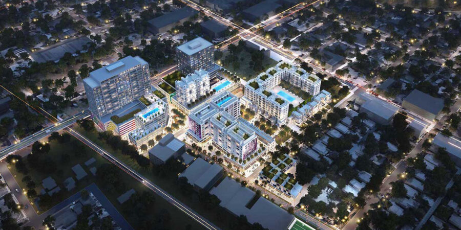
December 22, 2022Renderings have been released for Upland Park, a $1b transit-oriented development planned near the Dolphin Mall.
The development will be “the first truly viable alternative to automobile commuting,”. Upland Park is being purpose-built for integration with the upcoming east-west transit corridor, according to the developer. The community will have expedited access to major employment areas such as Miami International Airport, the Health District, Downtown and Brickell, the developer says. The project site itself is at the planned Dolphin rapid transit station. [caption id="attachment_27290" align="aligncenter" width="1290"] A rendering released by Miami-Dade County showing the BRT service planned on the east-west corridor of the SMART plan[/caption]Once inside the community, residents and workers will enjoy a master-planned walkable neighborhood with built-in traffic solutions, along with resiliency features. The goal is to also have a variety of residence sizes and price points within the neighborhood, catering to “all ages and audiences,” from students to seniors.
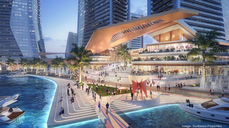
Sunbeam, controlled by the billionaire Ansin family and owner of TV station WSVN, won approval this month to build a massive walkable development in North Bay Village.As part of the approval, a construction permit must be applied for within two years.The project will include 7.3 million square feet, including 8-10 towers rising up to 650 feet, with:1,936 residential units (117 will be workforce housing units)
200,000 square foot Class A HQ office building
300-room luxury hotel with sky restaurant and observation deck (Hyatt signed a letter expressing interest in operating the hotel)
670,000 square feet of commercial, with grocery store, restaurants, entertainment, and retail
a small production studio
a state-of-the-art marina
5,000 parking spacesUniversity of Miami architecture students studied the property to help come up with a plan. The goal is to create a “15-minute city,” with essential needs within walking distance.A baywalk along the waterfront called Island Walk is planned. The developer also wants to build a pedestrian bridge across 79th street (the property spans both sides) and add a water taxi/ferry service.The developer told the SFBJ that the first phase will include two towers with 500 to 600 units, with ground floor grocery, restaurants and retail.Plusurbia is designing the project.
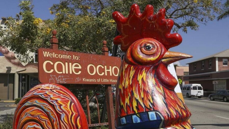
BY OMAR RODRÍGUEZ ORTIZ For the last six years, Florida’s transportation agency has been looking into upgrading Little Havana’s main street, Calle Ocho, to boost safety, encourage alternative transportation and open better access to the Brickell area. Among the enhancements considered, but not adopted, for Southwest Eighth and Seventh streets — two main arteries consisting of six one-way lanes connecting Little Havana and Brickell — are bus lanes, bike lanes and wider sidewalks. Instead, the conclusion of the $3 million study that began in 2016 is a plan to leave the majority of the corridor alone, while adding car-centric modifications near Interstate 95 pending further evaluation, Florida Department of Transportation officials revealed Tuesday at a public information meeting at Miami Dade College’s campus in Little Havana. Calle Ocho falls under the agency’s jurisdiction because it’s a state road.FDOT’s cars-first approach proposals include:▪ Widening the Interstate 95 southbound off-ramp at Southwest Seventh Street.▪ Providing an eastbound to northbound left turn at Southwest Eight Street and Second Avenue intersection.▪ Closing of Southwest Fourth Avenue at Seventh Street.▪ Conversion to two-way traffic at Southwest Fourth and Third avenues between Southwest Sixth and Seventh streets.But several Miami residents who attended the meeting told FDOT leaders they want bike lanes. Carolina Flores, a tour guide who lives in Little Havana, said that a protected bike lane would benefit residents and tourists who ride bicycles and electric scooters. “We should be promoting other modes of transportation,” Flores said.Eric Barton, who lives in Miami, said the plan proposed only looks to further the movement of cars while ignoring other forms of transportation, like bicycles with their own lanes.“This is a plan that perpetuates a mistake,” Barton said. “We have a neighborhood that was built on the backs of immigrants and we put a six-lane highway through the middle of it.” In a four-year span from September 2018 to Aug. 31, Miami police have responded to at least four fatal crashes in the studied area of Southwest Seventh Street, and none on Calle Ocho, according to preliminary police data. In the most recent crash, a woman crossing Southwest Seventh Street at Fifth Avenue on March 14 was struck and killed by a car.Miami City Commissioner Joe Carollo, who represents Calle Ocho and surrounding areas, told the Miami Herald on Wednesday that the city is looking into potential locations where multi-level parking structures could be built. He said the City Commission should receive a report before the end of the year. These parking lots, Carollo said, could allow the city to expand sidewalks by eliminating street parking along Calle Ocho between 12th and 18th avenues. But he said bike-only lanes wouldn’t be used enough to alleviate traffic in the area. “We aren’t China,” Carollo said in Spanish. “This bicycle thing is a nice fairy tale.”At the heart of the issue, according to planner Juan Mullerat, who lives near Calle Ocho, is FDOT’s authority to have a final say on any modifications in the corridor. He said the solution is for Miami to take control of Calle Ocho like in 2014 when the city took over a large portion of Brickell Avenue from FDOT. Officials were frustrated with the inability to lower the speed limit and cull overgrown brush and trees.Read more at: https://www.miamiherald.com/news/local/community/miami-dade/little-havana/article265102319.html#storylink=cpy
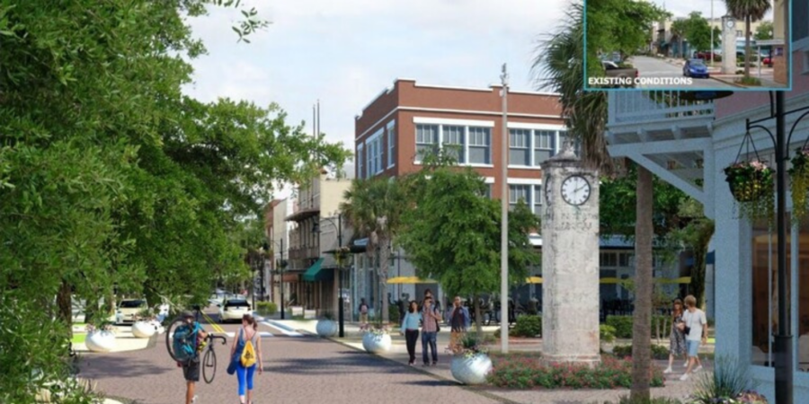
West Palm Beach will be moving in a new direction as developers begin executing on a plan to remake an industrial neighborhood north of Downtown into a food and retail hub. The district, rebranded “Nora,” spans 40 acres in the environs of North Railroad Avenue, and will include 2 million square feet of residential and office development, as well as a hotel.The redevelopment is being led by NDT Development and Place Projects, which spearheaded the reshaping of Miami’s Wynwood district. Urban planning firm PlusUrbia had a hand in creating the major design elements as Downtown expands. Wheelock Street Capital is financing the venture with a budget of up $150 million for the first phase alone, Bloomberg reported.
upstatebizSC: Article
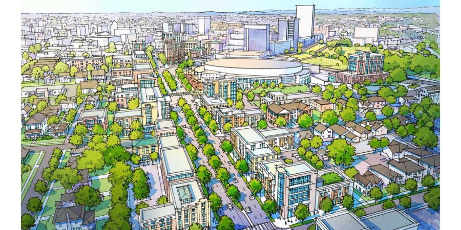
February 24, 2022Plusurbia, the Miami-based urban design group leading the Greenville Gateway master plan project, this week unveiled a reimagined gateway into downtown. Built on community input gathered over several days, the concepts include pedestrian-friendly pathways and greenspace, restaurants, entertainment, sports, and mixed-use developments.The plan was constructed around six key principles: connect, protect, calibrate, reinvest, enhance, and collaborate.The presentation followed four days of public charrettes and open studio hours, during which residents, elected officials, business leaders, and designers gathered to submit ideas. Plusurbia compiled the input into a set of initial concepts for the area that includes East North Street, the Bon Secours Wellness Arena, the Greenville County Law Enforcement Center, Lavinia Street, East Park Avenue, and the Pettigru Historic District.The project spearheaded by DOM360’s Robert and Jennifer Donovan collected 400 survey responses in addition to the input from the charrettes’ attendees.The designers from Plusurbia will continue to collect input from stakeholders via an online survey on the project website at GatewayGreenville.com. Over the next two months, the group will work closely with the city and county to ensure Plusurbia’s recommendations dovetail with the agencies’ current work.Plusurbia will provide recommendations to the City of Greenville by May with the goal of creating a report of stakeholders’ visions and desires for the area that can help guide decision-making for the Greenville Gateway’s future.
We use cookies
We use our own and third-party cookies to be able to correctly offer you all the functionalities of the website for analytical purposes. You can accept all cookies by clicking "Accept cookies", obtain more information in our
Website Policyor configure/reject their use by clicking on Settings".
Accept cookies
SettingsBasic cookie informationConfirm preferences
This website uses cookies and/or similar technologies that store and retrieve information when you browse. In general, these technologies can serve very different purposes, such as, for example, recognizing you as a user, obtaining information about your browsing habits or customizing the way in which the content is displayed. The specific uses we make of these technologies are described below. By default, all cookies are disabled, except for the technical ones, which are necessary for the website to work. If you wish to expand the information or exercise your data protection rights, you can consult our Website Policy.
Accept cookiesManage preferencesTechnical and/or necessary cookies
Always active
Technical cookies are those that facilitate user navigation and the use of the different options or services offered by the web such as identifying the session, allowing access to certain areas, filling in forms, storing language preferences, security, facilitating functionalities. (videos, social networks…).
Analytic Cookies
Analysis cookies are those used to carry out anonymous analysis of the behavior of web users and that allow user activity to be measured and navigation profiles to be created with the objective of improving websites.