our
news
AWARDS, ACCOLADES, PUBLICATIONS AND NEWS.
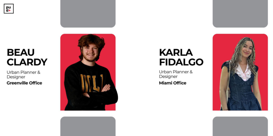
Plusurbia Design is pleased to announce that Karla Fidalgo and Beau Clardy have joined the firm as full-time Urban Planners & Designers. Both began their professional journeys with Plusurbia as interns and have now advanced into permanent roles within the team.Karla will be based in the Miami office, while Beau will work from the Greenville, South Carolina, office. Their transition reflects the firm’s continued commitment to developing emerging talent and strengthening multidisciplinary planning and design capacity across regions.At Plusurbia Design, growth is grounded in collaboration, curiosity, and a people-centered approach to design. Karla and Beau have consistently demonstrated these values through their work, contributing energy and dedication to projects focused on creating thriving, community-driven places.Their advancement marks an important milestone for the firm as Plusurbia continues to invest in professionals who help shape resilient, inclusive, and well-designed communities.
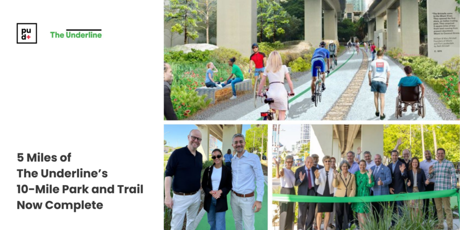
Proud to share that Friends of The Underline has recently reached a significant milestone, completing five miles of its 10-mile linear park and urban trail beneath Miami's Metrorail, connecting Brickell to Coconut Grove and Dadeland.
What began five years ago as a bold vision for how Miami could reclaim its public realm is now a living civic destination where mobility, recreation, culture, and community converge.
Plusurbia Principal and Founder Juan Mullerat, who serves on the Board of Directors of The Underline Conservancy, has been part of supporting this vision as it takes shape across Miami's neighborhoods. His work advancing walkable, connected, and inclusive urban environments reflects the same commitment that drives everything we do at Plusurbia: great places begin and end with people.
Five miles down. Five more to go.
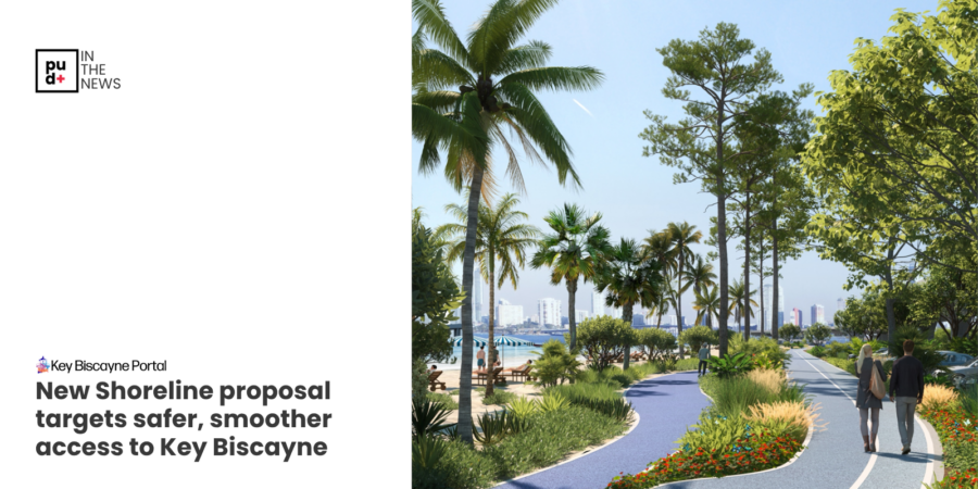
Plusurbia was recently featured in the Key Biscayne Portal in a piece covering the latest progress on The Shoreline, a proposed redesign of the Rickenbacker Causeway that would transform how people move to and from Key Biscayne.The article highlights several key concepts our team has been developing alongside HDR ENGINEERING and Friends of The Underline, including a split-level viaduct that separates fast-moving traffic from pedestrians and cyclists, 160% more beach space below, and improved access to destinations such as Virginia Key, Miami Marine Stadium, and MAST Academy.This project reflects exactly the kind of work Plusurbia was built to do. Complex, context-driven, and rooted in the belief that great infrastructure should serve people first. The Shoreline is not just a transportation solution. It is an opportunity to create a more connected, walkable, and resilient corridor for the tens of thousands of people who use the causeway every day.We believe that understanding a place and its context is critical in planning for the future. That means listening, analyzing, and designing with precision so that bold ideas can become implementable ones.The feasibility study is underway, and the conversation is just getting started.
Read the full article and follow the progress.
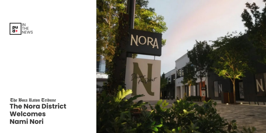
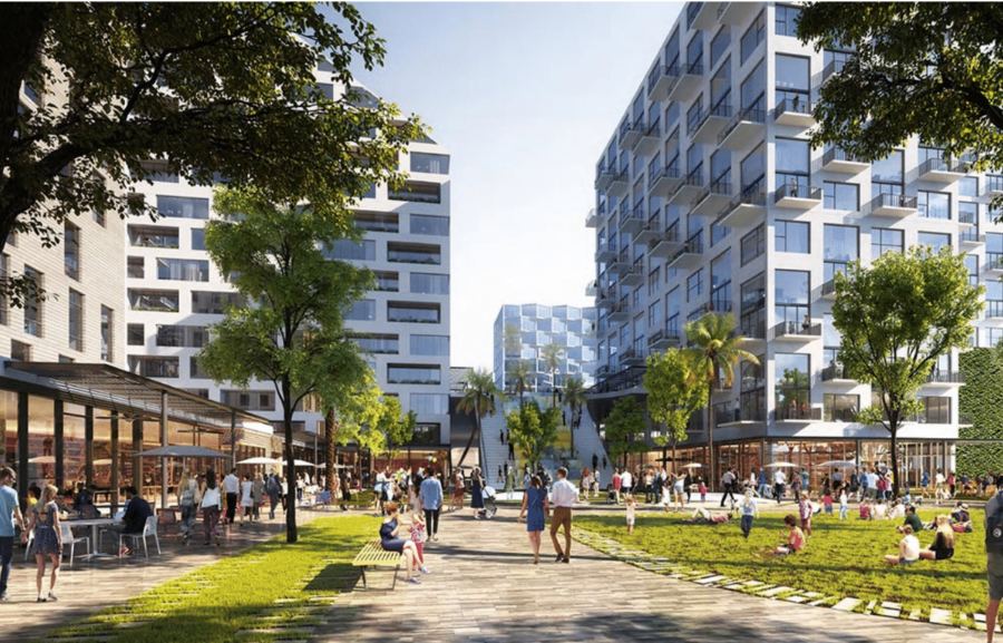
Plusurbia was recently featured in the Boca Raton Tribune in a piece spotlighting The Nora District. The article specifically references our role in shaping the master plan alongside the City of West Palm Beach.Districts like Nora don't happen by accident. They are the result of planning that begins with a deep understanding of place, its patterns of daily life, and its cultural context. When that foundation is in place, it creates the conditions for operators who are equally intentional about their concepts to want to be part of what the place can become.At Plusurbia, we believe the creation of great places begins and ends with people. That means listening and translating what we hear into environments where urban life can unfold naturally and where communities can genuinely thrive.Nora is a living example of what that process produces.
Read more: here
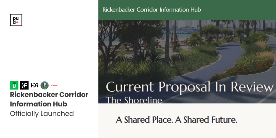
The Rickenbacker Causeway was designed to move traffic. Like most highways, it is defined by asphalt, speed, and capacity. But along Biscayne Bay, infrastructure also defines the health of the shoreline, and the quality of life for the people who use it.Today, the Causeway is more than a roadway. It is the primary connection to Virginia Key and Key Biscayne, and the front door to some of South Florida’s most important parks and coastal ecosystems. It carries vehicles, but it also shapes water flow, habitat continuity, and how people access, experience, and relate to the bay.The Shoreline concept asks a simple question: can infrastructure perform as both a mobility and green system, without compromise, and in a way that better serves people?By elevating through-traffic in strategic segments, it explores how the ground plane could be opened up, not by reducing lanes or capacity, but by reorganizing them. This creates room for restored shoreline conditions, native landscapes, stormwater absorption, and continuous public access along the water’s edge, while improving safety and connectivity for pedestrians and cyclists.This is not a typical highway project. It reframes infrastructure as part of a larger environmental system that supports ecology, resilience, and everyday public life.As part of this ongoing conversation, a new Rickenbacker Corridor Information Hub has been launched by the Key Biscayne Community Foundation, with support from the Knight Foundation, to provide a centralized resource on the corridor’s history, function, and future planning.This effort complements the feasibility study being conducted by Plusurbia Design, in collaboration with Friends of The Underline, exploring how the corridor can evolve as a more integrated system that supports mobility, ecology, and public life. The platform brings together key materials, timelines, and opportunities for public engagement as planning continues.Learn more at rickenbackercorridor.org
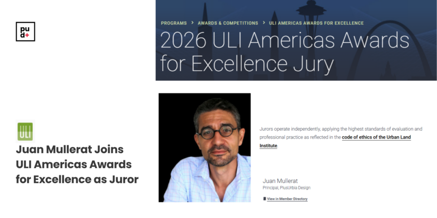
We’re proud to announce that Juan Mullerat, Founding Principal of Plusurbia Design, has been selected to serve as a juror for the Urban Land Institute Americas Awards for Excellence 2026.
ULI began the Awards for Excellence program in 1979 to recognize truly superior development efforts in the private, public, and nonprofit sectors. Winning projects represent the highest standards of achievement in the development industry—standards that ULI members deem worthy of attainment in their professional endeavors.
The jury brings together leaders from across the country to evaluate projects that are shaping how cities function and how they connect people, integrate nature, and respond to long-term social and environmental pressures.
A jury of ULI members chooses finalists and winners. Members of the jury are leaders who represent a broad geographic diversity and many areas of real estate and land use expertise, including finance, planning, development, public affairs, design, and professional services, among others.
In this role, Juan will help assess the ideas and approaches influencing the next generation of urban development, reflecting a broader shift toward more intentional and community-centered design.
His selection underscores Plusurbia’s continued focus on creating places that are grounded in context and designed to serve the communities around them.
We look forward to sharing perspectives from the process in the weeks ahead.Keep posted here.
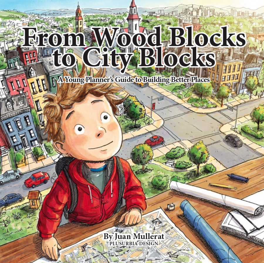
Cities shape children long before children understand what a city is.
They walk on sidewalks that may be cracked or smooth. They wait at bus stops without knowing why some have benches, and others do not. They cross streets designed by people they will never meet. These decisions influence their safety, independence, and sense of belonging long before they have the language to describe them.
Yet conversations about planning are usually reserved for professionals. By the time most people encounter zoning, infrastructure, or civic process, their assumptions about how places work are already formed.
We believe planning literacy should begin earlier. Planning is not only a professional practice. It is also a civic skill.
From Wood Blocks to City Blocks was created with that idea in mind. The book introduces young readers to the basic habits of good planning: observing, listening to others, identifying problems, and imagining practical improvements.
Over more than two decades of professional practice, our team has participated in charrettes, workshops, public meetings, and community engagement processes across many different settings. One pattern appears repeatedly. While public participation is encouraged, there are very few structured tools designed to involve children in meaningful ways. When children are included, their participation is often informal or symbolic. Yet children already experience the successes and failures of planning every day, often more directly than adults.
Yet children experience the public realm differently. They move at a different scale. They notice obstacles adults overlook. In workshops, they often point directly to problems in sidewalks, crossings, parks, and everyday infrastructure that professionals may have normalized.
For this reason, From Wood Blocks to City Blocks is not only a story, but it is also a practical engagement tool.
For planners. The book can support workshops, charrettes, and community engagement processes by providing activities that help children articulate what they observe and what they would change. For educators, it offers a framework for introducing civic responsibility, accessibility, and shared public space in language appropriate for younger audiences.
The story encourages children to observe closely, listen carefully, draw their ideas clearly, and begin with one small improvement. These habits mirror the fundamentals of responsible planning practice. Streets, parks, sidewalks, libraries, and schools are shared spaces. They belong to everyone. Understanding how cities work and how shared spaces can improve should not be limited to specialists or institutions.
For that reason, the digital edition of the book is offered freely. Planning knowledge should be accessible to the people who experience cities every day. It is shared under a Creative Commons license, allowing teachers, planners, educators, and community groups to use, print, share, and adapt it with attribution for non-commercial purposes. A low-cost print edition is also available for libraries, classrooms, workshops, and project teams that prefer a physical copy for public settings or community use.
Cities improve when more people are invited into the conversation. That invitation can begin early.
View the free digital edition, download the printable PDF, or order a print copy here.
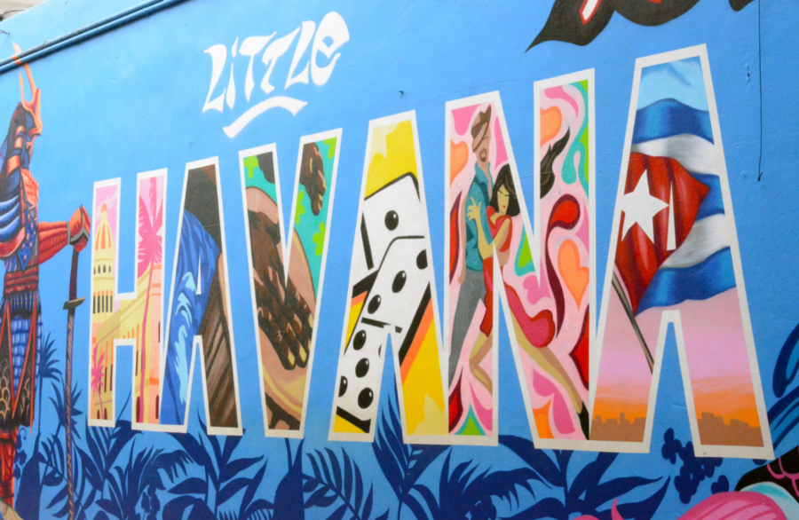
WLRN Public Media | By Sherrilyn CabreraPublished January 15, 2026 at 7:00 AM ESTCity leaders once lauded it as a bold vision for the future of one of Miami’s most famous streets and tourist destinations.When urban planning and design firm PlusUrbia unveiled its Calle Ocho Revitalization Plan in 2015, Miami city commissioners even went so far as to declare a day for the firm on Nov. 19 of that year. The plan laid out a reimagining of Little Havana’s SW 8th St — commonly known as Eighth Street or Calle Ocho, the Spanish translation — that aimed to bring a more pedestrian-friendly atmosphere.The vibrant cultural hub has been a bustling thoroughfare for decades, lined with shops, bars, and restaurants. It’s also home to renowned establishments like the historic Ball & Chain, Tower Theater, and the famous Domino Park — where mostly older Cuban residents gather to play dominoes while tourists watch. “Calle Ocho and Little Havana are the heart of Miami,” said Juan Mullerat, principal of PlusUrbia.The firm’s plan sought to build on that identity with a plan that visualized what Calle Ocho could look like — if cars did not dominate the wide, three-lane, one-way street. Instead, it would return the vibrant strip back into the two-way, two lane road it was before the late 1960s.The plan asks for expanded sidewalks, dedicated bike and bus lanes, and wider crosswalks that would be hard to miss. Instead of painted stripes on the road, a mural of giant dominoes would symbolize the crosswalks.“ By no means do we want to imply that Calle Ocho should be entirely pedestrian,” said Mullerat. “But if we're honest with ourselves … you experience great streets on foot. You don't experience them by car.”The plan got community input, too. Mullerat, along with Megan McLaughlin, PlusUrbia’s office director, spoke with residents and business owners about what they thought Calle Ocho needed.“All of our projects begin with community outreach, but also a lot of research into the culture and history of a community,” said McLaughlin. “What creates its DNA, what gives its identity?”“[The community is] continuing to advocate for greater walkability, safety,” she said. The firm also found that residents want to preserve the strip’s historic architecture.But since the introduction of the master plan a decade ago, the city has not picked up or signed off on any major changes to Little Havana’s Eighth Street.“ You always need a champion and you need that champion to stick with you for the longest possible period of time,” said Mullerat.Master plans for neighborhoods and cities, from idea to execution, take time, even decades. Meanwhile, politics tends to run in a four-year cycle. Urban planning and politics, Mullerat said, “are always at odds with each other.”
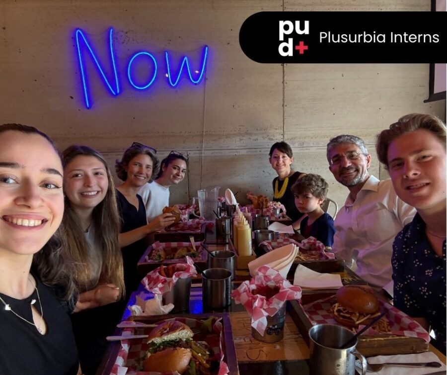
Plusurbia is thrilled to welcome a team of talented interns who will work alongside our staff on ongoing planning and urban design initiatives. They will take a hands-on role in project production and contribute to research and analysis, including our ongoing historic preservation work. Their involvement strengthens our team and underscores our commitment to forward-thinking, visionary planning and design.
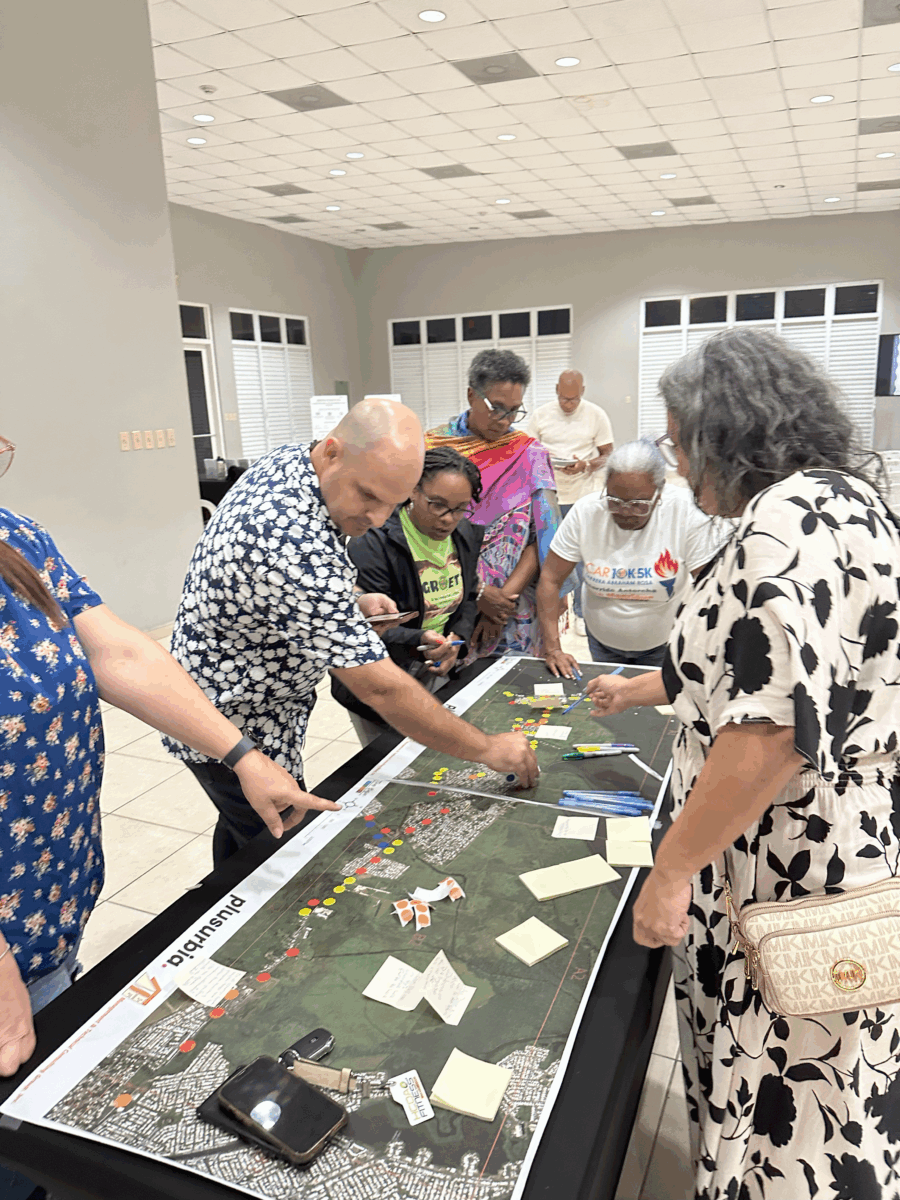
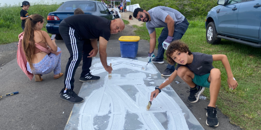
TOA BAJA, PR — August 2025 — Community Engagement in Full Swing! ❤️
Our team in Puerto Rico has successfully completed the first four community meetings as part of the Toa Baja Safety Action Plan—and the momentum continues to build. With four additional sessions planned, community engagement remains at the heart of this initiative.
We’re honored and inspired by the enthusiastic participation of residents and local stakeholders who are deeply committed to creating safer streets. Their insights, lived experiences, and thoughtful recommendations are shaping a plan that truly reflects the community’s priorities.These meetings represent a key step toward building a collaborative vision for safer, more accessible neighborhoods. At Plusurbia, we believe meaningful change begins with listening—and the voices of the community have been clear and impactful.Thank you to everyone who has taken part in the process so far. Your input is the foundation of this effort, and we’re excited to continue working together to create safer, more connected communities.Scroll down for highlights from the events![gallery size="medium" columns="2" link="file" ids="28647,28646,28645,28644,28638,28641,28642,28643"]

Miami's identity is etched in its past. A vibrant history that continues to shape the Magic City’s present and future.
This year, Plusurbia partnered with the Miami-Dade County's Office of Historic Preservation (OHP) to develop four interactive StoryMaps that bring the county’s vibrant history to life. Each StoryMap explores a unique chapter in Miami-Dade’s development, from agriculture and architecture to land development and preservation, illustrating how the past continues to influence the region’s culture, economy, and urban form.
These StoryMaps aim to make local history more accessible to residents, students, and visitors alike—inviting everyone to explore, learn, and connect with the stories of our shared past.
You can explore the StoryMaps directly via the links below:Historic Preservation in Miami-Dade County
Miami-Dade County’s Architectural LegacyThe History of Agriculture in Miami-Dade County
1920s Themed Developments in Miami-Dade CountyAs part of this effort, Plusurbia also worked with the County and local municipalities to create a Historic Resource Guide. The guide provides residents and property owners with a detailed overview of every locally designated historic site in Miami-Dade County and how preservation works at the local level.
You can view or download the Historic Resource Guide here: Miami-Dade Historic Resource Guide (PDF)
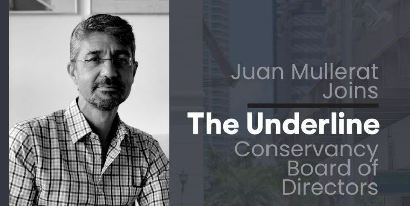
We are proud to share that Juan Mullerat, Principal and Founder of Plusurbia, has joined the Board of Directors of The Underline Conservancy.
The Underline is reshaping how Miami experiences public space, transit, and neighborhood connections. As a transformative urban project, it creates a linear park and civic destination that brings together mobility, recreation, and culture—making Miami a more connected and livable city.
Juan’s new role reflects Plusurbia’s dedication to contextual design, community engagement, and long-term planning. His experience in advancing resilient, walkable, and inclusive urban environments will help support The Underline’s continued growth as a civic space that strengthens neighborhoods and fosters connection across Miami.
On June 10, 2025, the Hialeah City Council unanimously adopted the Hialeah 2050 Master Plan, marking a major milestone for one of South Florida’s most vibrant and evolving cities. The planning process, coordinated by Plusurbia in collaboration with the city and partners, guided the development of this transformative, long-range vision.Built over nearly two years of collaboration and community engagement, the plan reflects the voices of residents, stakeholders, and local partners. Grounded in equity, connectivity, walkability, and economic opportunity, the Hialeah 2050 Master Plan provides a community-first roadmap to guide the city’s growth through 2050 while fostering neighborhood pride and enhancing the quality of life for all residents.We extend our gratitude to the City of Hialeah Municipal Government and to Debora Storch and Claudia Hasbun, AICP, for their leadership and trust throughout this process. We also thank our exceptional project team, including Urbe Studio, EXP, Corradino, and CÚRE & PENABAD, whose expertise helped bring this vision to life.Finally, thank you to all residents, stakeholders, and partners who contributed their voices, ideas, and energy to shape this plan. Together, we are building Hialeah’s future.Explore the full plan at: www.hialeah2050.com

Are you passionate about shaping resilient, vibrant communities? Do you believe in the power of innovative, context-driven design? Plusurbia Design is looking for a creative Urban Designer to join our dynamic team.Position: Urban DesignerLocation: Miami, FLType: Full-TimeResponsibilities:Develop innovative urban design solutions for diverse projects, including master plans, community development, and public space design.
Collaborate with interdisciplinary teams to integrate planning, architecture, and landscape architecture into cohesive urban designs.
Conduct site analyses, conceptual design, and detailed design work, ensuring alignment with project goals and Plusurbia's philosophy.
Engage with communities and stakeholders to gather insights and incorporate feedback into design processes.
Prepare and present design proposals, reports, and visualizations to clients and public agencies.
Stay updated on urban design trends, zoning regulations, and sustainable practices to bring fresh ideas to projects.Required Qualifications and Skills:Bachelor’s degree in Architecture, Urban Design, or related field.
Strong portfolio demonstrating experience with urban design projects, including master plans, public spaces, and community developments.
Proficiency in design software such as AutoCAD, Adobe Creative Suite, Lumion, SketchUp, and GIS.
Excellent verbal, written, and graphic communication skills, with the ability to articulate design concepts clearly.
A passion for sustainable, resilient, and community-oriented design.
Self-motivated with good time management skills.Why Plusurbia Design?Plusurbia Design is an award-winning urban planning and design firm dedicated to creating inclusive, sustainable, and context-sensitive urban spaces. We work closely with communities, stakeholders, and local governments to deliver projects that enhance the quality of life and reflect the unique DNA of each place we touch. Our approach is rooted in the principles of placemaking, community engagement, and sustainable development.Be part of a growing, forward-thinking firm that values creativity, sustainability, and community impact.
Work on transformative projects that make a real difference in urban environments, from Regional Comprehensive plans to neighborhood and district revitalization and design.
Collaborate with a talented and passionate team in a supportive, innovative work environment.
Enjoy opportunities for professional growth and career advancement.Salary and Benefits:Salary – commensurate with experience and competitive in the marketplace.
401K ‘Elective Safe Harbor’ – Up to 3% of salary.
End-of-year performance-based bonus.
Benefits include personal days off, holidays, individual medical, dental, and vision insurance, and short—and long-term disability insurance.How to Apply:We'd love to hear from you if you're ready to contribute to meaningful urban design projects and grow with a leading firm!Send your resume, portfolio, and cover letter detailing your experience and why you’re a great fit for Plusurbia Design to careers@plusurbia.com.Applications that don't meet the requirements will be dismissed. Format the email with the subject line ‘Urban Designer Position.’
Portfolio, Resume, & Cover Letter must be in PDF format attached to the email. Deadline: Applications will be accepted until September 25th, 2024.Plusurbia Design is an equal-opportunity employer. We celebrate diversity and are committed to creating an inclusive environment for all employees.Join us in shaping the cities of tomorrow—today!
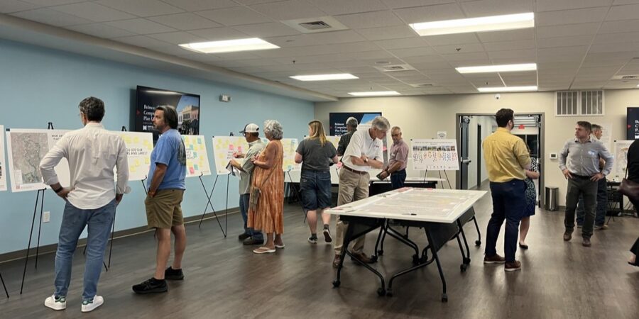
Belmont, NC–Plusurbia is thrilled to announce the completion of a successful multi-month public engagement campaign in the City of Belmont. Featuring eight community workshops, informative presentations, Q&A, small group meetings and an online survey, the initiative provided essential guidance for the city’s Comprehensive Land Use Plan update.Altogether, our team received nearly 1,600 comments on Belmont’s opportunities, challenges and aspirations, far exceeding community involvement during the last plan update in 2018. We also invested over two weeks of in-person time, talking with community stakeholders and getting to know Belmont, foraging a deeper connection with residents, business owners and community leaders.
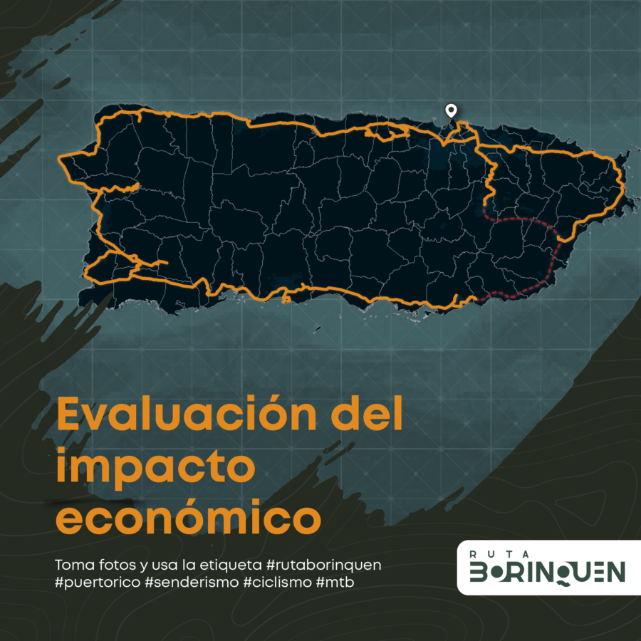
The Puerto Rican government is making strides in preserving its rich rail heritage with the introduction of House Bill (PC 2141). Filed by five representatives, this bill seeks to enshrine the preservation of 19th and 20th-century railroad routes as public policy. It also directs government entities to create a non-motorized transportation route for historical, cultural, and ecological tourism, proposing the development of the Borinquen Trail.Historical SignificancePC 2141 highlights that by the late 19th century, Puerto Rico boasted approximately 1,000 kilometers of railroads, positioning it as one of the regions with the most extensive railroad networks per square kilometer. These railroads were integral to the island’s development and historical landscape.Efforts by Plusurbia DesignPlusurbia Design has been working to preserve this legacy since 2018. The Borinquen Trail encompasses a 426-mile corridor aimed at safeguarding the historical importance of Puerto Rico’s old train tracks. This initiative seeks to enhance the island’s cultural heritage, support sustainable tourism, and engage the community.The Borinquen Trail: A Vision for the FutureThe Borinquen Trail will feature a multimodal ecological route designed for biking and pedestrian use, traversing the Puerto Rican archipelago. It will link various natural, historical, cultural, tourist, and gastronomic attractions along the old rail routes. This pioneering project promotes health, stimulates economic and tourist activity, and fosters a vibrant cycling and pedestrian community, all while preserving and celebrating Puerto Rico’s natural, historical, and cultural heritage.
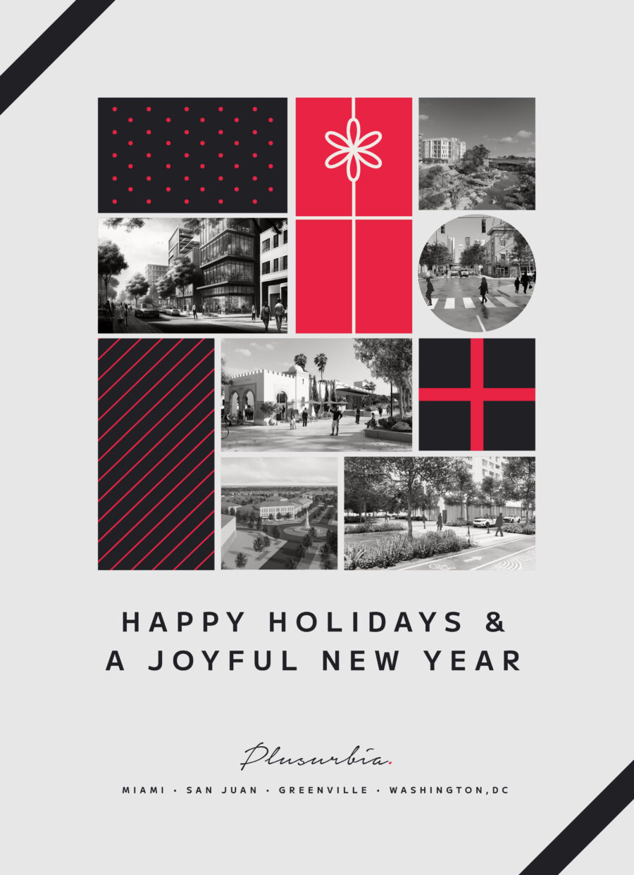
This year has seen the birth of new connections, the strengthening of communities, and the laying of foundations for more resilient cities. Together, we've embarked on innovative projects that have not only shaped our path but have also contributed to the positive transformation of the spaces we touch. [video width="1920" height="1080" mp4="https://plusurbia.com/wp-content/uploads/2023/12/20231214-PUD-Holiday-Card-Photocard.mp4"][/video] We extend our heartfelt gratitude for your collaboration, support, and shared commitment to building a better future. May the holiday season bring you joy, peace, and moments of well-deserved rest.
Wishing you and your loved ones a festive holiday season and a prosperous New Year!
Tactical urbanism is part of the toolkit communities have to transform their streets, fostering innovation, awareness of pedestrians and micro-mobility on the road, and community belonging. Tactical urbanism revitalizes neglected spaces by empowering citizens to reshape their surroundings with small-scale, quick interventions. It cultivates a powerful civic pride, driving positive social change and sustainable development.At Plusurbia, we believe that tactical interventions can lead to long-term change. Establishing a long-term vision is critical before Tactical Urbanism interventions are considered. We work with our clients to create roadmaps that address communities' needs and create lasting change. Exercises such as mobility master planning, corridor studies, and comprehensive planning, are critical steps in generating the long term vision for mobility in any given city or township.Comprehensive and mobility planning are a careful balance between enhancing the existing public realm while anticipating future development needs. We combine best practices in complete streets design with local knowledge of network planning. As such, site visits and community outreach are core to the process of generating viable solutions that work for everyone. A successful study takes care to look beyond crash data analysis, towards travel patterns and safety audits to identify community needs that match community desires and support economic development.These planning strategies generate high-level recommendations, such as corridor selection and prioritization, necessary for the funding, design, and construction phases of projects. In addition, long-term visions are key to define objectives that lead to short-term implementations, such as pilot projects. This is where tactical urbanism is key, by creating projects that are implementable in a short period of time, which is key to demonstrate progress. This is why we are using tactical urbanism to advance the Borinquen Trail, an island-wide trail network for Puerto Rico.Tactical urbanism facilitates practitioners and governments, along with communities, to partner on advancing the implementation of soft treatments, such as pedestrian crosswalks, bicycle route symbols on pavements, and signage that will be the base for a future street improvements through reconstruction. Most of all, it is empowering to communities that wish to support safety advocacy efforts, and this empowerment leads to public policy success as communities adopt a culture of safe driving, rolling, and walking. As an added bonus, communities may adopt these tools as a means to continue the conversation beyond pilot projects, and these desires can be supported by governments through street improvement permitting and adopt-a-street initiatives.
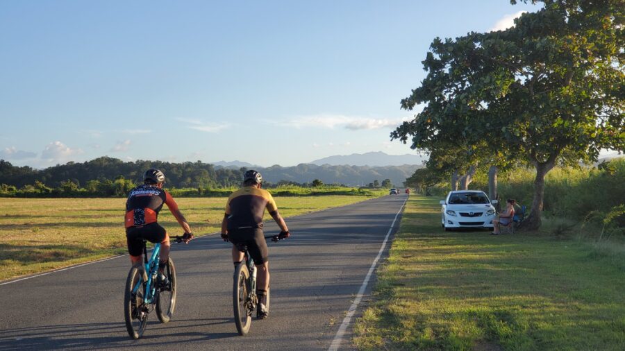
On Celebrate Trails Day (this Saturday, April 22), Rails-to-Trails Conservancy (RTC), the largest U.S.-based trails advocacy organization, showcases the impact of trails and trail systems on people, places and the planet by encouraging everyone to get outside on trails.Joining this year's celebration is the Borinquen Trail in Puerto Rico as part of its partnership with RTC. In addition, Borinquen Trail will collaborate with RTC on technical assistance initiatives and advocate for funding sources and best practices in trail implementation. Since 1992, RTC has helped advocate for more than $20 billion in funds to support more than 40,000 trail and active transportation projects throughout the nation.The Borinquen Trail is a 600-mile multi-use trail for walking and bicycling, endorsed by RTC. The trail repurposes former railroad right-of-way encircling the island, including breathtaking beachfront and historic tunnel segments. The route will connect 22 municipalities and, once fully implemented, could generate up to $673 million in annual user spending through direct, indirect, and induced economic effects. Adding to this sum will be the growth and creation of businesses associated with the outdoor recreation industry, including restaurants, sports equipment and bicycle rental establishments, history and tourism groups, hotels, and more. The trail could support between 4,708 and 7,294 jobs and is expected to spur an annual $21-41 million in new island and federal tax income.The implementation of the Borinquen Trail has already begun, a critical step in the island’s journey to a more sustainable environmental, and resilient future. Last month, planning for the Borinquen’s pilot project in Playa de Ponce (in the south of the island) was completed, and new local partners are joining to drive construction and designation of the trail. When finished, it will establish a multimodal connection between two historic centers: Playa de Ponce and the municipality’s town core.The Borinquen Trail has the potential to significantly increase tourism island-wide, create thousands of jobs, and improve public health across Puerto Rico. With the rail-trail already in motion, there is much to look forward to as its route unfolds over the coming years. To learn more and support this effort, visit https://www.rutaborinquen.org.Celebrate Trails Day is the annual celebration of the spring trail season, recognized on the fourth Saturday in April. The national celebration is organized by RTC, the largest U.S.-based trails organization—with a grassroots community more than 1 million strong. RTC is dedicated to building a nation connected by trails, reimagining public spaces to create safe ways for everyone to walk, bike and be active outdoors. Follow #CelebrateTrails on social media for updates, and connect with RTC at railstotrails.org and @railstotrails on Facebook, Twitter and Instagram.
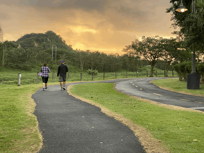
Last January, our team collected information for an ongoing economic impact analysis of the trail, which will provide hard numbers to prove its value. Dylan Gehring and David Soto visited existing trail segments that will one day be connected and integrated into the future 595 mile Borinquen Trail. They ran trail counts every day during peak-use times and collected trail user spending data by conducting brief surveys. They also examined portions of the old railroad embankments and bridge systems that are not currently trails. Among the trails surveyed, Paseo Lineal Río Bayamón proved to be the most popular and highest-quality segment.Dylan and David conducted seven days of consecutive data collection across five trails (2 trail segments were repeated to determine the factor of difference between weekdays and weekends) which garnered about 550 responses. The selection of the trails studied was tied to the necessity of having an example of each typology: urban, suburban, rural, beachfront, and natural preserve. This data will be used for an economic impact analysis and to continue to assess and design future segments of the Borinquen Trail.
The Next Miami: Article
December 22, 2022Renderings have been released for Upland Park, a $1b transit-oriented development planned near the Dolphin Mall.
The development will be “the first truly viable alternative to automobile commuting,”. Upland Park is being purpose-built for integration with the upcoming east-west transit corridor, according to the developer. The community will have expedited access to major employment areas such as Miami International Airport, the Health District, Downtown and Brickell, the developer says. The project site itself is at the planned Dolphin rapid transit station. [caption id="attachment_27290" align="aligncenter" width="1290"] A rendering released by Miami-Dade County showing the BRT service planned on the east-west corridor of the SMART plan[/caption]Once inside the community, residents and workers will enjoy a master-planned walkable neighborhood with built-in traffic solutions, along with resiliency features. The goal is to also have a variety of residence sizes and price points within the neighborhood, catering to “all ages and audiences,” from students to seniors.
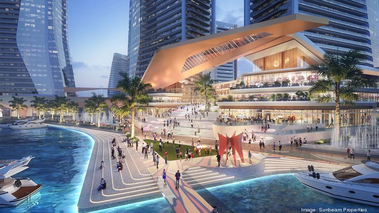
Sunbeam, controlled by the billionaire Ansin family and owner of TV station WSVN, won approval this month to build a massive walkable development in North Bay Village.As part of the approval, a construction permit must be applied for within two years.The project will include 7.3 million square feet, including 8-10 towers rising up to 650 feet, with:1,936 residential units (117 will be workforce housing units)
200,000 square foot Class A HQ office building
300-room luxury hotel with sky restaurant and observation deck (Hyatt signed a letter expressing interest in operating the hotel)
670,000 square feet of commercial, with grocery store, restaurants, entertainment, and retail
a small production studio
a state-of-the-art marina
5,000 parking spacesUniversity of Miami architecture students studied the property to help come up with a plan. The goal is to create a “15-minute city,” with essential needs within walking distance.A baywalk along the waterfront called Island Walk is planned. The developer also wants to build a pedestrian bridge across 79th street (the property spans both sides) and add a water taxi/ferry service.The developer told the SFBJ that the first phase will include two towers with 500 to 600 units, with ground floor grocery, restaurants and retail.Plusurbia is designing the project.
West Palm Beach will be moving in a new direction as developers begin executing on a plan to remake an industrial neighborhood north of Downtown into a food and retail hub. The district, rebranded “Nora,” spans 40 acres in the environs of North Railroad Avenue, and will include 2 million square feet of residential and office development, as well as a hotel.The redevelopment is being led by NDT Development and Place Projects, which spearheaded the reshaping of Miami’s Wynwood district. Urban planning firm PlusUrbia had a hand in creating the major design elements as Downtown expands. Wheelock Street Capital is financing the venture with a budget of up $150 million for the first phase alone, Bloomberg reported.
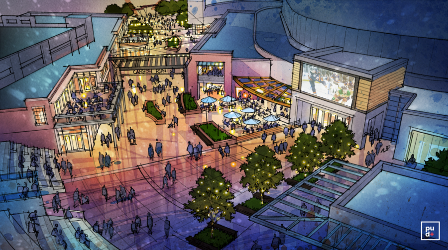
Urban planning group Plusurbia Design revealed what the future of the Greenville Gateway could become on Tues., Oct. 18.After a series of community meetings and a survey earlier this year (which received 479 responses), the urban design group designed a future look for specific areas of the corridor, including:Bon Secours Wellness Arena
East North Street (at the end of I-385 + continuing past The Well)
Pettigru Historic DistrictSome of the most notable changes proposed include transforming East North Street with trees, bike lanes + additional apartments and shifting Bon Secours Wellness Arena’s entrance into a pedestrian-friendly entertainment hub with restaurants and outdoor space.The project, initiated by the owners of local automotive marketing agency DOM360, focuses on a specific corridor of Greenville between these streets:North Church Street
East Washington Street
Atlas Street
Sunflower Street
Richland WayFamiliar places in this area include Bon Secours Wellness Arena, Greenville’s Law Enforcement Center, and the Pettigru Historic District.Plusurbia Design will help develop and implement this vision with private + public funding, and with input from community leaders, organizations, and you.
It fills us with pride to have been outlined as experts in cyclist mobility in Ciclosfera Magazine. Biggest thanks to Muévete en Bici Puerto Rico and the cyclist community for continuing to elevate our archipelago's presence as a cycling-tourism destination at the global forum..Read the article here: https://www.ciclosfera.com/…/ciclosfera-31-invierno-2019-2…/
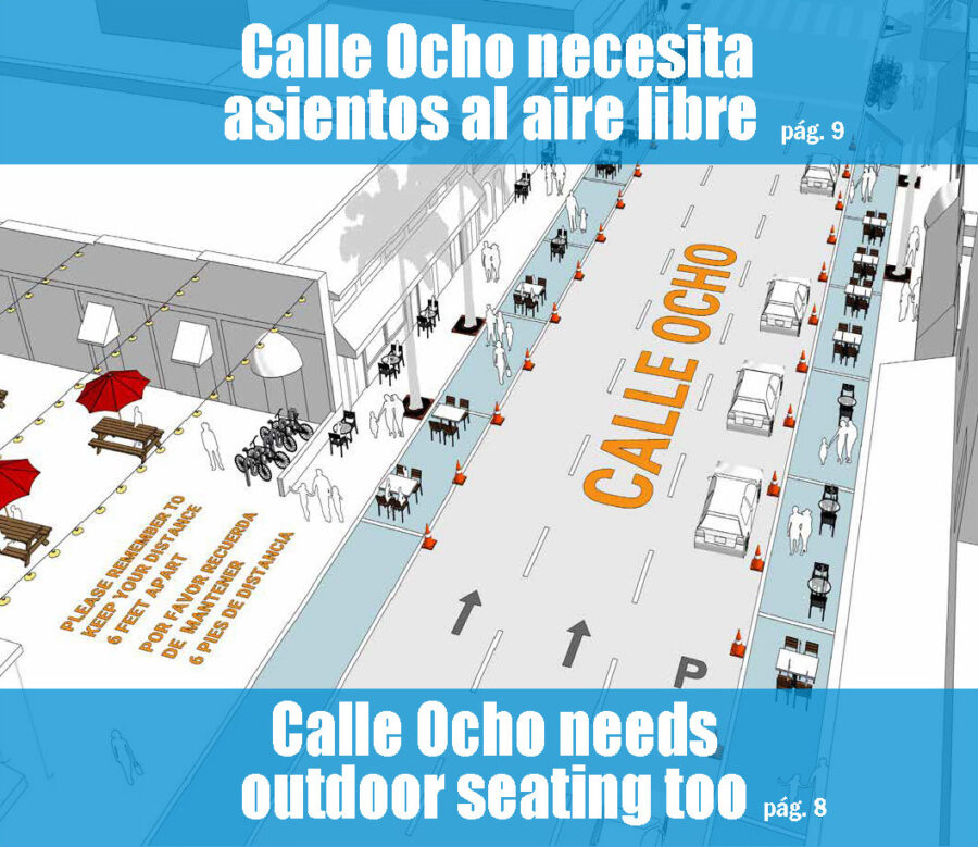
Calle Ocho risks losing many businesses if the government does not allow for expanded outdoor seating by using parking lanes and closing streets.Brianna LopezJuly 8, 2020Little Havana business owners are finding themselves at an extreme loss of business as the COVID-19 pandemic continues for longer than anyone expected it to. For months, Calle Ocho has been clear of the tourists and visitors that would usually flood the streets because of the mandated shutdowns of many businesses, in addition to the closure of dining rooms in restaurants. Businesses have suffered tremendous losses because of the lack of foot traffic on the Calle Ocho strip.Calle Ocho is a South Florida pillar that thrives on tourism, travel, and restaurants. Many of the restaurants are family-owned, run by generations of families who began their journey to Miami when they immigrated from Cuba in the 1960s. These people know what it is like to start from nothing and have worked all of their lives to build their businesses, pouring blood, sweat, and tears into the restaurants and shops that tourists love to visit.To read the complete article, please click here.
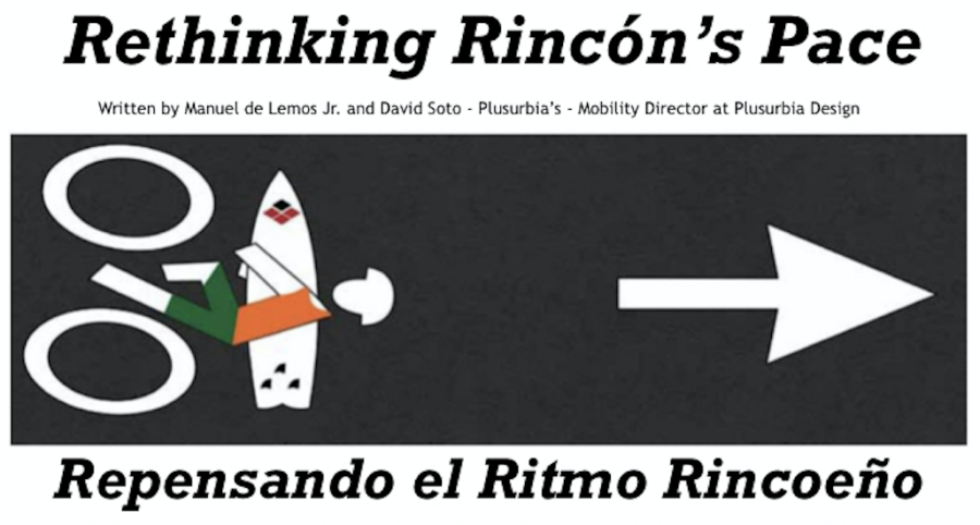
Plusurbia's Manuel de Lemos and David Soto authored a piece regarding the high traffic volumes and speeds in Rincón, Puerto Rico, for El Coquí of Rincón Magazine. The article, "Rethinking Rincón's Pace," calls for rethinking mobility in Rincón. It advocates for proper investments in multimodal streets and emphasizes a community's need for access to safe streets, free from the risk of transit at dangerous speeds, and with universal access to people of all ages and abilities.Unfortunately, the need to mitigate the danger from speeding vehicles was highlighted when a tragic accident occurred in the area on June 10, 2020, in which one person died when a conductor lost control of their vehicle and crashed into an eating establishment where the victim was seated.Please follow the links below to access the news articles about the incident:El Vocero Puerto RicoTelemundo Puerto RicoBelow, the article published in El Coquí of Rincón magazine:

A healthy city calibrates and makes room for mobility changes on their streets over time to encourage low-tech safe and accessible options to move around. It needs to provide more balanced mobility options by reconsidering the amount of space for cars, pedestrians, bicycles, and transit - accommodating new technologies and trends.
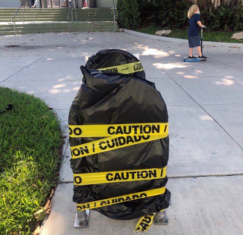
Magic City mobility leaders are questioning the city's response to active transportation during the pandemic.By Marcia Duprat | May 19, 2020[caption id="attachment_4010" align="alignnone" width="800"] Bike racks were made inaccessible in parks across Miami in an ill-advised response to the COVID-19 pandemic. Source: Marcia Duprat[/caption]It started with the closing of bike shops.Early in the COVID-19 pandemic, Miami-Dade County’s COVID-19 shutdown deemed auto supply and repair shops essential — but forced the closure of bike shops. It set the stage for what has become an ongoing string of questionable policy decisions — decisions that, over time, have cemented an image of Miami as a place where car ownership affords you protection, while using greener, more socially responsible modes of transportation, like bicycles, puts you at a disadvantage.With traffic at an all-time low, we have been afforded a brief vision of a Miami without cars, forcing us to reconsider our relationship with our hostile streets. Miamians are embracing a new normal where walking and biking is safer than usual. Moreover, with public transportation undergoing service reductions and experiencing crowding, bikes are a far safer option for many of the 90,000 households in the county who do not own a car.Yet, the local government’s response to the crisis has unfortunately discouraged cycling as a solution.Parks recently reopened with an unusual caveat: while parking lots remain open, the use of bike racks is prohibited. Most U.S. cities are doing exactly the opposite, banning car parking as a measure to control crowding, thereby making parks available to neighboring residents within walking and biking distance. Miami Beach was forced to learn this the hard way when it had to close one of its most iconic parks, South Pointe, less than a week after reopening.Miami-Dade is also the only county nationwide to ban both shared bikes and shared scooters. Meanwhile, in cities from Tampa to Los Angeles, scooter- and bike-sharing companies have been offering free and low-cost trips to essential workers, taking steps to increase the frequency of sanitation, and adapting their service boundaries to be centered around the areas with the most urgent transportation needs, such as medical centers. Instead of deploying a variety of modes of transportation as a way to ease mobility during the crisis, our local government has continued the ban, putting those without a vehicle at a disadvantage.Our most vulnerable residents often face the severest effects of these policies. Until recently, food distribution occurred exclusively in drive-through settings. All current coronavirus testing sites except two still require a car. At a time when residents are facing grave economic consequences, policymakers continue to send a clear signal: keep your car payment.For decades Miami-Dade County has been overrun by policymaking that puts cars above every other mode of sustainable transportation. With traffic at an all-time low, now is the perfect opportunity to create safer streets for pedestrians and cyclists and a more sustainable future. Cities nationwide have been adapting their streets to accommodate social distancing, dedicate more space to outdoor restaurant seating, and expedite infrastructure projects such as wider sidewalks and new bike and bus lanes. But Miami is lagging behind or entirely absent from these trends, and car-focused road construction projects are being expedited. If this continues, the city is set to emerge from this crisis more car-dependent than before.The stakes are high – and human. Restaurant workers returning to their jobs on bicycles. Nurses relying on transit after 12-hour shifts. Communities where park space is already lacking, locked in by dangerous streets. Our actions as we recover from this crisis can shape the city we want to move towards. In ordinary times, we strive for mobility to be the great equalizer – granting access to opportunities that can change people’s lives for the better. Amidst this crisis, we have to ensure the opposite doesn’t happen – that communities that have been left behind are connected, literally, to our recovery efforts with new pedestrian, cycling, and transit efforts.Elected leaders and administrators need to take a hard look at how cities have adapted with policies that foster a present and a future where bicycling and safer, sustainable mobility is part of the solution – rather than the problem.This article is authored by. Marcia Duprat is the Campaign Manager at Transit Alliance, a non-profit advocating for walkable streets, bikeable neighborhoods, and better public transit in Miami-Dade County. It is co-signed by the following: The League of American Bicyclists, Bill NesperBike Coconut Grove, Hank ResnickBike SoMi, Maricé ChaelDover, Kohl & Partners, Victor DoverKittelson & Associates, Fabian De La EspriellaPlusurbia Design, Juan MulleratPlease click here to view the full article online.

ACCESSORY DWELLING UNITS IN A TIME OF PANDEMICSAn accessory dwelling unit (ADU) on your property can serve as housing for front line staff and medical professionals who can't go home during this crisis. If you own an ADU, reach out and help!PEOPLE STREETSLimiting the circulation of cars enables the creation of “people streets” for essential workers and grocery shoppers to accomplish their daily needs while maintaining social distancing #OpenStreets HAPPY EARTH DAYHappy Earth Day! Air pollution has already decreased due to less vehicle use during this crisis. Let's work together and redesign our cities to keep this going! #earthdayeverydayVideo possible with Google EarthURBANISM AND THE IMPACTS OF CORONAVIRUSBUILD PARKLETS. SAVE OUR RESTAURANTS.EXTENDING SIDEWALKS FOR OUTDOOR SEATING[video width="720" height="404" mp4="https://plusurbia.com/wp-content/uploadsold/2020/04/20200521-Extending-Sidewalks-Plusurbia-sm.mp4"][/video] WORLD BICYCLE DAYLet's continue to promote the use of bicycles to improve the environment and our physical and mental health. All places should build the necessary infrastructure to ensure people are safe when riding a bike. #TransformMobility #WorldBicycleDayADAPTING FOR COVID19: EMBRACING MIAMI'S VENTANITAS + PARKLETS!

Plusurbia's Andrew Georgiadis was featured recently in an episode of Preferred Shore Real Estate podcast. The podcast features conversations about real estate. The owner of the podcast, Robert Milligan, interviews productive relators, lenders, attorneys and other service providers in order to offer tips to help people succeed in their careers. This episode is an interview with Andrew Georgiadis, who is trained as an architect and has devoted his life's work to urban design.Listen to the episode here!
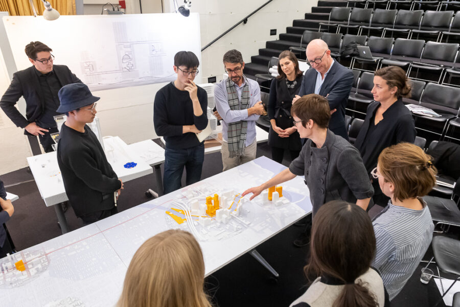
Plusurbia's Juan Mullerat was invited to participate as a juror for the final project review for a class taught by Eric Howeler and Corey Zehngebot at the Harvard Graduate School of Design. The final projects focused on architecture and urbanism in Miami and addressed a broad range of topics that generated important conversations and solutions to the pressing issues the city is currently facing. The topics included housing, mobility, typology, community development, ecosystems, the public realm, climate adaptive architecture, immigration and assimilation, health care, and tourism.Below are pictures of the review by Justin Knight (@jakphotojustin):
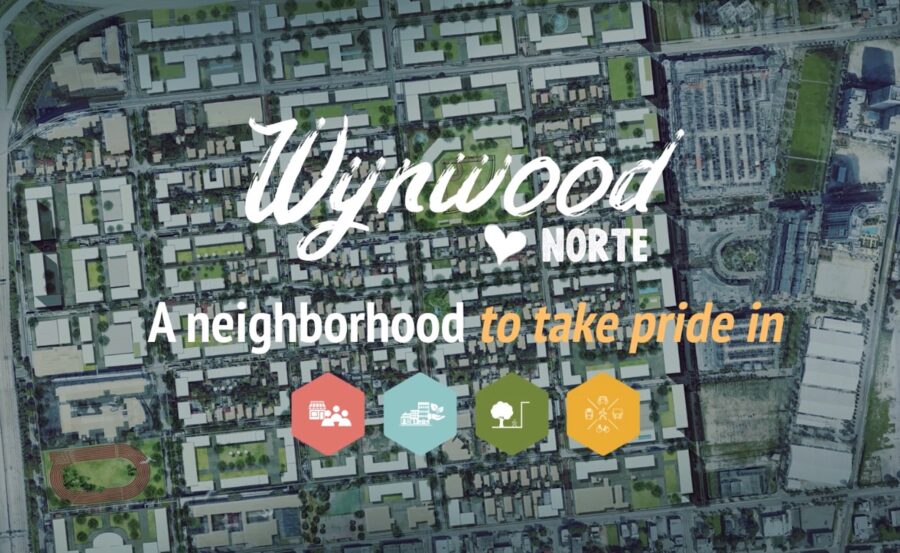
Plusurbia is excited to be a part of the team that worked on the community-led Master Planning effort for Wynwood Norte, the results of which were presented at a well-attended community meeting at Roberto Clemente Park on Thursday, September 19. Residents and community members gathered to see the outcome after months of working together to create a vision for the future of the neighborhood.To learn more about this project, please follow the link below:Wynwood Norte Community Vision Plan Members of the Wynwood Community Enhancement Association (WynwoodCEA) with Steven Wernick and members of the Plusurbia team. Commissioner Keon Hardemon speaks at the community meeting for the Wynwood Norte Community Vision Plan.Images of Roberto Clemente Park, one of the special places within the Wynwood Norte neighborhood.
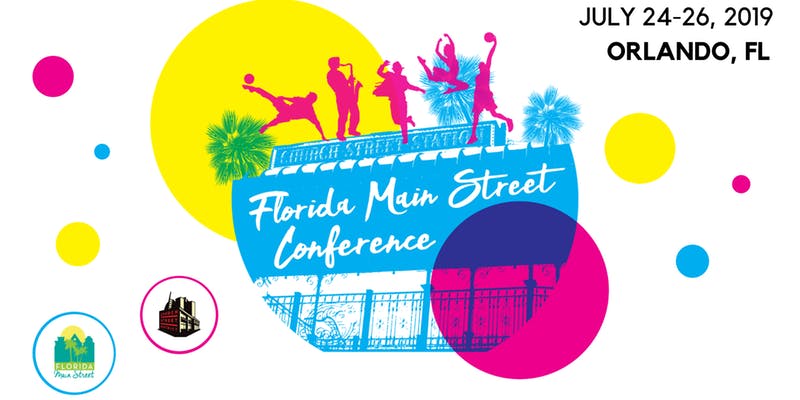
PlusUrbia's Megan McLaughlin is presenting at the Florida Main Street Annual Conference, held in Orlando, Florida on July 24-26.Megan's presentation, "New Buildings With Old Character," focuses on promoting urban infill on Main Street that is compatible with beautiful historic buildings. As a historic preservation expert, Megan will share effective tools for protecting historic districts from out of scale redevelopment. Megan's previous work at the City of Coral Gables in the North Ponce Neighborhood Conservation District and current work at PlusUrbia on the Little Havana Me Importa Revitalization Plan allows her to share a unique perspective, expertise, and new ideas, such as creating a strategic partnership with the National Trust for Historic Preservation how to adapt incentives to promote preservation in a key neighborhood.Megan McLaughlin is a certified planner, urban designer and preservationist who has over 15 years of experience. She is the preservation planning leader for PlusUrbia Design and has served as City of Miami Preservation Officer and as City of Coral Gables City Planner. McLaughlin has extensive experience in policy, code and guiding appropriate urban infill development for historic downtown/main street districts.
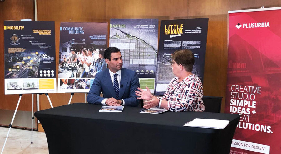
National Trust for Historic Preservation, PlusUrbia Design and local partners issue report with input from over 2,700 Little Havana residents and stakeholders.Miami (June 11, 2019) – With the goal of promoting the revitalization of the Little Havana neighborhood for current and future residents, the National Trust for Historic Preservation and PlusUrbia Design today released a master plan focused on building a healthy, equitable and resilient neighborhood community in Little Havana. The plan, put together over the course of more than two years and with the input of over 2,700 neighborhood residents and stakeholders and several local partners, brings together best practices and the latest thinking from a range of fields—from public health to urban planning to architectural design and historic preservation. It is the first plan of its kind to focus specifically on revitalizing and improving the quality of life for people in Miami’s most iconic neighborhood.The revitalization plan includes input from a collection of civic and non-profit organizations currently working in Little Havana, including: The Health Foundation of South Florida, Live Healthy Little Havana, Urban Health Partnerships and Dade Heritage Trust.From the time the National Trust named Little Havana a National Treasure in January of 2017, the Trust and its local partners led by Plusurbia Design, a local planning firm, have been focused on ways to retain the things that make this place one of America’s most beloved neighborhoods. While it is an iconic historic place, Little Havana is also a dynamic urban neighborhood whose residents face a range of challenges and threats, including poverty, sub-standard housing, displacement, poor transportation options and insufficient open space. This plan is an attempt to comprehensively address these challenges by bringing together an integrated set of national best practices from a diverse array of professional perspectives. Rather than a regulatory approach, the plan relies on increasing incentives, lowering barriers and respecting the existing heritage of Little Havana.“Little Havana is the heart and soul of Miami. It is also a longstanding symbol of the immigrant experience and one of the most essential places in America,” said Robert Nieweg, NTHP. “But there is no denying that this important place is also facing a range of threats, and its residents confront significant challenges on a daily basis, from sub-standard housing to poor transportation options to a lack of green space. In developing this plan, we listened to the concerns of thousands of local residents and stakeholders, and took advantage of the latest thinking in fields from public health to urban planning to architectural design and historic preservation to find solutions to these concerns. This is the first report of its kind, and webelieve it can be a road map for making life better for current and future Little Havanaresidents”"La Pequeña Habana is one of the best-known Latin-American barrios in the United States,"said Juan Mullerat, principal at PlusUrbia Design. "Though the neighborhood is one of Miami’spremier tourist destinations, those who spend time there know that its real value lies in itspeople and the legacies they have built over many generations in the neighborhood. This plan isinspired by the culture of Little Havana, and it seeks to ensure that this unique place and thepeople who created it will always have a home here." ABOUT THE NATIONAL TRUST FOR HISTORIC PRESERVATIONThe National Trust for Historic Preservation, a privately funded nonprofit organization, works to save America’s historic places. www.SavingPlaces.orgABOUT PLUSURBIA DESIGNPlusurbia Design is a Miami-based planning firm that designs contextual cities, towns and neighborhoodscollaboratively to create lasting value. www.plusurbia.comMEDIA CONTACTS: VIRGIL MCDILL, NATIONAL TRUST, 202.294.9187, VIRGILMCDILL@GMAIL.COMJUAN MULLERAT, PLUSURBIA DESIGN, 305.444.4850, JUAN@PLUSURBIA.COMRelated articles:WLRNhttps://www.wlrn.org/post/little-havana-revitalization-plan-released-will-now-go-actionThe Real Dealhttps://therealdeal.com/miami/2019/06/11/little-havana-could-be-redeveloped-like-wynwood/El Nuevo Heraldhttps://www.elnuevoherald.com/noticias/finanzas/acceso-miami/comunidades/article231432093.htmlWJCThttps://news.wjct.org/post/little-havana-revitalization-plan-released-will-now-go-actionCBS Miamihttps://miami.cbslocal.com/video/4102931-city-of-miami-unveils-plan-for-revitalization-of-little-havana/NBC Miamihttps://www.nbcmiami.com/on-air/as-seen-on/Mayor-Unveils-Plan-to-Revitalize-Little-Havana_Miami-511153152.htmlArchinecthttps://archinect.com/news/article/150141827/revitalization-plan-for-miami-s-little-havana-to-focus-on-more-affordable-housing-and-healthy-urban-livingCalle Ocho Newshttps://calleochonews.com/new-revitalization-plan-little-havana-me-importa/
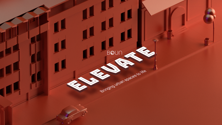
PlusUrbia's Juan Mullerat is thrilled to be able to participate as part of the jury in the Elevate - Bringing urban spaces to life competition.Learn more below from the competition's website: PREMISE Technology has miraculously enabled people to stay connected, informed, and entertained, from every street and corner. It is usual for someone to stare at their screens despite being surrounded by people in public spaces that are designed to offer respite from the constant hubbub of urban life and engage people in interactions.Social interaction is a way to communicate ideas, meet new people and share conversations in a social setting. However, this definition is changing with the introduction of new companions in the form of devices that accompany people. This raises the question of whether we have surrendered ourselves to devices that in turn isolate us from those around?Or conversely, is the real world not interesting enough? CHALLENGE The hyper-productivity mindset with passing time has eventually made humans more dissatisfied and caught up with things in the name of efficiency. And our feelings for the role of public spaces, in general, are no different from this fundamental idea. It's this similar mindset that propels the civic planners to squeeze in an extra office block, or a housing unit, or a road for quick mobility - instead of creating actual quality public space for plenty reasons - but mostly in the name of ‘efficient’ and ’cost effective’ city planning.Does this mean our devices are getting better but our public spaces are not?What can we do for these outdated poorly performing public spaces/streets suffering from this quality crisis and outdated design? If we can’t break this connectivity continuum, how can we break the screen time for a short while to disconnect and reconnect, even for a few seconds? If not possible to break the screen time then how can we use these devices in our hands to make our public spaces relevant again?
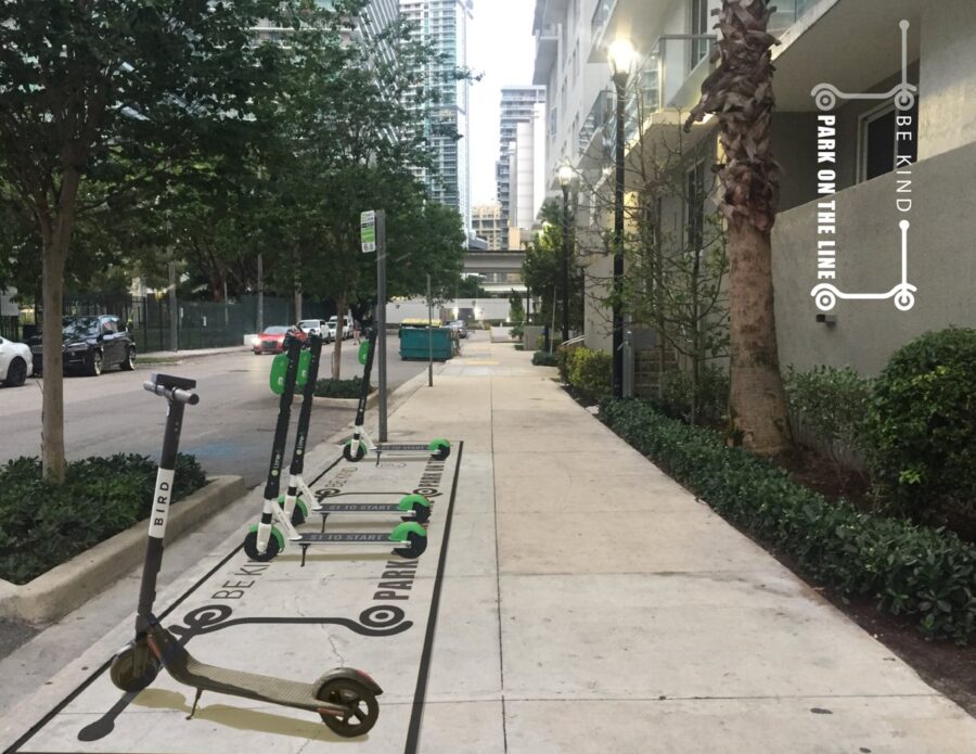
The Miami Foundation's Public Space Challenge is back this year and it is all about the way Miami moves!From the Public Space Challenge website:The Miami Foundation’s Public Space Challenge is back! This year, we’re investing $250,000 in your ideas to create, activate or improve how we move around our community. Think bus stops, bike lanes, water ways, streets, sidewalks, crosswalks or wayfinding signs and how you can make them more safe, fun and easier to use. The way you do that is totally up to you!PlusUrbia has proposed two ideas to improve mobility in the City and make it a more civil place.1. Be Kind - Park on the Line MY IDEA TO IMPROVE THIS PLACE...Misplacement of scooters has become a nuisance, a danger to pedestrians, as well as an obstruction to private property. As a result of the increased use of scooters, sidewalks have become less safe as people park them without any order, oftentimes blocking pedestrian mobility. The idea is to designate spaces for scooter parking by painting lines or areas on sidewalks so that people can leave the scooters within those boundaries -- providing a safer pedestrian environment.SO THAT PEOPLE COULD...The intent is to provide safer sidewalks for pedestrians. Scooter users will be able to enjoy the scooters and have designated places to park them.2. Cuban Memorial Blvd - Pedestrian Enhancement MY IDEA TO IMPROVE THIS PLACE...Is to provide continuity to the existing paths within the medians located in SW 13th Avenue. The idea is to define these connections with paint or textured surfaces to provide safer crossings to pedestrians and bicycles to one of the longest and narrowest open spaces in Miami. Currently, these medians contain paths that are intended for pedestrian use, however, due to the lack of visual connection between them and the substantial crossing distance, pedestrians feel insecure, and cars invade the crossing frequently. Therefore, a variety of floor murals for the 16 intersections are proposed as a creative solution to the current problem.SO THAT PEOPLE COULD...Enjoy a safer pedestrian path and an improved sense of direction, whilealso allowing car users to become more aware and cautious when driving over the pedestrian path. This initiative will also add aesthetically pleasing murals on the ground that will enhance the pedestrian and bicycle experience.
We use cookies
We use our own and third-party cookies to be able to correctly offer you all the functionalities of the website for analytical purposes. You can accept all cookies by clicking "Accept cookies", obtain more information in our
Website Policyor configure/reject their use by clicking on Settings".
Accept cookies
SettingsBasic cookie informationConfirm preferences
This website uses cookies and/or similar technologies that store and retrieve information when you browse. In general, these technologies can serve very different purposes, such as, for example, recognizing you as a user, obtaining information about your browsing habits or customizing the way in which the content is displayed. The specific uses we make of these technologies are described below. By default, all cookies are disabled, except for the technical ones, which are necessary for the website to work. If you wish to expand the information or exercise your data protection rights, you can consult our Website Policy.
Accept cookiesManage preferencesTechnical and/or necessary cookies
Always active
Technical cookies are those that facilitate user navigation and the use of the different options or services offered by the web such as identifying the session, allowing access to certain areas, filling in forms, storing language preferences, security, facilitating functionalities. (videos, social networks…).
Analytic Cookies
Analysis cookies are those used to carry out anonymous analysis of the behavior of web users and that allow user activity to be measured and navigation profiles to be created with the objective of improving websites.