Climate and Green Gentrification and Displacement
press,
Published on
03/24/2023
03/24/2023
Date: 20230315
At Plusurbia, we focus on making cities better places to live and work by improving walkability, affordability, and context. Our projects range from creating walkable neighborhoods with a mix of housing types to creating inclusive public spaces that can be enjoyed by people of all ages and backgrounds. We also specialize in leveraging data to create targeted solutions for communities facing gentrification and displacement, such as developing tools to help assess the potential effects of development decisions on existing residents.
Our firm has always balanced private, public, and pro-bono projects. We work for municipalities or the state, we work with private developers and property owners, and then, this is the exciting side of our studio: we get involved with non-profits or communities with limited or no budgets to help them improve their neighborhoods. We are currently involved in Ruta Borinquen, a not-for-profit effort to revitalize communities along a 426-mile stretch of the former railway in Puerto Rico. We are designing and implementing pocket parks in various neighborhoods, and we are working with some communities experiencing very aggressive displacement.
Our team is committed to engaging local stakeholders throughout the planning and implementation process so that all voices are heard and community vision prevails. Ultimately, we aim to ensure that all communities become safe and accessible places with robust amenities and the tools to improve lives.

At Plusurbia, our mission is to design walkable, affordable and resilient, contextually relevant neighborhoods. Climate gentrification is a term coined a few years ago by our friend Jesse Keenan seeing it as a true challenge of our times. Two of our offices are located blocks away from flood zones. Both our Puerto Rico and Miami offices are seeing the effects of sea level and the pressure that Climate Gentrification has on our neighborhoods and the projects we work on.
Looking at how communities can be designed in a way that helps them adapt to the effects of climate change while also combatting displacement is key to maintaining healthy housing mixes and retaining our legacy residents.
When walkable and affordable neighborhoods become desirable because of their higher resiliency indices, the pressures for displacement are real. We have recently seen this in Little Havana, the West Grove, a historically black community that is seeing an aggressive demographic change. Increased demand for those areas, leading to rising land values and displacement of existing residents who can no longer afford the cost of living in the area, requires us to provide protection and solutions to our housing shortage and affordability strategies.
The key to combating climate gentrification (displacement) is first to adapt the most climate-vulnerable areas to reduce migration. There is no single solution, but it can include living shorelines, raising buildings, changing building codes to encourage understories in new construction, and increasing permeability throughout neighborhoods, among others. Then, we must put measures in place to protect our residents in those areas targeted with inbound migration, those most vulnerable. This means conditions for future development that incentivize the right housing mix, opt-in zoning bonuses to encourage affordable components, and, most importantly, programs to help legacy residents keep their homes and find avenues for upward mobility.
It also means creating walkable neighborhoods with a mix of housing types and price points that foster sustainable development while protecting existing communities from displacement. We believe this can be achieved through the thoughtful integration of zoning codes and green infrastructure, providing additional benefits to encourage sustainable development and improved stormwater management plans (passive whenever possible).

Focusing on a particular zoning plan in Miami, the Wynwood North Neighborhood Revitalization District, could you set the stage for our listeners on how this plan came about and what makes it different from other zoning plans?
The Wynwood North Neighborhood Revitalization District was created as part of a larger effort to revitalize an area surrounded by some of the most expensive real estate in Miami. The plan seeks to create an affordable, walkable neighborhood by encouraging sustainable development while protecting existing communities from displacement. To do this, the plan includes provisions such as up-zoning certain areas for more dense development with conditions for attainable housing, increased open space, and a focus on walkability by integrating green infrastructure and active frontages. Additionally, the plan includes incentives for developers to create affordable housing and provides funding mechanisms to help improve infrastructure and existing residents stay in the area.
This plan differs from other zoning plans’ emphasis on character-conscious development, walkability, and affordability while considering context-specific considerations such as existing infrastructure and land use. The plan is designed to strengthen a walkable neighborhood appropriate for the local context while protecting existing residents from displacement. It is an example of how resiliency, walkability, and affordability can be achieved in a way that benefits all involved.
Ultimately, a balance between mobility, infrastructure, open space, a mix of housing, and an impetus to encourage local businesses is essential for creating thriving and resilient cities – but walkability and affordability must go hand-in-hand to ensure neighborhoods remain accessible for generations to come. The Wynwood North Neighborhood Revitalization District exemplifies how walkability and affordability can be achieved through thoughtful zoning calibration that delivers context-specific development. This approach allows us to evolve our cities without risking displacement and identity.
Green gentrification occurs when green infrastructure investments increase property values and displacement of existing residents.
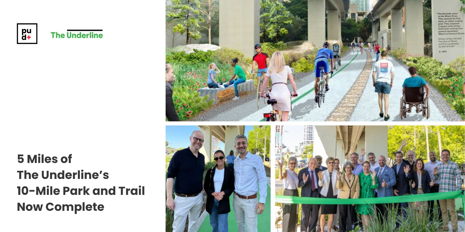
Gentrification and displacement are two terms often used in discussions about the development of cities, towns, and neighborhoods. While these concepts may appear to be interchangeable at first glance, it is important to note that there are several key distinctions between them. Gentrification occurs when a neighborhood undergoes physical and demographic changes due to an influx of higher-income earners. At the same time, displacement happens when existing residents cannot stay in the area due to rising rents or other development pressures. We saw this risk especially along the Underline, an 11 mile green corridor under the Metro Rail in Miami.
To better separate the positive effects of green infrastructure from negative effects like gentrification, it’s important to incorporate walkability and affordability into green infrastructure plans extending the impact to a larger area — in the case of the underline, a capture area of half a mile on either side was planned. This way, we can increase the positive impacts while diluting the pressure on the immediate vicinity of the improvement. This can be achieved through thoughtful design with context-specific considerations such as existing infrastructure, adapting zoning regulations for gentle density within the capture area, and land use calibrations. Additionally, incentives for developers to create affordable housing and funding to help existing residents stay in the area should be included in walkable neighborhood plans.

By taking this approach, we can ensure anti-displacement tools are in place to mitigate rising prices for the community and accessibility is expanded to diversify and dilute the impact area protecting existing communities from displacement. This way, green infrastructure investments can positively impact the local community improving walkability and affordability holistically.
Lastly, what tips would you give cities/neighborhoods looking to create walkable neighborhoods?
When creating walkable neighborhoods, there are a few key things to consider